Amblar elevation
Amblar (Trentino-Alto Adige, Provincia autonoma di Trento), Italy elevation is 992 meters and Amblar elevation in feet is 3255 ft above sea level [src 1]. Amblar is a seat of a third-order administrative division (feature code) with elevation that is 670 meters (2198 ft) bigger than average city elevation in Italy.
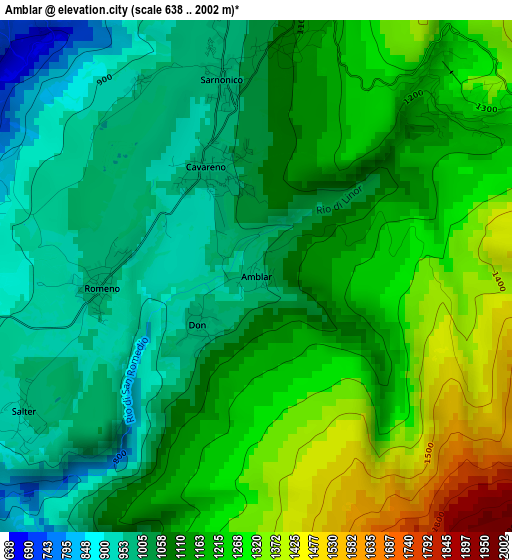
Below is the Elevation map of Amblar, which displays elevation range with different colors. Scale of the first map is from 638 to 2002 m (2093 to 6568 ft) with average elevation of 1134 meters (=3720 ft) [note 1]
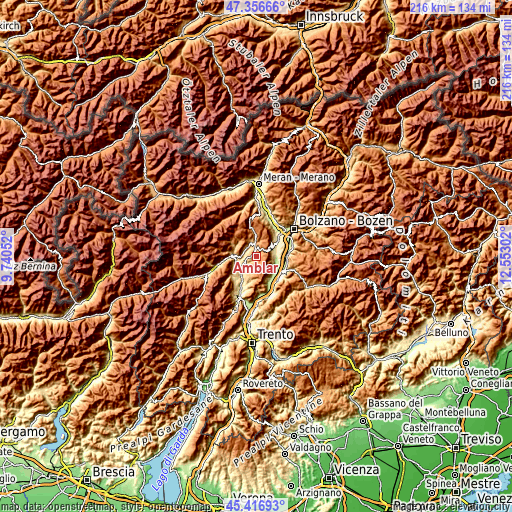
These maps also provides idea of topography and contour of this city, they are displayed at different zoom levels. More info about maps, scale and edge coordinates you can find below images.
| \ | Map #1 | Topo.Map |
| Scale [m] | 638..2002 m | × |
| Scale [ft] | 2093..6568 ft | × |
| Average | 1134 m = 3720 ft | × |
| Width | 6.74 km = 4.2 mi | 215.7 km = 134 mi |
| Height | 6.74 km = 4.2 mi | 215.7 km = 134 mi |
| ↑Max Latitude | 46.42571° | 47.35666° |
| Latitude at center | 46.39541° | 46.39541° |
| ↓Min Latitude | 46.365093° | 45.41693° |
| ← Min Longitude | 11.102825° | 9.74052° |
| Longitude center | 11.14677° | 11.14677° |
| →Max Longitude | 11.190715° | 12.55302° |
Nearby cities:
Cities around Amblar sort by population:
• Fondo elevation 978 m
4.9 km,  351°
351°
• Cavareno 976 m
1.5 km,  337°
337°
• Romeno 964 m
2.1 km,  267°
267°
• Cloz 763 m
5.2 km,  296°
296°
• Sarnonico 985 m
2.7 km, 351°
• Romallo 744 m
6.2 km, 271°
• Brez 805 m
5.2 km,  322°
322°
• Dambel 742 m
4.2 km,  284°
284°
• Ronzone 1098 m
3.3 km,  8°
8°
• Malosco 1083 m
4.5 km,  359°
359°
• Ruffrè 1202 m
3.2 km,  47°
47°
• Don 984 m
1 km,  229°
229°
Multilingual:
 En español:
Amblar elevación 992 m.
 En France:
Amblar élévation 992 m.


Sources and notes:
- [note 1] Map square and city borders are not equal. Map elevation data is calculated only from area inside that square.
- [src 1] Elevation data from geonames database provided with same terms of usage.
- [src 2] The elevation map of Amblar is generated using elevation data from NASA's 3 arcsec (90m) resolution SRTM data.
- [src 3] Base (background) map © OpenStreetMap contributors tiles are generated by Geofabrik and OpenTopoMap.
Copyright & License:
This Amblar Elevation Map is licensed under CC BY-SA. You may reuse any part from this page, if you give a proper credit by linking to this URL:
 More info on terms of use page.