Fino del Monte elevation
Fino del Monte (Lombardy, Provincia di Bergamo), Italy elevation is 695 meters and Fino del Monte elevation in feet is 2280 ft above sea level [src 1]. Fino del Monte is a seat of a third-order administrative division (feature code) with elevation that is 373 meters (1224 ft) bigger than average city elevation in Italy.
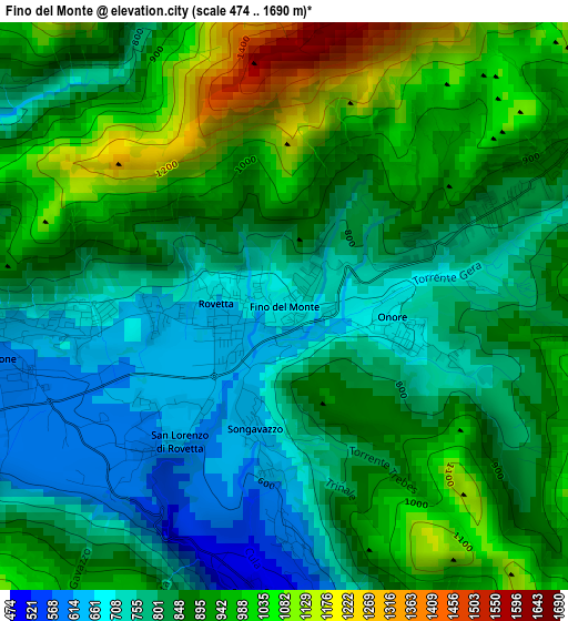
Below is the Elevation map of Fino del Monte, which displays elevation range with different colors. Scale of the first map is from 474 to 1690 m (1555 to 5545 ft) with average elevation of 864.8 meters (=2837 ft) [note 1]
These maps also provides idea of topography and contour of this city, they are displayed at different zoom levels. More info about maps, scale and edge coordinates you can find below images.
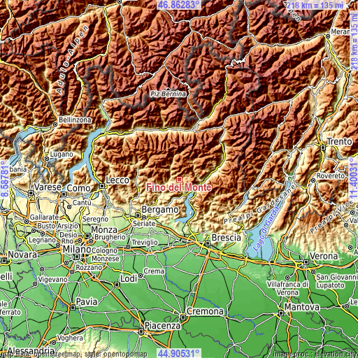
| \ | Map #1 | Topo.Map |
| Scale [m] | 474..1690 m | × |
| Scale [ft] | 1555..5545 ft | × |
| Average | 864.8 m = 2837 ft | × |
| Width | 6.8 km = 4.2 mi | 217.7 km = 135.3 mi |
| Height | 6.8 km = 4.2 mi | 217.6 km = 135.2 mi |
| ↑Max Latitude | 45.923268° | 46.86283° |
| Latitude at center | 45.89269° | 45.89269° |
| ↓Min Latitude | 45.862095° | 44.90531° |
| ← Min Longitude | 9.950115° | 8.58781° |
| Longitude center | 9.99406° | 9.99406° |
| →Max Longitude | 10.038005° | 11.40031° |
Nearby cities:
Cities around Fino del Monte sort by population:
• Clusone elevation 600 m
3.7 km,  259°
259°
• Castione della Presolana 960 m
5.3 km,  62°
62°
• Rovetta 646 m
0.9 km, 263°
• Ardesio 577 m
6.9 km,  314°
314°
• Villa d'Ogna 536 m
5.1 km,  285°
285°
• San Lorenzo di Rovetta 620 m
2 km,  225°
225°
• Piario 543 m
5.2 km,  274°
274°
• Bossico 855 m
8.2 km,  151°
151°
• Onore 700 m
1.3 km,  95°
95°
• Songavazzo 643 m
1.5 km,  193°
193°
• Cerete Alto 600 m
2.8 km,  179°
179°
• Oltressenda Alta 735 m
4.6 km,  303°
303°
Multilingual:
 En español:
Fino del Monte elevación 695 m.
 En France:
Fino del Monte élévation 695 m.
 Auf Deutsch:
Fino del Monte höhe über dem Meeresspiegel ist 695 m.

Sources and notes:
- [note 1] Map square and city borders are not equal. Map elevation data is calculated only from area inside that square.
- [src 1] Elevation data from geonames database provided with same terms of usage.
- [src 2] The elevation map of Fino del Monte is generated using elevation data from NASA's 3 arcsec (90m) resolution SRTM data.
- [src 3] Base (background) map © OpenStreetMap contributors tiles are generated by Geofabrik and OpenTopoMap.
Copyright & License:
This Fino del Monte Elevation Map is licensed under CC BY-SA. You may reuse any part from this page, if you give a proper credit by linking to this URL:
 More info on terms of use page.