Chiuduno elevation
Chiuduno (Lombardy, Provincia di Bergamo), Italy elevation is 216 meters and Chiuduno elevation in feet is 709 ft above sea level [src 1]. Chiuduno is a seat of a third-order administrative division (feature code) with elevation that is 106 meters (348 ft) smaller than average city elevation in Italy.
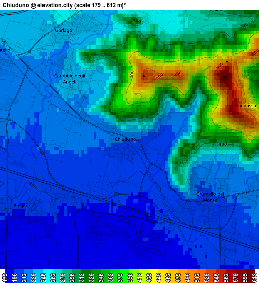
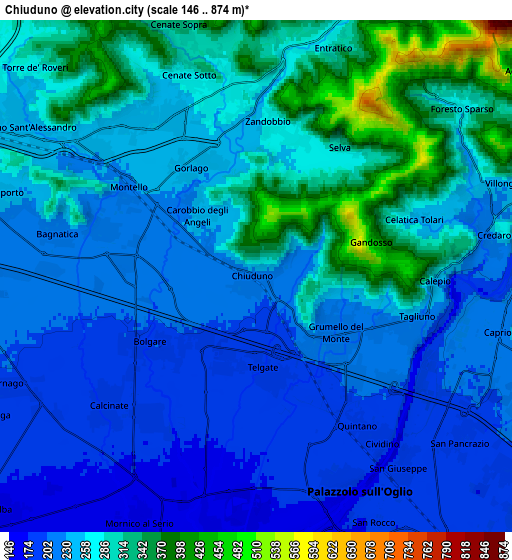
Below is the Elevation map of Chiuduno, which displays elevation range with different colors. Scale of the first map is from 179 to 612 m (587 to 2008 ft) with average elevation of 255.8 meters (=839 ft) [note 1]
These maps also provides idea of topography and contour of this city, they are displayed at different zoom levels. More info about maps, scale and edge coordinates you can find below images.
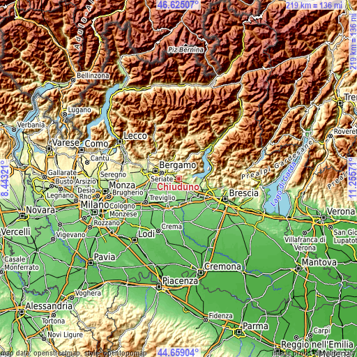
| \ | Map #1 | Map #2 | Topo.Map |
| Scale [m] | 179..612 m | 146..874 m | × |
| Scale [ft] | 587..2008 ft | 479..2867 ft | × |
| Average | 255.8 m = 839 ft | 257.1 m = 844 ft | × |
| Width | 6.83 km = 4.2 mi | 13.66 km = 8.5 mi | 218.6 km = 135.8 mi |
| Height | 6.83 km = 4.2 mi | 13.66 km = 8.5 mi | 218.6 km = 135.8 mi |
| ↑Max Latitude | 45.681391° | 45.712085° | 46.62507° |
| Latitude at center | 45.65068° | 45.65068° | 45.65068° |
| ↓Min Latitude | 45.619952° | 45.589208° | 44.65904° |
| ← Min Longitude | 9.805515° | 9.761569° | 8.44321° |
| Longitude center | 9.84946° | 9.84946° | 9.84946° |
| →Max Longitude | 9.893405° | 9.937351° | 11.25571° |
Nearby cities:
Cities around Chiuduno sort by population:
• Trescore Balneario elevation 271 m
4.9 km,  352°
352°
• Grumello del Monte 208 m
2.6 km,  130°
130°
• Bolgare 196 m
3.4 km,  233°
233°
• Gorlago 236 m
3.3 km,  321°
321°
• Telgate 191 m
2.5 km,  180°
180°
• Carobbio 234 m
2.1 km, 315°
• Carobbio degli Angeli 236 m
2.3 km, 315°
• Montello 228 m
4.2 km,  304°
304°
• Costa di Mezzate 218 m
4.4 km,  287°
287°
• Zandobbio 266 m
4 km,  9°
9°
• Gandosso 459 m
3.2 km,  73°
73°
• Tagliuno 227 m
4.7 km,  101°
101°
Multilingual:
 En español:
Chiuduno elevación 216 m.
 En France:
Chiuduno élévation 216 m.
 Auf Deutsch:
Chiuduno höhe über dem Meeresspiegel ist 216 m.

Sources and notes:
- [note 1] Map square and city borders are not equal. Map elevation data is calculated only from area inside that square.
- [src 1] Elevation data from geonames database provided with same terms of usage.
- [src 2] The elevation map of Chiuduno is generated using elevation data from NASA's 3 arcsec (90m) resolution SRTM data.
- [src 3] Base (background) map © OpenStreetMap contributors tiles are generated by Geofabrik and OpenTopoMap.
Copyright & License:
This Chiuduno Elevation Map is licensed under CC BY-SA. You may reuse any part from this page, if you give a proper credit by linking to this URL:
 More info on terms of use page.