Bisuschio elevation
Bisuschio (Lombardy, Provincia di Varese), Italy elevation is 357 meters and Bisuschio elevation in feet is 1171 ft above sea level [src 1]. Bisuschio is a seat of a third-order administrative division (feature code) with elevation that is 35 meters (115 ft) bigger than average city elevation in Italy.
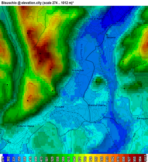
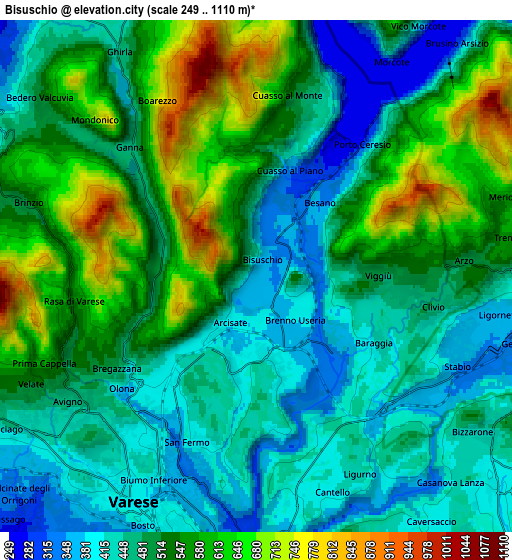
Below is the Elevation map of Bisuschio, which displays elevation range with different colors. Scale of the first map is from 274 to 1012 m (899 to 3320 ft) with average elevation of 486.5 meters (=1596 ft) [note 1]
These maps also provides idea of topography and contour of this city, they are displayed at different zoom levels. More info about maps, scale and edge coordinates you can find below images.
| \ | Map #1 | Map #2 | Topo.Map |
| Scale [m] | 274..1012 m | 249..1110 m | × |
| Scale [ft] | 899..3320 ft | 817..3642 ft | × |
| Average | 486.5 m = 1596 ft | 509.2 m = 1671 ft | × |
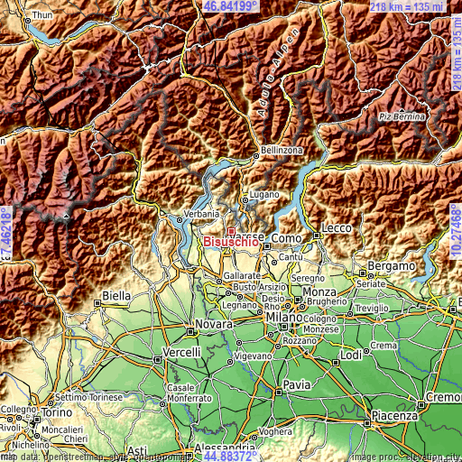
| Width | 6.8 km = 4.2 mi | 13.61 km = 8.5 mi | 217.7 km = 135.3 mi |
| Height | 6.8 km = 4.2 mi | 13.61 km = 8.5 mi | 217.7 km = 135.3 mi |
| ↑Max Latitude | 45.902069° | 45.932642° | 46.84199° |
| Latitude at center | 45.87148° | 45.87148° | 45.87148° |
| ↓Min Latitude | 45.840874° | 45.810251° | 44.88372° |
| ← Min Longitude | 8.824485° | 8.780539° | 7.46218° |
| Longitude center | 8.86843° | 8.86843° | 8.86843° |
| →Max Longitude | 8.912375° | 8.956321° | 10.27468° |
Nearby cities:
Cities around Bisuschio sort by population:
• Induno Olona elevation 389 m
3.6 km,  216°
216°
• Arcisate 381 m
1.7 km,  180°
180°
• Viggiù 489 m
3.1 km,  91°
91°
• Saltrio 521 m
4.3 km, 87°
• Besano 348 m
2.6 km,  40°
40°
• Brenno Useria 368 m
1.3 km,  146°
146°
• Cuasso al Piano 321 m
2.7 km,  18°
18°
• Clivio 451 m
4.9 km,  101°
101°
• Baraggia 415 m
3.6 km,  120°
120°
• Valganna 461 m
4.9 km,  314°
314°
• Ganna 468 m
4.7 km,  316°
316°
• Cuasso al Monte 539 m
4.9 km,  9°
9°
Multilingual:
 En español:
Bisuschio elevación 357 m.
 En France:
Bisuschio élévation 357 m.
 Auf Deutsch:
Bisuschio höhe über dem Meeresspiegel ist 357 m.

Sources and notes:
- [note 1] Map square and city borders are not equal. Map elevation data is calculated only from area inside that square.
- [src 1] Elevation data from geonames database provided with same terms of usage.
- [src 2] The elevation map of Bisuschio is generated using elevation data from NASA's 3 arcsec (90m) resolution SRTM data.
- [src 3] Base (background) map © OpenStreetMap contributors tiles are generated by Geofabrik and OpenTopoMap.
Copyright & License:
This Bisuschio Elevation Map is licensed under CC BY-SA. You may reuse any part from this page, if you give a proper credit by linking to this URL:
 More info on terms of use page.