Corna Imagna elevation
Corna Imagna (Lombardy, Provincia di Bergamo), Italy elevation is 723 meters and Corna Imagna elevation in feet is 2372 ft above sea level [src 1]. Corna Imagna is a seat of a third-order administrative division (feature code) with elevation that is 401 meters (1316 ft) bigger than average city elevation in Italy.
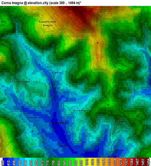
Below is the Elevation map of Corna Imagna, which displays elevation range with different colors. Scale of the first map is from 369 to 1494 m (1211 to 4902 ft) with average elevation of 725.9 meters (=2382 ft) [note 1]
These maps also provides idea of topography and contour of this city, they are displayed at different zoom levels. More info about maps, scale and edge coordinates you can find below images.
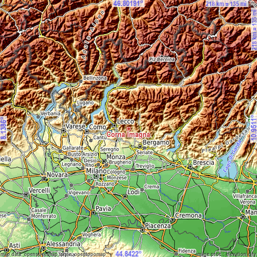
| \ | Map #1 | Topo.Map |
| Scale [m] | 369..1494 m | × |
| Scale [ft] | 1211..4902 ft | × |
| Average | 725.9 m = 2382 ft | × |
| Width | 6.81 km = 4.2 mi | 217.9 km = 135.4 mi |
| Height | 6.81 km = 4.2 mi | 217.9 km = 135.4 mi |
| ↑Max Latitude | 45.861292° | 46.80191° |
| Latitude at center | 45.83068° | 45.83068° |
| ↓Min Latitude | 45.800051° | 44.8422° |
| ← Min Longitude | 9.500905° | 8.1386° |
| Longitude center | 9.54485° | 9.54485° |
| →Max Longitude | 9.588795° | 10.9511° |
Nearby cities:
Cities around Corna Imagna sort by population:
• Sant'Omobono Terme elevation 398 m
2.6 km,  195°
195°
• Selino Basso 398 m
2.4 km, 198°
• Brembilla 422 m
4.2 km,  104°
104°
• Berbenno 695 m
2.7 km,  131°
131°
• Rota d'Imagna 666 m
2.5 km,  270°
270°
• Calchera-Frontale 643 m
2.6 km,  278°
278°
• Botta 544 m
1 km, 280°
• Locatello 556 m
1 km,  300°
300°
• Gerosa 765 m
3 km,  44°
44°
• Fuipiano Valle Imagna 1055 m
2.9 km,  334°
334°
• Brumano 896 m
4.3 km,  307°
307°
• Blello 841 m
2.2 km,  68°
68°
Multilingual:
 En español:
Corna Imagna elevación 723 m.
 En France:
Corna Imagna élévation 723 m.
 Auf Deutsch:
Corna Imagna höhe über dem Meeresspiegel ist 723 m.

Sources and notes:
- [note 1] Map square and city borders are not equal. Map elevation data is calculated only from area inside that square.
- [src 1] Elevation data from geonames database provided with same terms of usage.
- [src 2] The elevation map of Corna Imagna is generated using elevation data from NASA's 3 arcsec (90m) resolution SRTM data.
- [src 3] Base (background) map © OpenStreetMap contributors tiles are generated by Geofabrik and OpenTopoMap.
Copyright & License:
This Corna Imagna Elevation Map is licensed under CC BY-SA. You may reuse any part from this page, if you give a proper credit by linking to this URL:
 More info on terms of use page.