Montemarzino elevation
Montemarzino (Piedmont, Provincia di Alessandria), Italy elevation is 449 meters and Montemarzino elevation in feet is 1473 ft above sea level [src 1]. Montemarzino is a seat of a third-order administrative division (feature code) with elevation that is 127 meters (417 ft) bigger than average city elevation in Italy.
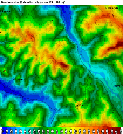
Below is the Elevation map of Montemarzino, which displays elevation range with different colors. Scale of the first map is from 183 to 482 m (600 to 1581 ft) with average elevation of 302.1 meters (=991 ft) [note 1]
These maps also provides idea of topography and contour of this city, they are displayed at different zoom levels. More info about maps, scale and edge coordinates you can find below images.
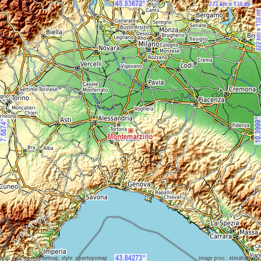
| \ | Map #1 | Topo.Map |
| Scale [m] | 183..482 m | × |
| Scale [ft] | 600..1581 ft | × |
| Average | 302.1 m = 991 ft | × |
| Width | 6.93 km = 4.3 mi | 221.7 km = 137.8 mi |
| Height | 6.93 km = 4.3 mi | 221.7 km = 137.8 mi |
| ↑Max Latitude | 44.879498° | 45.83672° |
| Latitude at center | 44.84835° | 44.84835° |
| ↓Min Latitude | 44.817185° | 43.84273° |
| ← Min Longitude | 8.949705° | 7.5874° |
| Longitude center | 8.99365° | 8.99365° |
| →Max Longitude | 9.037595° | 10.3999° |
Nearby cities:
Cities around Montemarzino sort by population:
• Volpedo elevation 187 m
4.5 km,  352°
352°
• Pozzol Groppo 366 m
4.4 km,  40°
40°
• Brignano 283 m
5.2 km,  135°
135°
• Cerreto Grue 242 m
5 km,  262°
262°
• Monleale 297 m
4.3 km,  338°
338°
• Costa Vescovato 288 m
6.4 km,  235°
235°
• Volpeglino 229 m
5.6 km,  331°
331°
• Avolasca 404 m
5.5 km,  203°
203°
• Casasco 369 m
2.5 km,  157°
157°
• Momperone 270 m
3.4 km,  108°
108°
• Berzano di Tortona 285 m
4.6 km,  313°
313°
• Montegioco 327 m
2.5 km,  253°
253°
Multilingual:
 En español:
Montemarzino elevación 449 m.
 En France:
Montemarzino élévation 449 m.
 Auf Deutsch:
Montemarzino höhe über dem Meeresspiegel ist 449 m.

Sources and notes:
- [note 1] Map square and city borders are not equal. Map elevation data is calculated only from area inside that square.
- [src 1] Elevation data from geonames database provided with same terms of usage.
- [src 2] The elevation map of Montemarzino is generated using elevation data from NASA's 3 arcsec (90m) resolution SRTM data.
- [src 3] Base (background) map © OpenStreetMap contributors tiles are generated by Geofabrik and OpenTopoMap.
Copyright & License:
This Montemarzino Elevation Map is licensed under CC BY-SA. You may reuse any part from this page, if you give a proper credit by linking to this URL:
 More info on terms of use page.