Valle Aurina - Ahrntal elevation
Valle Aurina - Ahrntal (Trentino-Alto Adige, Bolzano), Italy elevation is 1062 meters and Valle Aurina - Ahrntal elevation in feet is 3484 ft above sea level [src 1]. Valle Aurina - Ahrntal is a seat of a third-order administrative division (feature code) with elevation that is 740 meters (2428 ft) bigger than average city elevation in Italy.
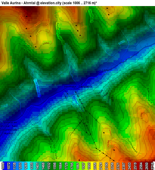
Below is the Elevation map of Valle Aurina - Ahrntal, which displays elevation range with different colors. Scale of the first map is from 1006 to 2716 m (3301 to 8911 ft) with average elevation of 1664.1 meters (=5460 ft) [note 1]
These maps also provides idea of topography and contour of this city, they are displayed at different zoom levels. More info about maps, scale and edge coordinates you can find below images.
| \ | Map #1 | Map #2 | Topo.Map |
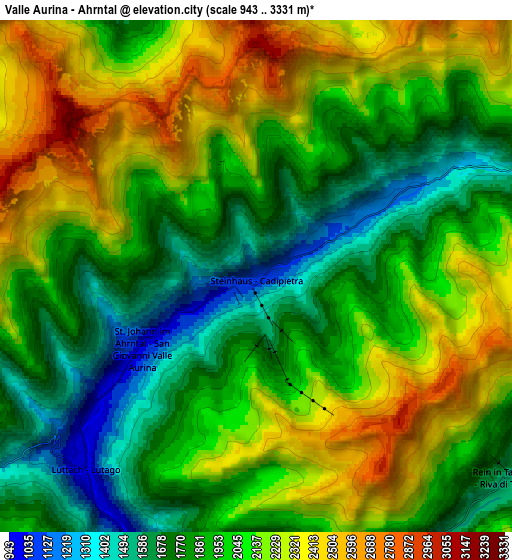
| Scale [m] | 1006..2716 m | 943..3331 m | × |
| Scale [ft] | 3301..8911 ft | 3094..10928 ft | × |
| Average | 1664.1 m = 5460 ft | 2005.3 m = 6579 ft | × |
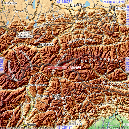
| Width | 6.67 km = 4.1 mi | 13.33 km = 8.3 mi | 213.3 km = 132.5 mi |
| Height | 6.67 km = 4.1 mi | 13.33 km = 8.3 mi | 213.3 km = 132.5 mi |
| ↑Max Latitude | 47.026194° | 47.056142° | 47.94676° |
| Latitude at center | 46.99623° | 46.99623° | 46.99623° |
| ↓Min Latitude | 46.966249° | 46.936251° | 46.02849° |
| ← Min Longitude | 11.935935° | 11.891989° | 10.57363° |
| Longitude center | 11.97988° | 11.97988° | 11.97988° |
| →Max Longitude | 12.023825° | 12.067771° | 13.38613° |
Nearby cities:
Cities around Valle Aurina - Ahrntal sort by population:
• Brunico elevation 829 m
22.2 km,  188°
188°
• Campo Tures 857 m
9.9 km, 188°
• Gais 837 m
17.9 km, 187°
• Falzes 1032 m
21.6 km,  199°
199°
• Mühlen in Taufers 859 m
11.1 km, 194°
• San Lorenzo di Sebato 809 m
24.1 km, 193°
• Terento 1242 m
23.8 km,  218°
218°
• Chienes 804 m
23.6 km,  206°
206°
• Perca 1010 m
22.6 km,  179°
179°
• Selva dei Molini 1176 m
15 km, 218°
• Cadipietra 1062 m
0.1 km,  151°
151°
• Predoi 1466 m
10.8 km,  62°
62°
Multilingual:
 En español:
Valle Aurina - Ahrntal elevación 1062 m.
 En France:
Valle Aurina - Ahrntal élévation 1062 m.
 Auf Deutsch:
Valle Aurina - Ahrntal höhe über dem Meeresspiegel ist 1062 m.
 На русском:
Valle Aurina - Ahrntal высота над уровнем моря 1062 м
Sources and notes:
- [note 1] Map square and city borders are not equal. Map elevation data is calculated only from area inside that square.
- [src 1] Elevation data from geonames database provided with same terms of usage.
- [src 2] The elevation map of Valle Aurina - Ahrntal is generated using elevation data from NASA's 3 arcsec (90m) resolution SRTM data.
- [src 3] Base (background) map © OpenStreetMap contributors tiles are generated by Geofabrik and OpenTopoMap.
Copyright & License:
This Valle Aurina - Ahrntal Elevation Map is licensed under CC BY-SA. You may reuse any part from this page, if you give a proper credit by linking to this URL:
 More info on terms of use page.