Campo nell'Elba elevation
Campo nell'Elba (Tuscany, Provincia di Livorno), Italy elevation is 14 meters and Campo nell'Elba elevation in feet is 46 ft above sea level [src 1]. Campo nell'Elba is a populated place (feature code) with elevation that is 308 meters (1010 ft) smaller than average city elevation in Italy.
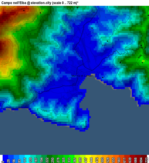
Below is the Elevation map of Campo nell'Elba, which displays elevation range with different colors. Scale of the first map is from 0 to 722 m (0 to 2369 ft) with average elevation of 160 meters (=525 ft) [note 1]
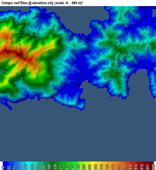
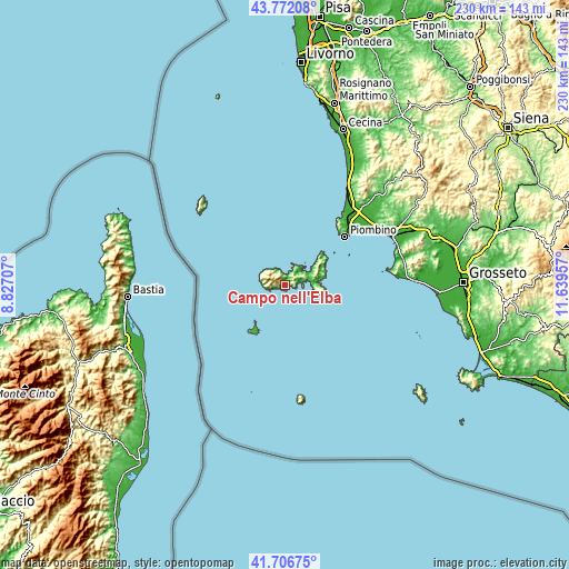
These maps also provides idea of topography and contour of this city, they are displayed at different zoom levels. More info about maps, scale and edge coordinates you can find below images.
| \ | Map #1 | Map #2 | Topo.Map |
| Scale [m] | 0..722 m | -6..989 m | × |
| Scale [ft] | 0..2369 ft | -20..3245 ft | × |
| Average | 160 m = 525 ft | 214.9 m = 705 ft | × |
| Width | 7.18 km = 4.5 mi | 14.35 km = 8.9 mi | 229.6 km = 142.7 mi |
| Height | 7.18 km = 4.5 mi | 14.35 km = 8.9 mi | 229.6 km = 142.7 mi |
| ↑Max Latitude | 42.780283° | 42.812529° | 43.77208° |
| Latitude at center | 42.74802° | 42.74802° | 42.74802° |
| ↓Min Latitude | 42.715741° | 42.683444° | 41.70675° |
| ← Min Longitude | 10.189375° | 10.145429° | 8.82707° |
| Longitude center | 10.23332° | 10.23332° | 10.23332° |
| →Max Longitude | 10.277265° | 10.321211° | 11.63957° |
Nearby cities:
Cities around Campo nell'Elba sort by population:
• Piombino elevation 26 m
31 km,  50°
50°
• Venturina 14 m
43.3 km,  43°
43°
• Portoferraio 2 m
9.7 km, 42°
• San Vincenzo 7 m
45.7 km,  33°
33°
• Porto Azzurro 20 m
13.6 km,  80°
80°
• Marina di Campo 3 m
0.6 km,  172°
172°
• Capoliveri 162 m
11.8 km,  91°
91°
• Marciana Marina 22 m
6.8 km,  332°
332°
• Vignale Riotorto 35 m
44.9 km, 54°
• Rio Marina 8 m
17.3 km,  65°
65°
• Rio nell'Elba 159 m
15.4 km,  62°
62°
• Marciana 379 m
7.3 km,  313°
313°
Multilingual:
 En español:
Campo nell'Elba elevación 14 m.
 En France:
Campo nell'Elba élévation 14 m.
 Auf Deutsch:
Campo nell'Elba höhe über dem Meeresspiegel ist 14 m.

Sources and notes:
- [note 1] Map square and city borders are not equal. Map elevation data is calculated only from area inside that square.
- [src 1] Elevation data from geonames database provided with same terms of usage.
- [src 2] The elevation map of Campo nell'Elba is generated using elevation data from NASA's 3 arcsec (90m) resolution SRTM data.
- [src 3] Base (background) map © OpenStreetMap contributors tiles are generated by Geofabrik and OpenTopoMap.
Copyright & License:
This Campo nell'Elba Elevation Map is licensed under CC BY-SA. You may reuse any part from this page, if you give a proper credit by linking to this URL:
 More info on terms of use page.