Palazzago elevation
Palazzago (Lombardy, Provincia di Bergamo), Italy elevation is 414 meters and Palazzago elevation in feet is 1358 ft above sea level [src 1]. Palazzago is a seat of a third-order administrative division (feature code) with elevation that is 92 meters (302 ft) bigger than average city elevation in Italy.
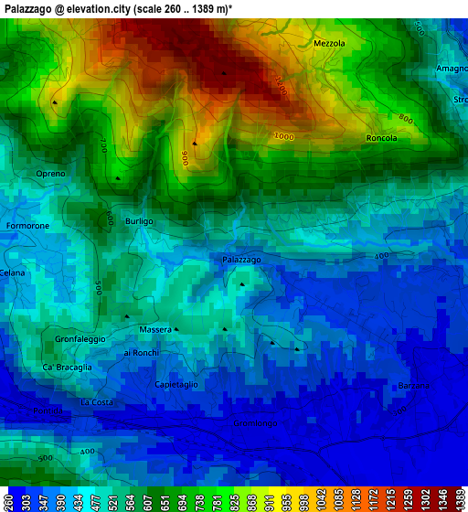
Below is the Elevation map of Palazzago, which displays elevation range with different colors. Scale of the first map is from 260 to 1389 m (853 to 4557 ft) with average elevation of 559.2 meters (=1835 ft) [note 1]
These maps also provides idea of topography and contour of this city, they are displayed at different zoom levels. More info about maps, scale and edge coordinates you can find below images.
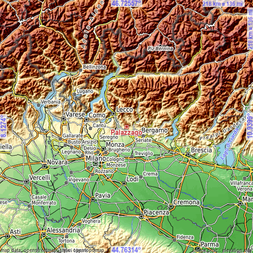
| \ | Map #1 | Topo.Map |
| Scale [m] | 260..1389 m | × |
| Scale [ft] | 853..4557 ft | × |
| Average | 559.2 m = 1835 ft | × |
| Width | 6.82 km = 4.2 mi | 218.2 km = 135.6 mi |
| Height | 6.82 km = 4.2 mi | 218.2 km = 135.6 mi |
| ↑Max Latitude | 45.783635° | 46.72557° |
| Latitude at center | 45.75298° | 45.75298° |
| ↓Min Latitude | 45.722309° | 44.76314° |
| ← Min Longitude | 9.489705° | 8.1274° |
| Longitude center | 9.53365° | 9.53365° |
| →Max Longitude | 9.577595° | 10.9399° |
Nearby cities:
Cities around Palazzago sort by population:
• Mapello elevation 257 m
4.8 km,  160°
160°
• Almenno San Bartolomeo 292 m
4 km,  112°
112°
• Pontida 308 m
3 km,  215°
215°
• Caprino 410 m
3.2 km,  262°
262°
• Ambivere 263 m
3.9 km, 160°
• Barzana 292 m
3.5 km,  128°
128°
• Gromlongo 279 m
2.7 km,  167°
167°
• Strozza 349 m
4.2 km,  57°
57°
• Bedulita 596 m
4.5 km,  18°
18°
• Camoneone 427 m
4.5 km,  37°
37°
• Torre de' Busi 446 m
4.8 km,  299°
299°
• Roncola 863 m
2.7 km,  50°
50°
Multilingual:
 En español:
Palazzago elevación 414 m.
 En France:
Palazzago élévation 414 m.
 Auf Deutsch:
Palazzago höhe über dem Meeresspiegel ist 414 m.

Sources and notes:
- [note 1] Map square and city borders are not equal. Map elevation data is calculated only from area inside that square.
- [src 1] Elevation data from geonames database provided with same terms of usage.
- [src 2] The elevation map of Palazzago is generated using elevation data from NASA's 3 arcsec (90m) resolution SRTM data.
- [src 3] Base (background) map © OpenStreetMap contributors tiles are generated by Geofabrik and OpenTopoMap.
Copyright & License:
This Palazzago Elevation Map is licensed under CC BY-SA. You may reuse any part from this page, if you give a proper credit by linking to this URL:
 More info on terms of use page.