Canonica d'Adda elevation
Canonica d'Adda (Lombardy, Provincia di Bergamo), Italy elevation is 140 meters and Canonica d'Adda elevation in feet is 459 ft above sea level [src 1]. Canonica d'Adda is a seat of a third-order administrative division (feature code) with elevation that is 182 meters (597 ft) smaller than average city elevation in Italy.
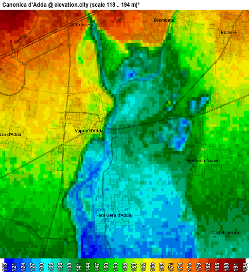
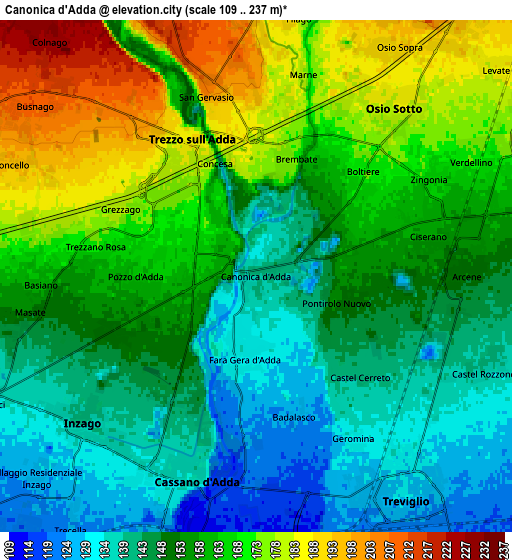
Below is the Elevation map of Canonica d'Adda, which displays elevation range with different colors. Scale of the first map is from 118 to 194 m (387 to 636 ft) with average elevation of 150.7 meters (=494 ft) [note 1]
These maps also provides idea of topography and contour of this city, they are displayed at different zoom levels. More info about maps, scale and edge coordinates you can find below images.
| \ | Map #1 | Map #2 | Topo.Map |
| Scale [m] | 118..194 m | 109..237 m | × |
| Scale [ft] | 387..636 ft | 358..778 ft | × |
| Average | 150.7 m = 494 ft | 156.5 m = 513 ft | × |
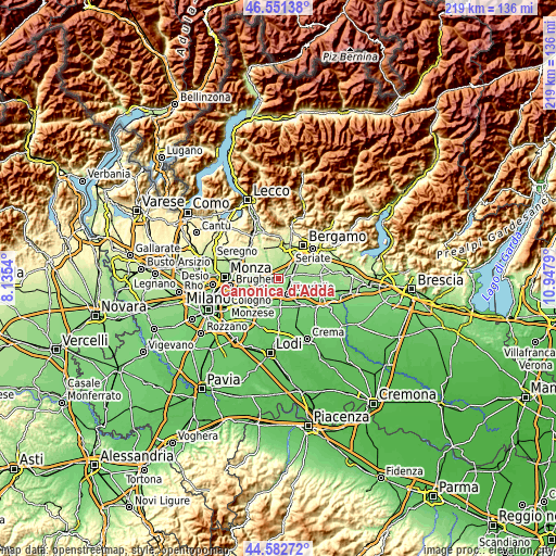
| Width | 6.84 km = 4.3 mi | 13.68 km = 8.5 mi | 218.9 km = 136 mi |
| Height | 6.84 km = 4.3 mi | 13.68 km = 8.5 mi | 218.9 km = 136 mi |
| ↑Max Latitude | 45.606432° | 45.637167° | 46.55138° |
| Latitude at center | 45.57568° | 45.57568° | 45.57568° |
| ↓Min Latitude | 45.544911° | 45.514126° | 44.58272° |
| ← Min Longitude | 9.497705° | 9.453759° | 8.1354° |
| Longitude center | 9.54165° | 9.54165° | 9.54165° |
| →Max Longitude | 9.585595° | 9.629541° | 10.9479° |
Nearby cities:
Cities around Canonica d'Adda sort by population:
• Trezzo sull'Adda elevation 181 m
3.9 km,  326°
326°
• Vaprio d'Adda 163 m
1.4 km,  273°
273°
• Capriate San Gervasio 189 m
4.2 km,  347°
347°
• Fara Gera d'Adda 133 m
2.2 km,  190°
190°
• Brembate 172 m
3.4 km,  17°
17°
• Boltiere 172 m
4 km,  45°
45°
• Trezzano Rosa 170 m
4.4 km,  279°
279°
• Pontirolo Nuovo 154 m
2.3 km,  108°
108°
• Pozzo d'Adda 160 m
3 km,  263°
263°
• Grezzago 179 m
3.9 km,  296°
296°
• Grignano 197 m
4.7 km,  0°
0°
• Badalasco 126 m
3.9 km,  164°
164°
Multilingual:
 En español:
Canonica d'Adda elevación 140 m.
 En France:
Canonica d'Adda élévation 140 m.
 Auf Deutsch:
Canonica d'Adda höhe über dem Meeresspiegel ist 140 m.

Sources and notes:
- [note 1] Map square and city borders are not equal. Map elevation data is calculated only from area inside that square.
- [src 1] Elevation data from geonames database provided with same terms of usage.
- [src 2] The elevation map of Canonica d'Adda is generated using elevation data from NASA's 3 arcsec (90m) resolution SRTM data.
- [src 3] Base (background) map © OpenStreetMap contributors tiles are generated by Geofabrik and OpenTopoMap.
Copyright & License:
This Canonica d'Adda Elevation Map is licensed under CC BY-SA. You may reuse any part from this page, if you give a proper credit by linking to this URL:
 More info on terms of use page.