Bizzarone elevation
Bizzarone (Lombardy, Provincia di Como), Italy elevation is 436 meters and Bizzarone elevation in feet is 1430 ft above sea level [src 1]. Bizzarone is a seat of a third-order administrative division (feature code) with elevation that is 114 meters (374 ft) bigger than average city elevation in Italy.
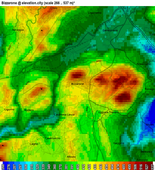
Below is the Elevation map of Bizzarone, which displays elevation range with different colors. Scale of the first map is from 266 to 537 m (873 to 1762 ft) with average elevation of 391.9 meters (=1286 ft) [note 1]
These maps also provides idea of topography and contour of this city, they are displayed at different zoom levels. More info about maps, scale and edge coordinates you can find below images.
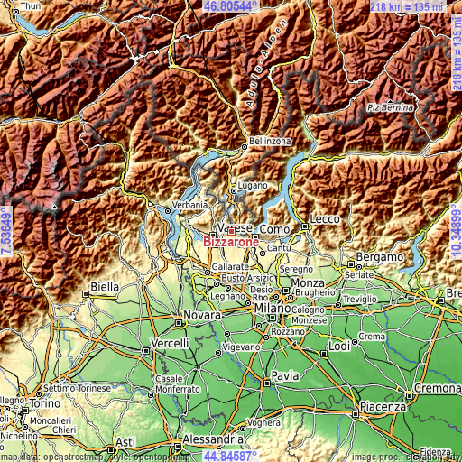
| \ | Map #1 | Topo.Map |
| Scale [m] | 266..537 m | × |
| Scale [ft] | 873..1762 ft | × |
| Average | 391.9 m = 1286 ft | × |
| Width | 6.81 km = 4.2 mi | 217.9 km = 135.4 mi |
| Height | 6.81 km = 4.2 mi | 217.9 km = 135.4 mi |
| ↑Max Latitude | 45.86489° | 46.80544° |
| Latitude at center | 45.83428° | 45.83428° |
| ↓Min Latitude | 45.803653° | 44.84587° |
| ← Min Longitude | 8.898795° | 7.53649° |
| Longitude center | 8.94274° | 8.94274° |
| →Max Longitude | 8.986685° | 10.34899° |
Nearby cities:
Cities around Bizzarone sort by population:
• Cantello elevation 408 m
3.9 km,  250°
250°
• Uggiate Trevano 419 m
1.8 km,  132°
132°
• Faloppio 383 m
3.2 km,  148°
148°
• Gaggino 376 m
3.4 km, 150°
• Albiolo 426 m
3.2 km,  184°
184°
• Valmorea 409 m
2.3 km,  203°
203°
• Cagno 414 m
3.2 km,  217°
217°
• Clivio 451 m
3.3 km,  343°
343°
• Baraggia 415 m
3.5 km,  311°
311°
• Camnago-Boscone 366 m
4.3 km,  139°
139°
• Ronago 373 m
3.2 km,  94°
94°
• Rodero 407 m
2.4 km,  241°
241°
Multilingual:
 En español:
Bizzarone elevación 436 m.
 En France:
Bizzarone élévation 436 m.
 Auf Deutsch:
Bizzarone höhe über dem Meeresspiegel ist 436 m.

Sources and notes:
- [note 1] Map square and city borders are not equal. Map elevation data is calculated only from area inside that square.
- [src 1] Elevation data from geonames database provided with same terms of usage.
- [src 2] The elevation map of Bizzarone is generated using elevation data from NASA's 3 arcsec (90m) resolution SRTM data.
- [src 3] Base (background) map © OpenStreetMap contributors tiles are generated by Geofabrik and OpenTopoMap.
Copyright & License:
This Bizzarone Elevation Map is licensed under CC BY-SA. You may reuse any part from this page, if you give a proper credit by linking to this URL:
 More info on terms of use page.