Cosseria elevation
Cosseria (Liguria, Provincia di Savona), Italy elevation is 530 meters and Cosseria elevation in feet is 1739 ft above sea level [src 1]. Cosseria is a seat of a third-order administrative division (feature code) with elevation that is 208 meters (682 ft) bigger than average city elevation in Italy.
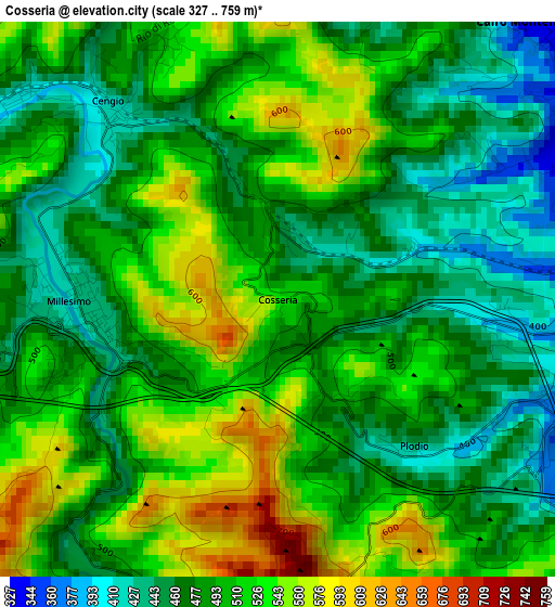
Below is the Elevation map of Cosseria, which displays elevation range with different colors. Scale of the first map is from 327 to 759 m (1073 to 2490 ft) with average elevation of 496.2 meters (=1628 ft) [note 1]
These maps also provides idea of topography and contour of this city, they are displayed at different zoom levels. More info about maps, scale and edge coordinates you can find below images.
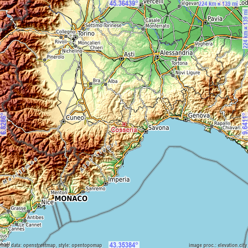
| \ | Map #1 | Topo.Map |
| Scale [m] | 327..759 m | × |
| Scale [ft] | 1073..2490 ft | × |
| Average | 496.2 m = 1628 ft | × |
| Width | 6.99 km = 4.3 mi | 223.6 km = 138.9 mi |
| Height | 6.99 km = 4.3 mi | 223.5 km = 138.9 mi |
| ↑Max Latitude | 44.399147° | 45.36439° |
| Latitude at center | 44.36774° | 44.36774° |
| ↓Min Latitude | 44.336317° | 43.35384° |
| ← Min Longitude | 8.190905° | 6.8286° |
| Longitude center | 8.23485° | 8.23485° |
| →Max Longitude | 8.278795° | 9.6411° |
Nearby cities:
Cities around Cosseria sort by population:
• Cairo Montenotte elevation 330 m
4.8 km,  45°
45°
• Carcare 357 m
4.6 km,  108°
108°
• Bormida-Genepro 407 m
3.8 km,  312°
312°
• Millesimo 430 m
2.5 km,  267°
267°
• Murialdo 517 m
7.7 km,  223°
223°
• Saliceto 391 m
7.3 km, 313°
• Roccavignale 451 m
3.6 km,  258°
258°
• Pallare 394 m
5.7 km,  141°
141°
• Valzemola 570 m
4.9 km, 265°
• Montezemolo 734 m
7.5 km,  277°
277°
• Cengio Alto 521 m
3.5 km,  302°
302°
• Plodio 471 m
1.8 km,  147°
147°
Multilingual:
 En español:
Cosseria elevación 530 m.
 En France:
Cosseria élévation 530 m.
 Auf Deutsch:
Cosseria höhe über dem Meeresspiegel ist 530 m.

Sources and notes:
- [note 1] Map square and city borders are not equal. Map elevation data is calculated only from area inside that square.
- [src 1] Elevation data from geonames database provided with same terms of usage.
- [src 2] The elevation map of Cosseria is generated using elevation data from NASA's 3 arcsec (90m) resolution SRTM data.
- [src 3] Base (background) map © OpenStreetMap contributors tiles are generated by Geofabrik and OpenTopoMap.
Copyright & License:
This Cosseria Elevation Map is licensed under CC BY-SA. You may reuse any part from this page, if you give a proper credit by linking to this URL:
 More info on terms of use page.