Camerana elevation
Camerana (Piedmont, Provincia di Cuneo), Italy elevation is 507 meters and Camerana elevation in feet is 1663 ft above sea level [src 1]. Camerana is a seat of a third-order administrative division (feature code) with elevation that is 185 meters (607 ft) bigger than average city elevation in Italy.
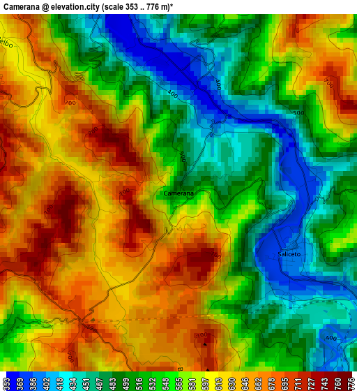
Below is the Elevation map of Camerana, which displays elevation range with different colors. Scale of the first map is from 353 to 776 m (1158 to 2546 ft) with average elevation of 566.2 meters (=1858 ft) [note 1]
These maps also provides idea of topography and contour of this city, they are displayed at different zoom levels. More info about maps, scale and edge coordinates you can find below images.
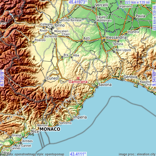
| \ | Map #1 | Topo.Map |
| Scale [m] | 353..776 m | × |
| Scale [ft] | 1158..2546 ft | × |
| Average | 566.2 m = 1858 ft | × |
| Width | 6.98 km = 4.3 mi | 223.3 km = 138.8 mi |
| Height | 6.98 km = 4.3 mi | 223.3 km = 138.8 mi |
| ↑Max Latitude | 44.455416° | 45.41973° |
| Latitude at center | 44.42404° | 44.42404° |
| ↓Min Latitude | 44.392647° | 43.4111° |
| ← Min Longitude | 8.097495° | 6.73519° |
| Longitude center | 8.14144° | 8.14144° |
| →Max Longitude | 8.185385° | 9.54769° |
Nearby cities:
Cities around Camerana sort by population:
• Bormida-Genepro elevation 407 m
5.9 km,  128°
128°
• Saliceto 391 m
2.5 km,  118°
118°
• Monesiglio 392 m
4.9 km,  339°
339°
• Priero 473 m
6.6 km,  215°
215°
• Sale delle Langhe 483 m
5.8 km,  236°
236°
• Montezemolo 734 m
5.2 km,  180°
180°
• Prunetto 661 m
7.2 km,  1°
1°
• Gottasecca 689 m
4.5 km,  27°
27°
• Mombarcaro 865 m
6.4 km,  318°
318°
• Paroldo 633 m
5.6 km,  279°
279°
• Cengio Alto 521 m
6.3 km, 134°
• Sale San Giovanni 586 m
5.8 km, 241°
Multilingual:
 En español:
Camerana elevación 507 m.
 En France:
Camerana élévation 507 m.
 Auf Deutsch:
Camerana höhe über dem Meeresspiegel ist 507 m.

Sources and notes:
- [note 1] Map square and city borders are not equal. Map elevation data is calculated only from area inside that square.
- [src 1] Elevation data from geonames database provided with same terms of usage.
- [src 2] The elevation map of Camerana is generated using elevation data from NASA's 3 arcsec (90m) resolution SRTM data.
- [src 3] Base (background) map © OpenStreetMap contributors tiles are generated by Geofabrik and OpenTopoMap.
Copyright & License:
This Camerana Elevation Map is licensed under CC BY-SA. You may reuse any part from this page, if you give a proper credit by linking to this URL:
 More info on terms of use page.