San Salvatore elevation
San Salvatore (Liguria, Provincia di Genova), Italy elevation is 14 meters and San Salvatore elevation in feet is 46 ft above sea level [src 1]. San Salvatore is a populated place (feature code) with elevation that is 308 meters (1010 ft) smaller than average city elevation in Italy.
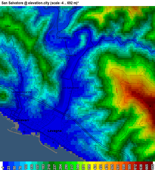
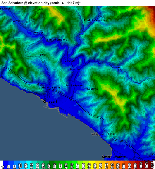
Below is the Elevation map of San Salvatore, which displays elevation range with different colors. Scale of the first map is from -4 to 692 m (-13 to 2270 ft) with average elevation of 168.7 meters (=553 ft) [note 1]
These maps also provides idea of topography and contour of this city, they are displayed at different zoom levels. More info about maps, scale and edge coordinates you can find below images.
| \ | Map #1 | Map #2 | Topo.Map |
| Scale [m] | -4..692 m | -4..1117 m | × |
| Scale [ft] | -13..2270 ft | -13..3665 ft | × |
| Average | 168.7 m = 553 ft | 251.7 m = 826 ft | × |
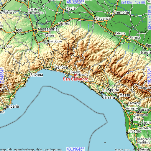
| Width | 6.99 km = 4.3 mi | 13.98 km = 8.7 mi | 223.7 km = 139 mi |
| Height | 6.99 km = 4.3 mi | 13.98 km = 8.7 mi | 223.7 km = 139 mi |
| ↑Max Latitude | 44.362406° | 44.393816° | 45.32826° |
| Latitude at center | 44.33098° | 44.33098° | 44.33098° |
| ↓Min Latitude | 44.299537° | 44.268077° | 43.31645° |
| ← Min Longitude | 9.310845° | 9.266899° | 7.94854° |
| Longitude center | 9.35479° | 9.35479° | 9.35479° |
| →Max Longitude | 9.398735° | 9.442681° | 10.76104° |
Nearby cities:
Cities around San Salvatore sort by population:
• Chiavari elevation 7 m
3 km,  240°
240°
• Sestri Levante 5 m
7.2 km,  152°
152°
• Lavagna 38 m
2.8 km,  181°
181°
• Leivi 234 m
4.3 km,  305°
305°
• Zoagli 14 m
7 km,  275°
275°
• Carasco 27 m
2.2 km,  340°
340°
• Mezzanego 80 m
6 km,  16°
16°
• Conscenti 57 m
3.6 km,  64°
64°
• Cogorno 215 m
1.7 km,  131°
131°
• Prati 74 m
6 km, 16°
• Chiesa Nuova 38 m
5.5 km,  321°
321°
• Bocco 209 m
4.7 km,  298°
298°
Multilingual:
 En español:
San Salvatore elevación 14 m.
 En France:
San Salvatore élévation 14 m.
 Auf Deutsch:
San Salvatore höhe über dem Meeresspiegel ist 14 m.

Sources and notes:
- [note 1] Map square and city borders are not equal. Map elevation data is calculated only from area inside that square.
- [src 1] Elevation data from geonames database provided with same terms of usage.
- [src 2] The elevation map of San Salvatore is generated using elevation data from NASA's 3 arcsec (90m) resolution SRTM data.
- [src 3] Base (background) map © OpenStreetMap contributors tiles are generated by Geofabrik and OpenTopoMap.
Copyright & License:
This San Salvatore Elevation Map is licensed under CC BY-SA. You may reuse any part from this page, if you give a proper credit by linking to this URL:
 More info on terms of use page.