Albano Sant'Alessandro elevation
Albano Sant'Alessandro (Lombardy, Provincia di Bergamo), Italy elevation is 244 meters and Albano Sant'Alessandro elevation in feet is 801 ft above sea level [src 1]. Albano Sant'Alessandro is a seat of a third-order administrative division (feature code) with elevation that is 78 meters (256 ft) smaller than average city elevation in Italy.
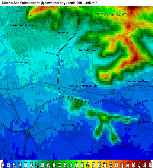
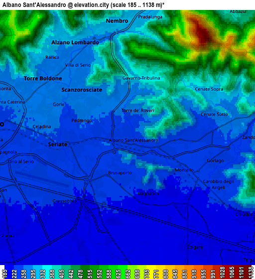
Below is the Elevation map of Albano Sant'Alessandro, which displays elevation range with different colors. Scale of the first map is from 209 to 495 m (686 to 1624 ft) with average elevation of 267.4 meters (=877 ft) [note 1]
These maps also provides idea of topography and contour of this city, they are displayed at different zoom levels. More info about maps, scale and edge coordinates you can find below images.
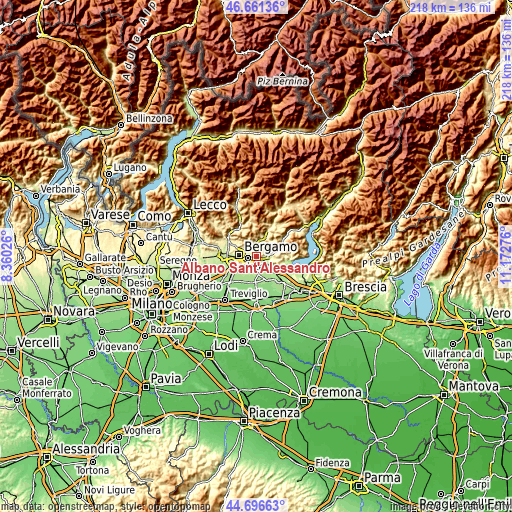
| \ | Map #1 | Map #2 | Topo.Map |
| Scale [m] | 209..495 m | 185..1138 m | × |
| Scale [ft] | 686..1624 ft | 607..3734 ft | × |
| Average | 267.4 m = 877 ft | 307.6 m = 1009 ft | × |
| Width | 6.83 km = 4.2 mi | 13.65 km = 8.5 mi | 218.5 km = 135.8 mi |
| Height | 6.83 km = 4.2 mi | 13.65 km = 8.5 mi | 218.4 km = 135.7 mi |
| ↑Max Latitude | 45.71831° | 45.748984° | 46.66136° |
| Latitude at center | 45.68762° | 45.68762° | 45.68762° |
| ↓Min Latitude | 45.656913° | 45.626189° | 44.69663° |
| ← Min Longitude | 9.722565° | 9.678619° | 8.36026° |
| Longitude center | 9.76651° | 9.76651° | 9.76651° |
| →Max Longitude | 9.810455° | 9.854401° | 11.17276° |
Nearby cities:
Cities around Albano Sant'Alessandro sort by population:
• Seriate elevation 249 m
3.2 km,  265°
265°
• Scanzo-Rosciate 276 m
3.5 km,  316°
316°
• Pedrengo 259 m
2.6 km,  290°
290°
• Brusaporto 234 m
1.9 km,  194°
194°
• San Paolo d'Argon 243 m
2.8 km,  88°
88°
• Bagnatica 220 m
3.2 km,  159°
159°
• Montello 228 m
3.5 km,  119°
119°
• Costa di Mezzate 218 m
3.6 km,  140°
140°
• Torre de' Roveri 258 m
1.1 km,  346°
346°
• Gavarno-Tribulina 343 m
3.4 km,  11°
11°
• Negrone 278 m
2.6 km, 345°
• Gavarno Rinnovata 317 m
4.1 km,  356°
356°
Multilingual:
 En español:
Albano Sant'Alessandro elevación 244 m.
 En France:
Albano Sant'Alessandro élévation 244 m.
 Auf Deutsch:
Albano Sant'Alessandro höhe über dem Meeresspiegel ist 244 m.
 На русском:
Albano Sant'Alessandro высота над уровнем моря 244 м
Sources and notes:
- [note 1] Map square and city borders are not equal. Map elevation data is calculated only from area inside that square.
- [src 1] Elevation data from geonames database provided with same terms of usage.
- [src 2] The elevation map of Albano Sant'Alessandro is generated using elevation data from NASA's 3 arcsec (90m) resolution SRTM data.
- [src 3] Base (background) map © OpenStreetMap contributors tiles are generated by Geofabrik and OpenTopoMap.
Copyright & License:
This Albano Sant'Alessandro Elevation Map is licensed under CC BY-SA. You may reuse any part from this page, if you give a proper credit by linking to this URL:
 More info on terms of use page.