Angera elevation
Angera (Lombardy, Provincia di Varese), Italy elevation is 218 meters and Angera elevation in feet is 715 ft above sea level [src 1]. Angera is a seat of a third-order administrative division (feature code) with elevation that is 104 meters (341 ft) smaller than average city elevation in Italy.
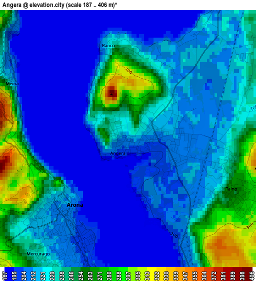
Below is the Elevation map of Angera, which displays elevation range with different colors. Scale of the first map is from 187 to 406 m (614 to 1332 ft) with average elevation of 225.1 meters (=739 ft) [note 1]
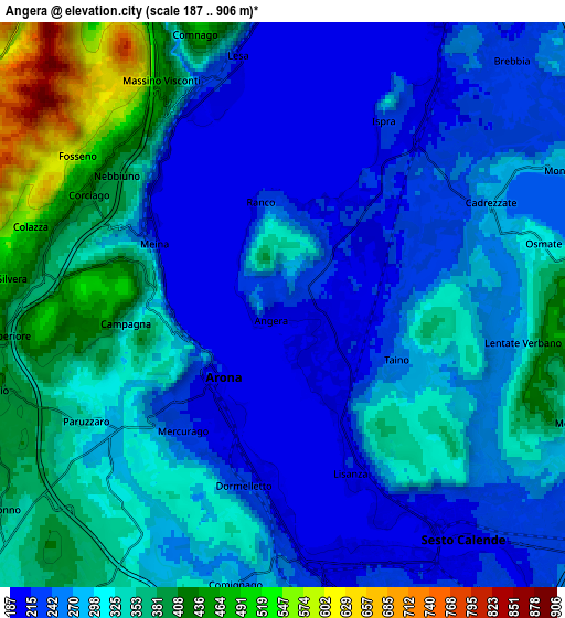
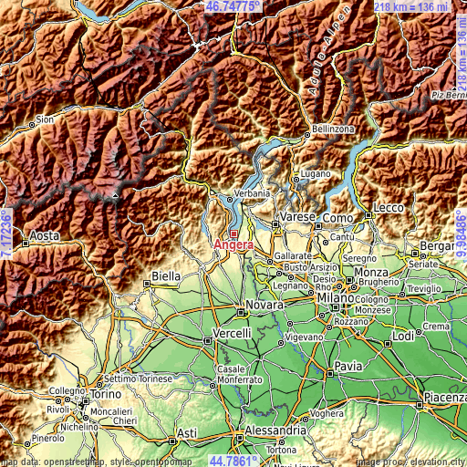
These maps also provides idea of topography and contour of this city, they are displayed at different zoom levels. More info about maps, scale and edge coordinates you can find below images.
| \ | Map #1 | Map #2 | Topo.Map |
| Scale [m] | 187..406 m | 187..906 m | × |
| Scale [ft] | 614..1332 ft | 614..2972 ft | × |
| Average | 225.1 m = 739 ft | 297.9 m = 977 ft | × |
| Width | 6.82 km = 4.2 mi | 13.63 km = 8.5 mi | 218.1 km = 135.5 mi |
| Height | 6.82 km = 4.2 mi | 13.63 km = 8.5 mi | 218.1 km = 135.5 mi |
| ↑Max Latitude | 45.806192° | 45.836817° | 46.74775° |
| Latitude at center | 45.77555° | 45.77555° | 45.77555° |
| ↓Min Latitude | 45.744891° | 45.714215° | 44.7861° |
| ← Min Longitude | 8.534665° | 8.490719° | 7.17236° |
| Longitude center | 8.57861° | 8.57861° | 8.57861° |
| →Max Longitude | 8.622555° | 8.666501° | 9.98486° |
Nearby cities:
Cities around Angera sort by population:
• Arona elevation 213 m
2.5 km,  221°
221°
• Ispra 222 m
5.1 km,  31°
31°
• Taino 261 m
3.3 km,  116°
116°
• Dormelletto 221 m
4.5 km,  192°
192°
• Lesa 210 m
5.2 km,  343°
343°
• Oleggio Castello 293 m
5 km,  233°
233°
• Cadrezzate 279 m
5.7 km,  62°
62°
• Meina 215 m
3.6 km,  298°
298°
• Lisanza 208 m
4.3 km,  159°
159°
• Nebbiuno 431 m
5.4 km,  311°
311°
• Ranco 217 m
2.5 km,  346°
346°
• Pisano 400 m
5.4 km,  294°
294°
Multilingual:
 En español:
Angera elevación 218 m.
 En France:
Angera élévation 218 m.


Sources and notes:
- [note 1] Map square and city borders are not equal. Map elevation data is calculated only from area inside that square.
- [src 1] Elevation data from geonames database provided with same terms of usage.
- [src 2] The elevation map of Angera is generated using elevation data from NASA's 3 arcsec (90m) resolution SRTM data.
- [src 3] Base (background) map © OpenStreetMap contributors tiles are generated by Geofabrik and OpenTopoMap.
Copyright & License:
This Angera Elevation Map is licensed under CC BY-SA. You may reuse any part from this page, if you give a proper credit by linking to this URL:
 More info on terms of use page.