Anzio elevation
Anzio (Latium, Città metropolitana di Roma Capitale), Italy elevation is 20 meters and Anzio elevation in feet is 66 ft above sea level [src 1]. Anzio is a seat of a third-order administrative division (feature code) with elevation that is 302 meters (991 ft) smaller than average city elevation in Italy.
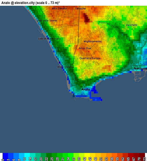
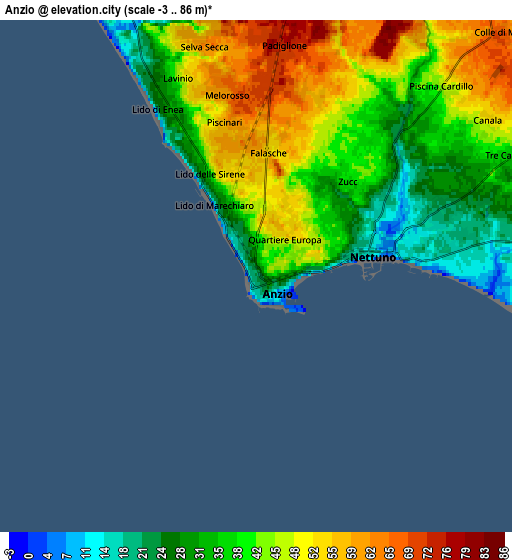
Below is the Elevation map of Anzio, which displays elevation range with different colors. Scale of the first map is from 0 to 73 m (0 to 240 ft) with average elevation of 37.3 meters (=122 ft) [note 1]
These maps also provides idea of topography and contour of this city, they are displayed at different zoom levels. More info about maps, scale and edge coordinates you can find below images.
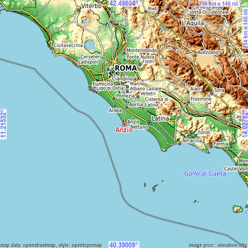
| \ | Map #1 | Map #2 | Topo.Map |
| Scale [m] | 0..73 m | -3..86 m | × |
| Scale [ft] | 0..240 ft | -10..282 ft | × |
| Average | 37.3 m = 122 ft | 41.9 m = 137 ft | × |
| Width | 7.32 km = 4.5 mi | 14.65 km = 9.1 mi | 234.4 km = 145.6 mi |
| Height | 7.32 km = 4.5 mi | 14.65 km = 9.1 mi | 234.4 km = 145.6 mi |
| ↑Max Latitude | 41.485559° | 41.518471° | 42.49804° |
| Latitude at center | 41.45263° | 41.45263° | 41.45263° |
| ↓Min Latitude | 41.419684° | 41.386722° | 40.39009° |
| ← Min Longitude | 12.577625° | 12.533679° | 11.21532° |
| Longitude center | 12.62157° | 12.62157° | 12.62157° |
| →Max Longitude | 12.665515° | 12.709461° | 14.02782° |
Nearby cities:
Cities around Anzio sort by population:
• Nettuno elevation 12 m
3.6 km,  80°
80°
• Aprilia 79 m
16 km,  9°
9°
• Marina di Ardea-Tor San Lorenzo 4 m
13.1 km,  329°
329°
• Ardea 14 m
18.5 km,  338°
338°
• Lavinio 32 m
6.2 km, 334°
• Genio Civile 55 m
12.1 km,  28°
28°
• Campo di Carne 83 m
11.2 km, 8°
• Fossignano 52 m
16.3 km, 342°
• Lido dei Pini 50 m
9.7 km, 344°
• Borgo Sabotino-Foce Verde 3 m
18.1 km,  102°
102°
• Casalazzara 63 m
19.3 km,  348°
348°
• Camilleri-Vallelata 74 m
16.2 km,  358°
358°
Multilingual:
 En español:
Anzio elevación 20 m.
 En France:
Anzio élévation 20 m.


Sources and notes:
- [note 1] Map square and city borders are not equal. Map elevation data is calculated only from area inside that square.
- [src 1] Elevation data from geonames database provided with same terms of usage.
- [src 2] The elevation map of Anzio is generated using elevation data from NASA's 3 arcsec (90m) resolution SRTM data.
- [src 3] Base (background) map © OpenStreetMap contributors tiles are generated by Geofabrik and OpenTopoMap.
Copyright & License:
This Anzio Elevation Map is licensed under CC BY-SA. You may reuse any part from this page, if you give a proper credit by linking to this URL:
 More info on terms of use page.