Besenello elevation
Besenello (Trentino-Alto Adige, Provincia autonoma di Trento), Italy elevation is 220 meters and Besenello elevation in feet is 722 ft above sea level [src 1]. Besenello is a seat of a third-order administrative division (feature code) with elevation that is 102 meters (335 ft) smaller than average city elevation in Italy.
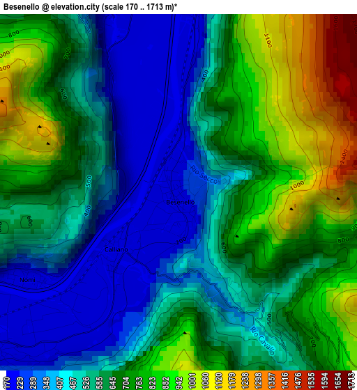
Below is the Elevation map of Besenello, which displays elevation range with different colors. Scale of the first map is from 170 to 1713 m (558 to 5620 ft) with average elevation of 616 meters (=2021 ft) [note 1]
These maps also provides idea of topography and contour of this city, they are displayed at different zoom levels. More info about maps, scale and edge coordinates you can find below images.
| \ | Map #1 | Topo.Map |
| Scale [m] | 170..1713 m | × |
| Scale [ft] | 558..5620 ft | × |
| Average | 616 m = 2021 ft | × |
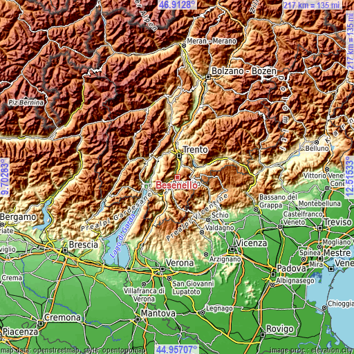
| Width | 6.8 km = 4.2 mi | 217.5 km = 135.1 mi |
| Height | 6.8 km = 4.2 mi | 217.4 km = 135.1 mi |
| ↑Max Latitude | 45.97411° | 46.9128° |
| Latitude at center | 45.94356° | 45.94356° |
| ↓Min Latitude | 45.912993° | 44.95707° |
| ← Min Longitude | 11.065135° | 9.70283° |
| Longitude center | 11.10908° | 11.10908° |
| →Max Longitude | 11.153025° | 12.51533° |
Nearby cities:
Cities around Besenello sort by population:
• Mattarello elevation 199 m
7.4 km,  12°
12°
• Volano 189 m
4.6 km,  230°
230°
• Aldeno 205 m
4 km,  341°
341°
• Villa Lagarina 184 m
6.5 km,  244°
244°
• Pomarolo 211 m
5.4 km,  251°
251°
• Folgaria 1151 m
5.5 km,  124°
124°
• Calliano 191 m
1.6 km,  222°
222°
• Nomi 183 m
3.3 km, 240°
• Nogaredo 230 m
7.4 km, 242°
• Covelo 535 m
5 km,  322°
322°
• Garniga Nuova 814 m
6.8 km,  345°
345°
• Cimoneri 678 m
5.4 km,  327°
327°
Multilingual:
 En español:
Besenello elevación 220 m.
 En France:
Besenello élévation 220 m.
 Auf Deutsch:
Besenello höhe über dem Meeresspiegel ist 220 m.

Sources and notes:
- [note 1] Map square and city borders are not equal. Map elevation data is calculated only from area inside that square.
- [src 1] Elevation data from geonames database provided with same terms of usage.
- [src 2] The elevation map of Besenello is generated using elevation data from NASA's 3 arcsec (90m) resolution SRTM data.
- [src 3] Base (background) map © OpenStreetMap contributors tiles are generated by Geofabrik and OpenTopoMap.
Copyright & License:
This Besenello Elevation Map is licensed under CC BY-SA. You may reuse any part from this page, if you give a proper credit by linking to this URL:
 More info on terms of use page.