Besnate elevation
Besnate (Lombardy, Provincia di Varese), Italy elevation is 296 meters and Besnate elevation in feet is 971 ft above sea level [src 1]. Besnate is a seat of a third-order administrative division (feature code) with elevation that is 26 meters (85 ft) smaller than average city elevation in Italy.
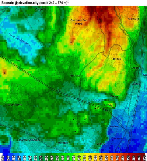
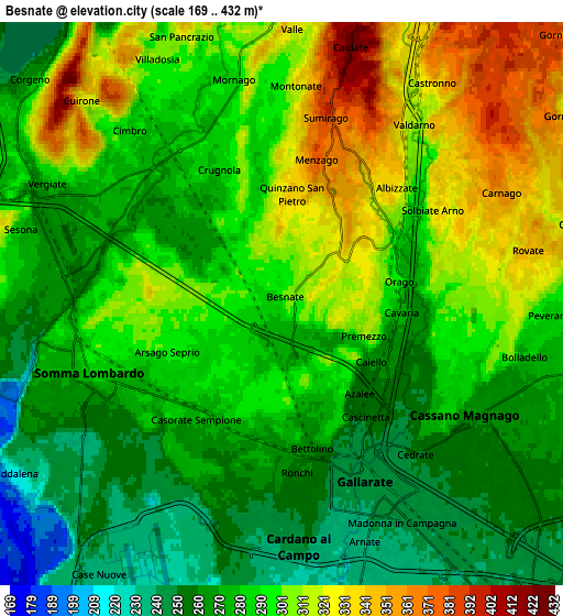
Below is the Elevation map of Besnate, which displays elevation range with different colors. Scale of the first map is from 242 to 374 m (794 to 1227 ft) with average elevation of 291.8 meters (=957 ft) [note 1]
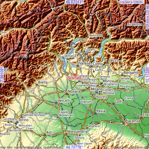
These maps also provides idea of topography and contour of this city, they are displayed at different zoom levels. More info about maps, scale and edge coordinates you can find below images.
| \ | Map #1 | Map #2 | Topo.Map |
| Scale [m] | 242..374 m | 169..432 m | × |
| Scale [ft] | 794..1227 ft | 554..1417 ft | × |
| Average | 291.8 m = 957 ft | 288.6 m = 947 ft | × |
| Width | 6.83 km = 4.2 mi | 13.65 km = 8.5 mi | 218.4 km = 135.7 mi |
| Height | 6.83 km = 4.2 mi | 13.65 km = 8.5 mi | 218.4 km = 135.7 mi |
| ↑Max Latitude | 45.729264° | 45.759932° | 46.67213° |
| Latitude at center | 45.69858° | 45.69858° | 45.69858° |
| ↓Min Latitude | 45.667879° | 45.637161° | 44.70778° |
| ← Min Longitude | 8.723395° | 8.679449° | 7.36109° |
| Longitude center | 8.76734° | 8.76734° | 8.76734° |
| →Max Longitude | 8.811285° | 8.855231° | 10.17359° |
Nearby cities:
Cities around Besnate sort by population:
• Gallarate elevation 245 m
4.7 km,  156°
156°
• Somma Lombardo 283 m
5 km,  248°
248°
• Casorate Sempione 271 m
3.5 km,  209°
209°
• Sumirago 376 m
4.4 km,  16°
16°
• Cavaria Con Premezzo 271 m
2.9 km,  103°
103°
• Albizzate 341 m
4.2 km,  41°
41°
• Jerago Con Orago 320 m
2.3 km,  73°
73°
• Arsago Seprio 292 m
2.8 km,  244°
244°
• Oggiona-Santo Stefano 309 m
3.9 km,  80°
80°
• Solbiate Arno 323 m
4.3 km,  57°
57°
• Crugnola 279 m
3.8 km,  333°
333°
• Monte 346 m
4.6 km, 66°
Multilingual:
 En español:
Besnate elevación 296 m.
 En France:
Besnate élévation 296 m.


Sources and notes:
- [note 1] Map square and city borders are not equal. Map elevation data is calculated only from area inside that square.
- [src 1] Elevation data from geonames database provided with same terms of usage.
- [src 2] The elevation map of Besnate is generated using elevation data from NASA's 3 arcsec (90m) resolution SRTM data.
- [src 3] Base (background) map © OpenStreetMap contributors tiles are generated by Geofabrik and OpenTopoMap.
Copyright & License:
This Besnate Elevation Map is licensed under CC BY-SA. You may reuse any part from this page, if you give a proper credit by linking to this URL:
 More info on terms of use page.