Birori elevation
Birori (Sardinia, Provincia di Nuoro), Italy elevation is 473 meters and Birori elevation in feet is 1552 ft above sea level [src 1]. Birori is a seat of a third-order administrative division (feature code) with elevation that is 151 meters (495 ft) bigger than average city elevation in Italy.
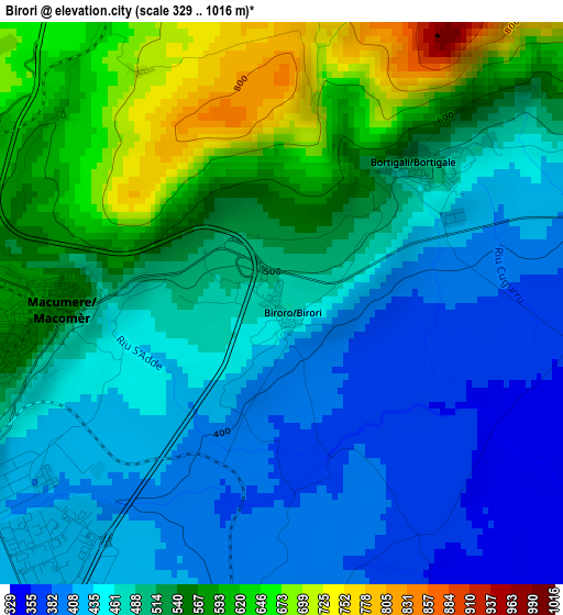
Below is the Elevation map of Birori, which displays elevation range with different colors. Scale of the first map is from 329 to 1016 m (1079 to 3333 ft) with average elevation of 500.5 meters (=1642 ft) [note 1]
These maps also provides idea of topography and contour of this city, they are displayed at different zoom levels. More info about maps, scale and edge coordinates you can find below images.
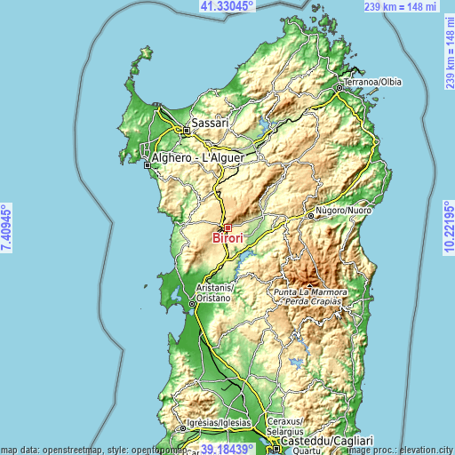
| \ | Map #1 | Topo.Map |
| Scale [m] | 329..1016 m | × |
| Scale [ft] | 1079..3333 ft | × |
| Average | 500.5 m = 1642 ft | × |
| Width | 7.46 km = 4.6 mi | 238.6 km = 148.3 mi |
| Height | 7.46 km = 4.6 mi | 238.6 km = 148.3 mi |
| ↑Max Latitude | 40.299454° | 41.33045° |
| Latitude at center | 40.26593° | 40.26593° |
| ↓Min Latitude | 40.232389° | 39.18439° |
| ← Min Longitude | 8.771755° | 7.40945° |
| Longitude center | 8.8157° | 8.8157° |
| →Max Longitude | 8.859645° | 10.22195° |
Nearby cities:
Cities around Birori sort by population:
• Macomer elevation 568 m
4.1 km,  264°
264°
• Bolotana 426 m
13.9 km,  62°
62°
• Sedilo 284 m
13.6 km,  139°
139°
• Borore 391 m
5.7 km,  190°
190°
• Silanus 410 m
6.9 km,  70°
70°
• Sindia 507 m
13.8 km,  283°
283°
• Bortigali 501 m
2.7 km,  47°
47°
• Norbello 316 m
14.7 km,  174°
174°
• Dualchi 322 m
8 km,  120°
120°
• Lei 475 m
9.8 km, 62°
• Aidomaggiore 249 m
11.1 km,  161°
161°
• Noragugume 288 m
10 km, 117°
Multilingual:
 En español:
Birori elevación 473 m.
 En France:
Birori élévation 473 m.


Sources and notes:
- [note 1] Map square and city borders are not equal. Map elevation data is calculated only from area inside that square.
- [src 1] Elevation data from geonames database provided with same terms of usage.
- [src 2] The elevation map of Birori is generated using elevation data from NASA's 3 arcsec (90m) resolution SRTM data.
- [src 3] Base (background) map © OpenStreetMap contributors tiles are generated by Geofabrik and OpenTopoMap.
Copyright & License:
This Birori Elevation Map is licensed under CC BY-SA. You may reuse any part from this page, if you give a proper credit by linking to this URL:
 More info on terms of use page.