Borriana elevation
Borriana (Piedmont, Provincia di Biella), Italy elevation is 307 meters and Borriana elevation in feet is 1007 ft above sea level [src 1]. Borriana is a seat of a third-order administrative division (feature code) with elevation that is 15 meters (49 ft) smaller than average city elevation in Italy.
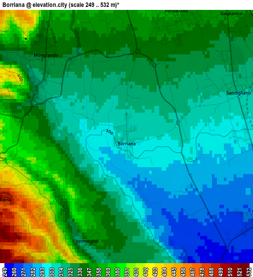
Below is the Elevation map of Borriana, which displays elevation range with different colors. Scale of the first map is from 249 to 532 m (817 to 1745 ft) with average elevation of 333.1 meters (=1093 ft) [note 1]
These maps also provides idea of topography and contour of this city, they are displayed at different zoom levels. More info about maps, scale and edge coordinates you can find below images.
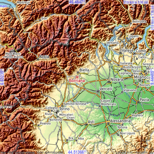
| \ | Map #1 | Topo.Map |
| Scale [m] | 249..532 m | × |
| Scale [ft] | 817..1745 ft | × |
| Average | 333.1 m = 1093 ft | × |
| Width | 6.85 km = 4.3 mi | 219.2 km = 136.2 mi |
| Height | 6.85 km = 4.3 mi | 219.1 km = 136.1 mi |
| ↑Max Latitude | 45.538599° | 46.4847° |
| Latitude at center | 45.50781° | 45.50781° |
| ↓Min Latitude | 45.477004° | 44.51366° |
| ← Min Longitude | 7.994655° | 6.63235° |
| Longitude center | 8.0386° | 8.0386° |
| →Max Longitude | 8.082545° | 9.44485° |
Nearby cities:
Cities around Borriana sort by population:
• Mongrando elevation 342 m
3.3 km,  312°
312°
• Occhieppo Inferiore 384 m
4.9 km,  343°
343°
• Ponderano 363 m
3.7 km,  21°
21°
• Gaglianico 347 m
4.5 km,  43°
43°
• Ceresane-Curanuova 329 m
3.1 km, 306°
• Sandigliano 325 m
3.4 km,  61°
61°
• Vergnasco 270 m
4.3 km,  121°
121°
• Verrone 283 m
6 km,  89°
89°
• Camburzano 429 m
4.9 km,  324°
324°
• Cerrione 260 m
4.9 km,  151°
151°
• Zubiena 497 m
3.8 km,  243°
243°
• Magnano 538 m
5.7 km,  209°
209°
Multilingual:
 En español:
Borriana elevación 307 m.
 En France:
Borriana élévation 307 m.
 Auf Deutsch:
Borriana höhe über dem Meeresspiegel ist 307 m.

Sources and notes:
- [note 1] Map square and city borders are not equal. Map elevation data is calculated only from area inside that square.
- [src 1] Elevation data from geonames database provided with same terms of usage.
- [src 2] The elevation map of Borriana is generated using elevation data from NASA's 3 arcsec (90m) resolution SRTM data.
- [src 3] Base (background) map © OpenStreetMap contributors tiles are generated by Geofabrik and OpenTopoMap.
Copyright & License:
This Borriana Elevation Map is licensed under CC BY-SA. You may reuse any part from this page, if you give a proper credit by linking to this URL:
 More info on terms of use page.