Brendola elevation
Brendola (Veneto, Provincia di Vicenza), Italy elevation is 51 meters and Brendola elevation in feet is 167 ft above sea level [src 1]. Brendola is a seat of a third-order administrative division (feature code) with elevation that is 271 meters (889 ft) smaller than average city elevation in Italy.
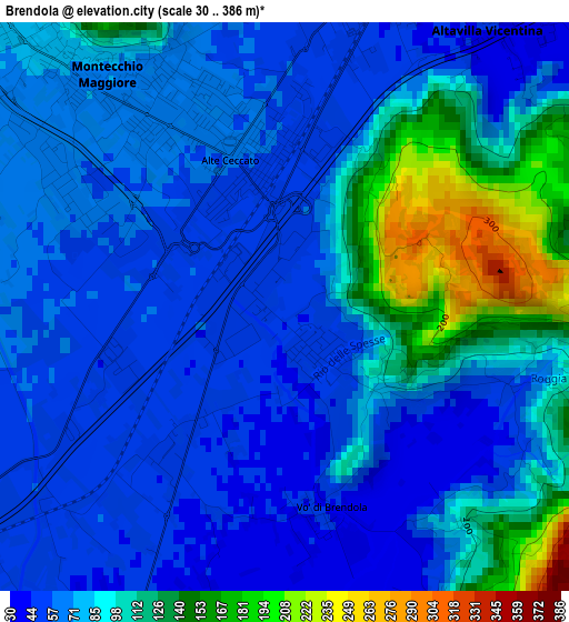
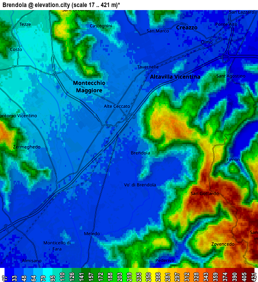
Below is the Elevation map of Brendola, which displays elevation range with different colors. Scale of the first map is from 30 to 386 m (98 to 1266 ft) with average elevation of 84.1 meters (=276 ft) [note 1]
These maps also provides idea of topography and contour of this city, they are displayed at different zoom levels. More info about maps, scale and edge coordinates you can find below images.
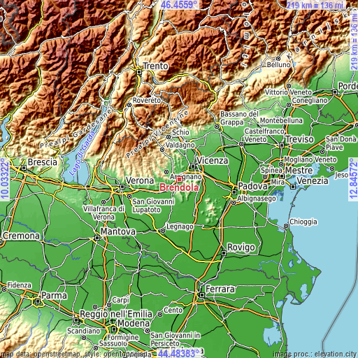
| \ | Map #1 | Map #2 | Topo.Map |
| Scale [m] | 30..386 m | 17..421 m | × |
| Scale [ft] | 98..1266 ft | 56..1381 ft | × |
| Average | 84.1 m = 276 ft | 102.2 m = 335 ft | × |
| Width | 6.85 km = 4.3 mi | 13.7 km = 8.5 mi | 219.3 km = 136.3 mi |
| Height | 6.85 km = 4.3 mi | 13.7 km = 8.5 mi | 219.3 km = 136.3 mi |
| ↑Max Latitude | 45.509295° | 45.540083° | 46.4559° |
| Latitude at center | 45.47849° | 45.47849° | 45.47849° |
| ↓Min Latitude | 45.447668° | 45.416829° | 44.48383° |
| ← Min Longitude | 11.395525° | 11.351579° | 10.03322° |
| Longitude center | 11.43947° | 11.43947° | 11.43947° |
| →Max Longitude | 11.483415° | 11.527361° | 12.84572° |
Nearby cities:
Cities around Brendola sort by population:
• Montecchio Maggiore-Alte Ceccato elevation 71 m
3.5 km,  322°
322°
• Altavilla Vicentina 45 m
4.5 km,  30°
30°
• Creazzo 38 m
6.6 km, 26°
• Montebello Vicentino 83 m
4.9 km,  244°
244°
• Sovizzo 45 m
5.4 km,  5°
5°
• Meledo 42 m
4.9 km,  202°
202°
• Montorso Vicentino 86 m
6.3 km,  282°
282°
• Monticello di Fara 38 m
6.7 km,  214°
214°
• Tavernelle 50 m
4.1 km, 9°
• Zermeghedo 62 m
5.1 km,  266°
266°
• Pederiva 46 m
6.5 km,  161°
161°
• Grancona 168 m
6.4 km,  171°
171°
Multilingual:
 En español:
Brendola elevación 51 m.
 En France:
Brendola élévation 51 m.


Sources and notes:
- [note 1] Map square and city borders are not equal. Map elevation data is calculated only from area inside that square.
- [src 1] Elevation data from geonames database provided with same terms of usage.
- [src 2] The elevation map of Brendola is generated using elevation data from NASA's 3 arcsec (90m) resolution SRTM data.
- [src 3] Base (background) map © OpenStreetMap contributors tiles are generated by Geofabrik and OpenTopoMap.
Copyright & License:
This Brendola Elevation Map is licensed under CC BY-SA. You may reuse any part from this page, if you give a proper credit by linking to this URL:
 More info on terms of use page.