Campogalliano elevation
Campogalliano (Emilia-Romagna, Provincia di Modena), Italy elevation is 41 meters and Campogalliano elevation in feet is 135 ft above sea level [src 1]. Campogalliano is a seat of a third-order administrative division (feature code) with elevation that is 281 meters (922 ft) smaller than average city elevation in Italy.
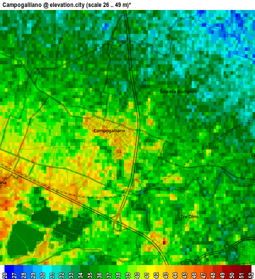
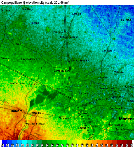
Below is the Elevation map of Campogalliano, which displays elevation range with different colors. Scale of the first map is from 26 to 49 m (85 to 161 ft) with average elevation of 36.1 meters (=118 ft) [note 1]
These maps also provides idea of topography and contour of this city, they are displayed at different zoom levels. More info about maps, scale and edge coordinates you can find below images.
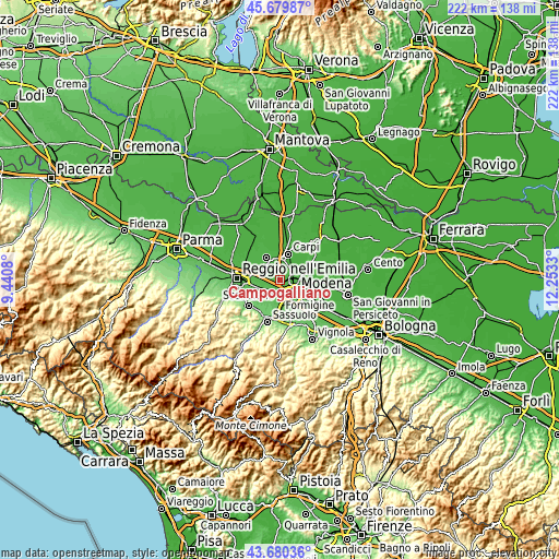
| \ | Map #1 | Map #2 | Topo.Map |
| Scale [m] | 26..49 m | 20..66 m | × |
| Scale [ft] | 85..161 ft | 66..217 ft | × |
| Average | 36.1 m = 118 ft | 36.5 m = 120 ft | × |
| Width | 6.95 km = 4.3 mi | 13.9 km = 8.6 mi | 222.3 km = 138.1 mi |
| Height | 6.95 km = 4.3 mi | 13.9 km = 8.6 mi | 222.3 km = 138.1 mi |
| ↑Max Latitude | 44.719974° | 44.751191° | 45.67987° |
| Latitude at center | 44.68874° | 44.68874° | 44.68874° |
| ↓Min Latitude | 44.657489° | 44.626222° | 43.68036° |
| ← Min Longitude | 10.803105° | 10.759159° | 9.4408° |
| Longitude center | 10.84705° | 10.84705° | 10.84705° |
| →Max Longitude | 10.890995° | 10.934941° | 12.2533° |
Nearby cities:
Cities around Campogalliano sort by population:
• Modena elevation 46 m
7.7 km,  126°
126°
• Correggio 34 m
10.1 km,  330°
330°
• Rubiera 53 m
6.8 km,  232°
232°
• Soliera 28 m
7.7 km,  49°
49°
• San Martino in Rio 40 m
7 km,  315°
315°
• Limidi 24 m
10.2 km,  34°
34°
• Baggiovara 61 m
9.5 km,  172°
172°
• Albareto 29 m
9.5 km,  89°
89°
• Bagno 52 m
7.9 km,  242°
242°
• Villanova 33 m
5.6 km, 89°
• Prato 36 m
8.4 km,  291°
291°
• Santa Croce Scuole 32 m
8.2 km,  1°
1°
Multilingual:
 En español:
Campogalliano elevación 41 m.
 En France:
Campogalliano élévation 41 m.
 Auf Deutsch:
Campogalliano höhe über dem Meeresspiegel ist 41 m.

Sources and notes:
- [note 1] Map square and city borders are not equal. Map elevation data is calculated only from area inside that square.
- [src 1] Elevation data from geonames database provided with same terms of usage.
- [src 2] The elevation map of Campogalliano is generated using elevation data from NASA's 3 arcsec (90m) resolution SRTM data.
- [src 3] Base (background) map © OpenStreetMap contributors tiles are generated by Geofabrik and OpenTopoMap.
Copyright & License:
This Campogalliano Elevation Map is licensed under CC BY-SA. You may reuse any part from this page, if you give a proper credit by linking to this URL:
 More info on terms of use page.