Casoria elevation
Casoria (Campania, Napoli), Italy elevation is 70 meters and Casoria elevation in feet is 230 ft above sea level [src 1]. Casoria is a seat of a third-order administrative division (feature code) with elevation that is 252 meters (827 ft) smaller than average city elevation in Italy.
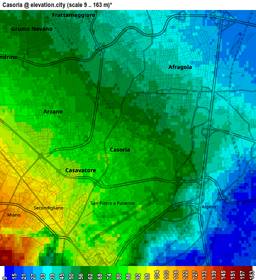
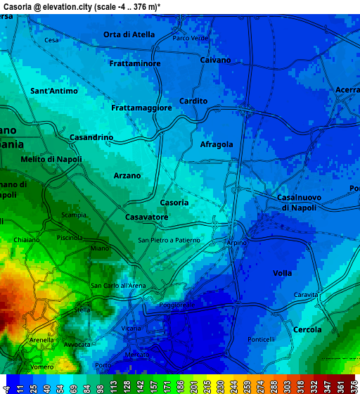
Below is the Elevation map of Casoria, which displays elevation range with different colors. Scale of the first map is from 9 to 163 m (30 to 535 ft) with average elevation of 59.7 meters (=196 ft) [note 1]
These maps also provides idea of topography and contour of this city, they are displayed at different zoom levels. More info about maps, scale and edge coordinates you can find below images.
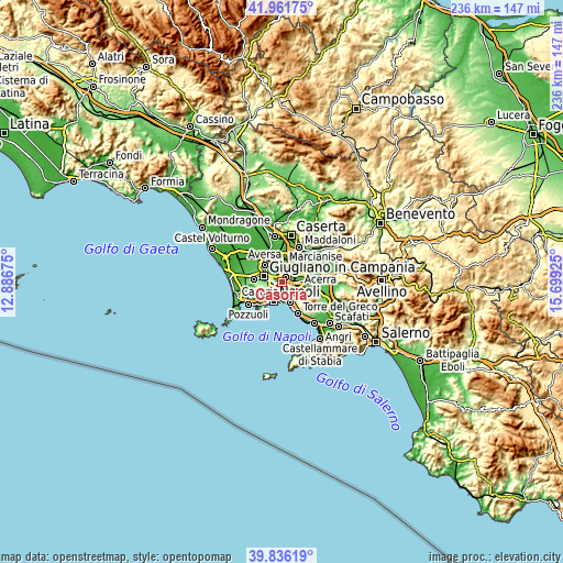
| \ | Map #1 | Map #2 | Topo.Map |
| Scale [m] | 9..163 m | -4..376 m | × |
| Scale [ft] | 30..535 ft | -13..1234 ft | × |
| Average | 59.7 m = 196 ft | 63.7 m = 209 ft | × |
| Width | 7.39 km = 4.6 mi | 14.77 km = 9.2 mi | 236.3 km = 146.8 mi |
| Height | 7.39 km = 4.6 mi | 14.77 km = 9.2 mi | 236.3 km = 146.8 mi |
| ↑Max Latitude | 40.940714° | 40.973902° | 41.96175° |
| Latitude at center | 40.90751° | 40.90751° | 40.90751° |
| ↓Min Latitude | 40.874289° | 40.841052° | 39.83619° |
| ← Min Longitude | 14.249055° | 14.205109° | 12.88675° |
| Longitude center | 14.293° | 14.293° | 14.293° |
| →Max Longitude | 14.336945° | 14.380891° | 15.69925° |
Nearby cities:
Cities around Casoria sort by population:
• Afragola elevation 45 m
2.2 km,  38°
38°
• Casalnuovo di Napoli 41 m
4.1 km,  86°
86°
• Secondigliano 89 m
2.4 km,  249°
249°
• Arzano 83 m
2.3 km,  275°
275°
• Frattamaggiore 46 m
4 km,  339°
339°
• Miano 102 m
4 km,  237°
237°
• Cardito 33 m
4.3 km,  7°
7°
• Arpino 28 m
3.1 km,  132°
132°
• Casavatore 85 m
1.7 km, 236°
• Grumo Nevano 59 m
4.2 km,  318°
318°
• San Pietro a Patierno 85 m
2.4 km,  185°
185°
• Casandrino 69 m
4.5 km,  301°
301°
Multilingual:
 En español:
Casoria elevación 70 m.
 En France:
Casoria élévation 70 m.


Sources and notes:
- [note 1] Map square and city borders are not equal. Map elevation data is calculated only from area inside that square.
- [src 1] Elevation data from geonames database provided with same terms of usage.
- [src 2] The elevation map of Casoria is generated using elevation data from NASA's 3 arcsec (90m) resolution SRTM data.
- [src 3] Base (background) map © OpenStreetMap contributors tiles are generated by Geofabrik and OpenTopoMap.
Copyright & License:
This Casoria Elevation Map is licensed under CC BY-SA. You may reuse any part from this page, if you give a proper credit by linking to this URL:
 More info on terms of use page.