Ceppaloni elevation
Ceppaloni (Campania, Provincia di Benevento), Italy elevation is 342 meters and Ceppaloni elevation in feet is 1122 ft above sea level [src 1]. Ceppaloni is a seat of a third-order administrative division (feature code) with elevation that is 20 meters (66 ft) bigger than average city elevation in Italy.
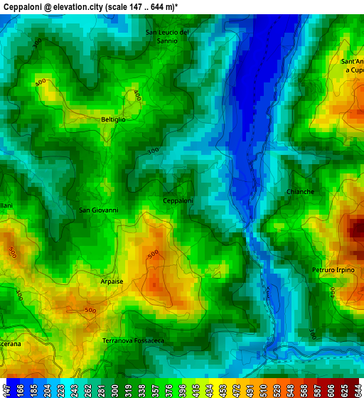
Below is the Elevation map of Ceppaloni, which displays elevation range with different colors. Scale of the first map is from 147 to 644 m (482 to 2113 ft) with average elevation of 330.2 meters (=1083 ft) [note 1]
These maps also provides idea of topography and contour of this city, they are displayed at different zoom levels. More info about maps, scale and edge coordinates you can find below images.
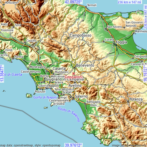
| \ | Map #1 | Topo.Map |
| Scale [m] | 147..644 m | × |
| Scale [ft] | 482..2113 ft | × |
| Average | 330.2 m = 1083 ft | × |
| Width | 7.37 km = 4.6 mi | 235.8 km = 146.5 mi |
| Height | 7.37 km = 4.6 mi | 235.8 km = 146.5 mi |
| ↑Max Latitude | 41.078365° | 42.09725° |
| Latitude at center | 41.04523° | 41.04523° |
| ↓Min Latitude | 41.012078° | 39.97612° |
| ← Min Longitude | 14.717075° | 13.35477° |
| Longitude center | 14.76102° | 14.76102° |
| →Max Longitude | 14.804965° | 16.16727° |
Nearby cities:
Cities around Ceppaloni sort by population:
• Altavilla Irpina elevation 354 m
4.7 km,  158°
158°
• Beltiglio-San Giovanni 378 m
2 km,  339°
339°
• Pannarano 355 m
6.2 km,  231°
231°
• San Leucio del Sannio-Cavuoti 362 m
3.3 km,  354°
354°
• Maccoli-Perrillo 309 m
6 km,  38°
38°
• Tufo 224 m
6 km,  127°
127°
• Sant'Angelo A Cupolo 472 m
4.5 km,  53°
53°
• Roccabascerana 406 m
4.8 km, 231°
• Arpaise 416 m
2.2 km,  219°
219°
• Torrioni 663 m
4.6 km,  105°
105°
• Petruro Irpino 491 m
3.4 km,  115°
115°
• Chianche 361 m
2.4 km,  87°
87°
Multilingual:
 En español:
Ceppaloni elevación 342 m.
 En France:
Ceppaloni élévation 342 m.
 Auf Deutsch:
Ceppaloni höhe über dem Meeresspiegel ist 342 m.

Sources and notes:
- [note 1] Map square and city borders are not equal. Map elevation data is calculated only from area inside that square.
- [src 1] Elevation data from geonames database provided with same terms of usage.
- [src 2] The elevation map of Ceppaloni is generated using elevation data from NASA's 3 arcsec (90m) resolution SRTM data.
- [src 3] Base (background) map © OpenStreetMap contributors tiles are generated by Geofabrik and OpenTopoMap.
Copyright & License:
This Ceppaloni Elevation Map is licensed under CC BY-SA. You may reuse any part from this page, if you give a proper credit by linking to this URL:
 More info on terms of use page.