Cerveteri elevation
Cerveteri (Latium, Città metropolitana di Roma Capitale), Italy elevation is 31 meters and Cerveteri elevation in feet is 102 ft above sea level [src 1]. Cerveteri is a seat of a third-order administrative division (feature code) with elevation that is 291 meters (955 ft) smaller than average city elevation in Italy.
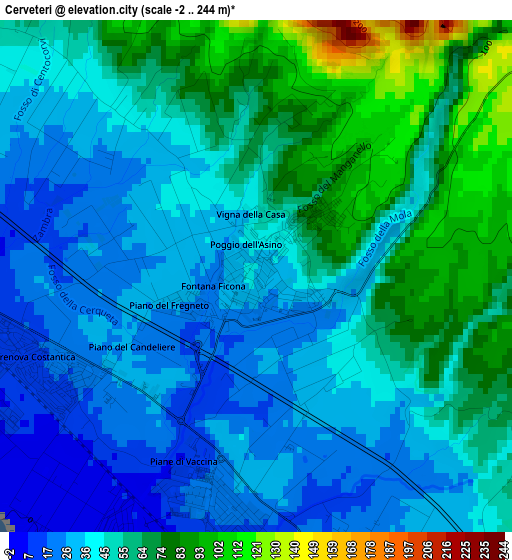
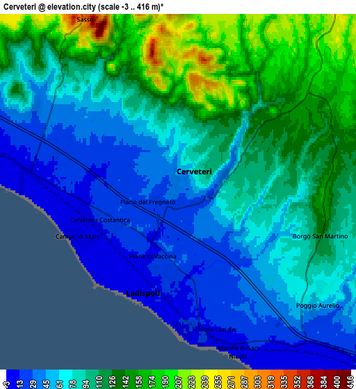
Below is the Elevation map of Cerveteri, which displays elevation range with different colors. Scale of the first map is from -2 to 244 m (-7 to 801 ft) with average elevation of 49.7 meters (=163 ft) [note 1]
These maps also provides idea of topography and contour of this city, they are displayed at different zoom levels. More info about maps, scale and edge coordinates you can find below images.
| \ | Map #1 | Map #2 | Topo.Map |
| Scale [m] | -2..244 m | -3..416 m | × |
| Scale [ft] | -7..801 ft | -10..1365 ft | × |
| Average | 49.7 m = 163 ft | 91.2 m = 299 ft | × |
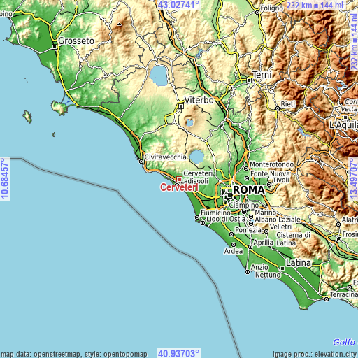
| Width | 7.26 km = 4.5 mi | 14.53 km = 9 mi | 232.4 km = 144.4 mi |
| Height | 7.26 km = 4.5 mi | 14.53 km = 9 mi | 232.4 km = 144.4 mi |
| ↑Max Latitude | 42.023454° | 42.056091° | 43.02741° |
| Latitude at center | 41.9908° | 41.9908° | 41.9908° |
| ↓Min Latitude | 41.958129° | 41.925442° | 40.93703° |
| ← Min Longitude | 12.046875° | 12.002929° | 10.68457° |
| Longitude center | 12.09082° | 12.09082° | 12.09082° |
| →Max Longitude | 12.134765° | 12.178711° | 13.49707° |
Nearby cities:
Cities around Cerveteri sort by population:
• Ladispoli elevation 8 m
4.6 km,  196°
196°
• Bracciano 314 m
13.9 km,  26°
26°
• Marina di Cerveteri 14 m
3.4 km,  248°
248°
• Ara Nova 73 m
13.9 km,  117°
117°
• Manziana 358 m
15.7 km,  10°
10°
• Passoscuro 3 m
11.3 km,  150°
150°
• Valcanneto 56 m
7.1 km,  128°
128°
• Canale Monterano 380 m
16.2 km,  3°
3°
• Ponton dell'Elce 166 m
12.4 km,  73°
73°
• Marina San Nicola 4 m
7.1 km,  159°
159°
• Tragliatella Campitello 146 m
13.6 km,  79°
79°
• Maccarese 7 m
16.6 km,  139°
139°
Multilingual:
 En español:
Cerveteri elevación 31 m.
 En France:
Cerveteri élévation 31 m.
 Auf Deutsch:
Cerveteri höhe über dem Meeresspiegel ist 31 m.

Sources and notes:
- [note 1] Map square and city borders are not equal. Map elevation data is calculated only from area inside that square.
- [src 1] Elevation data from geonames database provided with same terms of usage.
- [src 2] The elevation map of Cerveteri is generated using elevation data from NASA's 3 arcsec (90m) resolution SRTM data.
- [src 3] Base (background) map © OpenStreetMap contributors tiles are generated by Geofabrik and OpenTopoMap.
Copyright & License:
This Cerveteri Elevation Map is licensed under CC BY-SA. You may reuse any part from this page, if you give a proper credit by linking to this URL:
 More info on terms of use page.