Chieti elevation
Chieti (Abruzzo, Provincia di Chieti), Italy elevation is 344 meters and Chieti elevation in feet is 1129 ft above sea level [src 1]. Chieti is a seat of a second-order administrative division (feature code) with elevation that is 22 meters (72 ft) bigger than average city elevation in Italy.
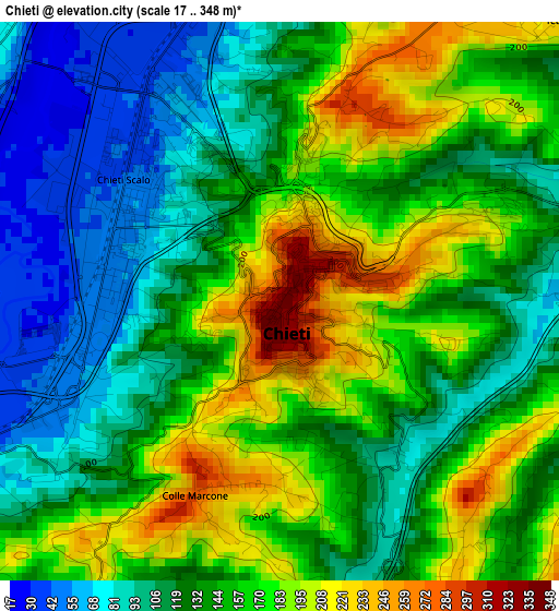
Below is the Elevation map of Chieti, which displays elevation range with different colors. Scale of the first map is from 17 to 348 m (56 to 1142 ft) with average elevation of 143.7 meters (=471 ft) [note 1]
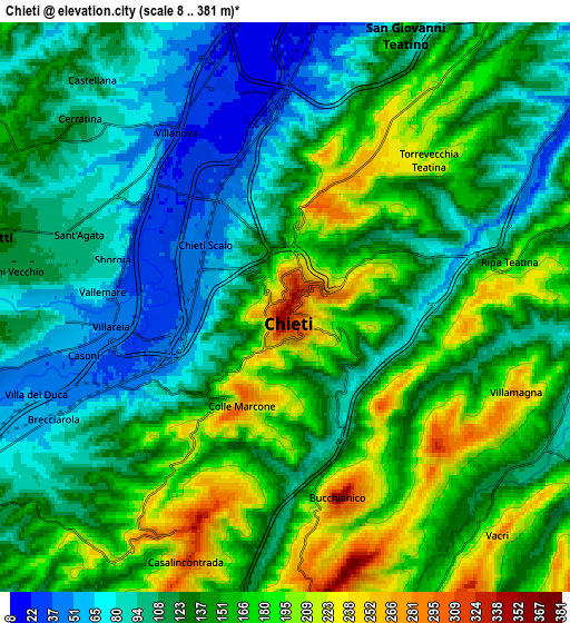
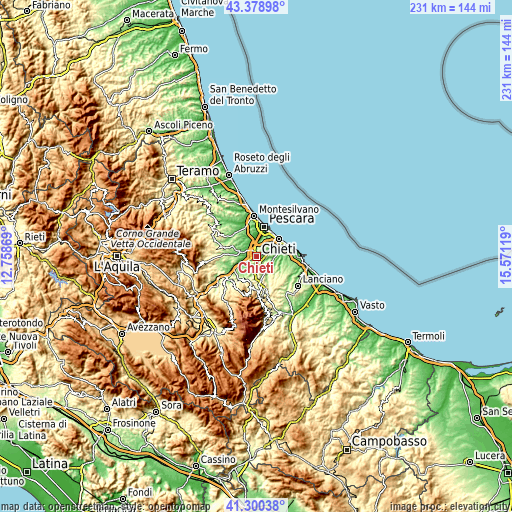
These maps also provides idea of topography and contour of this city, they are displayed at different zoom levels. More info about maps, scale and edge coordinates you can find below images.
| \ | Map #1 | Map #2 | Topo.Map |
| Scale [m] | 17..348 m | 8..381 m | × |
| Scale [ft] | 56..1142 ft | 26..1250 ft | × |
| Average | 143.7 m = 471 ft | 136 m = 446 ft | × |
| Width | 7.22 km = 4.5 mi | 14.45 km = 9 mi | 231.1 km = 143.6 mi |
| Height | 7.22 km = 4.5 mi | 14.44 km = 9 mi | 231.1 km = 143.6 mi |
| ↑Max Latitude | 42.38074° | 42.413193° | 43.37898° |
| Latitude at center | 42.34827° | 42.34827° | 42.34827° |
| ↓Min Latitude | 42.315783° | 42.28328° | 41.30038° |
| ← Min Longitude | 14.120995° | 14.077049° | 12.75869° |
| Longitude center | 14.16494° | 14.16494° | 14.16494° |
| →Max Longitude | 14.208885° | 14.252831° | 15.57119° |
Nearby cities:
Cities around Chieti sort by population:
• Sambuceto elevation 17 m
8.4 km,  12°
12°
• Santa Teresa 20 m
8.8 km,  356°
356°
• Cepagatti 144 m
7.7 km,  284°
284°
• Ripa Teatina 182 m
6.8 km,  73°
73°
• Bucchianico 300 m
5.2 km,  162°
162°
• Casalincontrada 330 m
6.2 km,  203°
203°
• Villanova 70 m
5.1 km,  318°
318°
• Cerratina 108 m
6.9 km,  312°
312°
• Villamagna 260 m
6.3 km,  109°
109°
• Torrevecchia 218 m
5.5 km,  46°
46°
• Ari 290 m
10.1 km,  130°
130°
• Vacri 233 m
7.7 km,  136°
136°
Multilingual:
 En español:
Chieti elevación 344 m.
 En France:
Chieti élévation 344 m.


Sources and notes:
- [note 1] Map square and city borders are not equal. Map elevation data is calculated only from area inside that square.
- [src 1] Elevation data from geonames database provided with same terms of usage.
- [src 2] The elevation map of Chieti is generated using elevation data from NASA's 3 arcsec (90m) resolution SRTM data.
- [src 3] Base (background) map © OpenStreetMap contributors tiles are generated by Geofabrik and OpenTopoMap.
Copyright & License:
This Chieti Elevation Map is licensed under CC BY-SA. You may reuse any part from this page, if you give a proper credit by linking to this URL:
 More info on terms of use page.