Ciano d'Enza elevation
Ciano d'Enza (Emilia-Romagna, Provincia di Reggio Emilia), Italy elevation is 202 meters and Ciano d'Enza elevation in feet is 663 ft above sea level [src 1]. Ciano d'Enza is a seat of a third-order administrative division (feature code) with elevation that is 120 meters (394 ft) smaller than average city elevation in Italy.
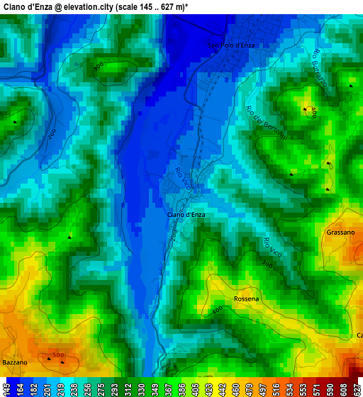
Below is the Elevation map of Ciano d'Enza, which displays elevation range with different colors. Scale of the first map is from 145 to 627 m (476 to 2057 ft) with average elevation of 288.8 meters (=948 ft) [note 1]
These maps also provides idea of topography and contour of this city, they are displayed at different zoom levels. More info about maps, scale and edge coordinates you can find below images.
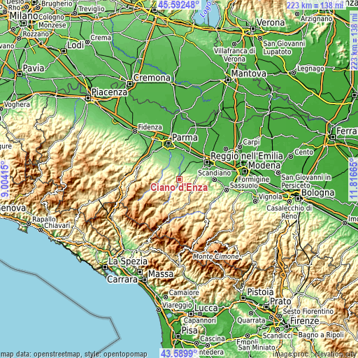
| \ | Map #1 | Topo.Map |
| Scale [m] | 145..627 m | × |
| Scale [ft] | 476..2057 ft | × |
| Average | 288.8 m = 948 ft | × |
| Width | 6.96 km = 4.3 mi | 222.7 km = 138.4 mi |
| Height | 6.96 km = 4.3 mi | 222.7 km = 138.4 mi |
| ↑Max Latitude | 44.631102° | 45.59248° |
| Latitude at center | 44.59982° | 44.59982° |
| ↓Min Latitude | 44.568521° | 43.5899° |
| ← Min Longitude | 10.366455° | 9.00415° |
| Longitude center | 10.4104° | 10.4104° |
| →Max Longitude | 10.454345° | 11.81665° |
Nearby cities:
Cities around Ciano d'Enza sort by population:
• Montecchio Emilia elevation 102 m
11.6 km,  16°
16°
• Langhirano 274 m
11.6 km,  280°
280°
• Bibbiano 127 m
8.6 km,  35°
35°
• Traversetolo 176 m
5.3 km,  333°
333°
• San Polo d'Enza 175 m
3.3 km, 23°
• Montecavolo 143 m
11.1 km,  70°
70°
• Lesignano de'Bagni 257 m
10 km,  299°
299°
• Quattro Castella 167 m
6.4 km,  52°
52°
• Vezzano sul Crostolo 188 m
10.6 km,  88°
88°
• Basilicanova 132 m
11.8 km,  337°
337°
• Montechiarugolo 127 m
10.4 km,  4°
4°
• Neviano degli Arduini 516 m
7.7 km,  256°
256°
Multilingual:
 En español:
Ciano d'Enza elevación 202 m.
 En France:
Ciano d'Enza élévation 202 m.
 Auf Deutsch:
Ciano d'Enza höhe über dem Meeresspiegel ist 202 m.

Sources and notes:
- [note 1] Map square and city borders are not equal. Map elevation data is calculated only from area inside that square.
- [src 1] Elevation data from geonames database provided with same terms of usage.
- [src 2] The elevation map of Ciano d'Enza is generated using elevation data from NASA's 3 arcsec (90m) resolution SRTM data.
- [src 3] Base (background) map © OpenStreetMap contributors tiles are generated by Geofabrik and OpenTopoMap.
Copyright & License:
This Ciano d'Enza Elevation Map is licensed under CC BY-SA. You may reuse any part from this page, if you give a proper credit by linking to this URL:
 More info on terms of use page.