Ciciliano elevation
Ciciliano (Latium, Città metropolitana di Roma Capitale), Italy elevation is 570 meters and Ciciliano elevation in feet is 1870 ft above sea level [src 1]. Ciciliano is a seat of a third-order administrative division (feature code) with elevation that is 248 meters (814 ft) bigger than average city elevation in Italy.
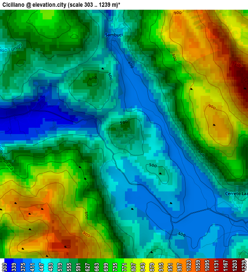
Below is the Elevation map of Ciciliano, which displays elevation range with different colors. Scale of the first map is from 303 to 1239 m (994 to 4065 ft) with average elevation of 622.3 meters (=2042 ft) [note 1]
These maps also provides idea of topography and contour of this city, they are displayed at different zoom levels. More info about maps, scale and edge coordinates you can find below images.
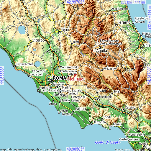
| \ | Map #1 | Topo.Map |
| Scale [m] | 303..1239 m | × |
| Scale [ft] | 994..4065 ft | × |
| Average | 622.3 m = 2042 ft | × |
| Width | 7.27 km = 4.5 mi | 232.5 km = 144.5 mi |
| Height | 7.27 km = 4.5 mi | 232.5 km = 144.5 mi |
| ↑Max Latitude | 41.99257° | 42.99702° |
| Latitude at center | 41.9599° | 41.9599° |
| ↓Min Latitude | 41.927213° | 40.90563° |
| ← Min Longitude | 12.897685° | 11.53538° |
| Longitude center | 12.94163° | 12.94163° |
| →Max Longitude | 12.985575° | 14.34788° |
Nearby cities:
Cities around Ciciliano sort by population:
• Castel Madama elevation 389 m
6.3 km,  283°
283°
• Vicovaro 318 m
7.4 km,  332°
332°
• Cerreto Laziale 513 m
3.8 km,  119°
119°
• San Gregorio da Sassola 485 m
7.2 km,  230°
230°
• Gerano 411 m
4.9 km, 124°
• Sambuci 402 m
2.8 km,  354°
354°
• Anticoli Corrado 551 m
6.7 km,  37°
37°
• Marano Equo 451 m
7.2 km,  56°
56°
• Pisoniano 547 m
5.9 km,  166°
166°
• Casape 463 m
7.5 km,  218°
218°
• Rocca Canterano 737 m
6.6 km,  93°
93°
• Saracinesco 883 m
4.9 km,  11°
11°
Multilingual:
 En español:
Ciciliano elevación 570 m.
 En France:
Ciciliano élévation 570 m.
 Auf Deutsch:
Ciciliano höhe über dem Meeresspiegel ist 570 m.

Sources and notes:
- [note 1] Map square and city borders are not equal. Map elevation data is calculated only from area inside that square.
- [src 1] Elevation data from geonames database provided with same terms of usage.
- [src 2] The elevation map of Ciciliano is generated using elevation data from NASA's 3 arcsec (90m) resolution SRTM data.
- [src 3] Base (background) map © OpenStreetMap contributors tiles are generated by Geofabrik and OpenTopoMap.
Copyright & License:
This Ciciliano Elevation Map is licensed under CC BY-SA. You may reuse any part from this page, if you give a proper credit by linking to this URL:
 More info on terms of use page.