Cles elevation
Cles (Trentino-Alto Adige, Provincia autonoma di Trento), Italy elevation is 666 meters and Cles elevation in feet is 2185 ft above sea level [src 1]. Cles is a seat of a third-order administrative division (feature code) with elevation that is 344 meters (1129 ft) bigger than average city elevation in Italy.
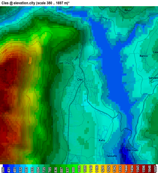
Below is the Elevation map of Cles, which displays elevation range with different colors. Scale of the first map is from 380 to 1697 m (1247 to 5568 ft) with average elevation of 793 meters (=2602 ft) [note 1]
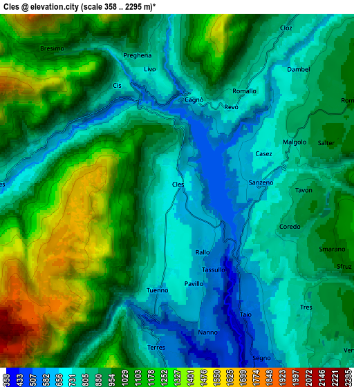
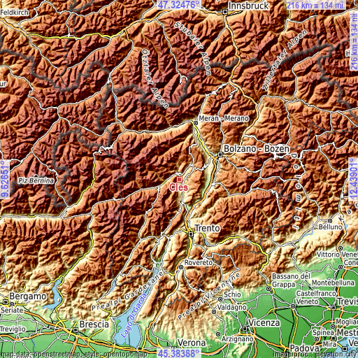
These maps also provides idea of topography and contour of this city, they are displayed at different zoom levels. More info about maps, scale and edge coordinates you can find below images.
| \ | Map #1 | Map #2 | Topo.Map |
| Scale [m] | 380..1697 m | 358..2295 m | × |
| Scale [ft] | 1247..5568 ft | 1175..7530 ft | × |
| Average | 793 m = 2602 ft | 935 m = 3068 ft | × |
| Width | 6.74 km = 4.2 mi | 13.49 km = 8.4 mi | 215.8 km = 134.1 mi |
| Height | 6.74 km = 4.2 mi | 13.49 km = 8.4 mi | 215.8 km = 134.1 mi |
| ↑Max Latitude | 46.393258° | 46.423559° | 47.32476° |
| Latitude at center | 46.36294° | 46.36294° | 46.36294° |
| ↓Min Latitude | 46.332605° | 46.302254° | 45.38388° |
| ← Min Longitude | 10.988815° | 10.944869° | 9.62651° |
| Longitude center | 11.03276° | 11.03276° | 11.03276° |
| →Max Longitude | 11.076705° | 11.120651° | 12.43901° |
Nearby cities:
Cities around Cles sort by population:
• Tuenno elevation 646 m
3.9 km,  190°
190°
• Tassullo 612 m
2.4 km,  156°
156°
• Coredo 841 m
4.7 km,  109°
109°
• Taio 520 m
5.3 km,  150°
150°
• Revò 745 m
3.8 km,  30°
30°
• Romallo 744 m
4.6 km, 33°
• Nanno 555 m
5.5 km,  168°
168°
• Sanzeno 657 m
3.3 km,  83°
83°
• Cagnò 671 m
3.5 km,  10°
10°
• Cis 717 m
4.5 km,  330°
330°
• Cavizzana 711 m
5.7 km,  274°
274°
• Livo 737 m
4.8 km,  347°
347°
Multilingual:
 En español:
Cles elevación 666 m.
 En France:
Cles élévation 666 m.


Sources and notes:
- [note 1] Map square and city borders are not equal. Map elevation data is calculated only from area inside that square.
- [src 1] Elevation data from geonames database provided with same terms of usage.
- [src 2] The elevation map of Cles is generated using elevation data from NASA's 3 arcsec (90m) resolution SRTM data.
- [src 3] Base (background) map © OpenStreetMap contributors tiles are generated by Geofabrik and OpenTopoMap.
Copyright & License:
This Cles Elevation Map is licensed under CC BY-SA. You may reuse any part from this page, if you give a proper credit by linking to this URL:
 More info on terms of use page.