Colorno elevation
Colorno (Emilia-Romagna, Provincia di Parma), Italy elevation is 30 meters and Colorno elevation in feet is 98 ft above sea level [src 1]. Colorno is a seat of a third-order administrative division (feature code) with elevation that is 292 meters (958 ft) smaller than average city elevation in Italy.
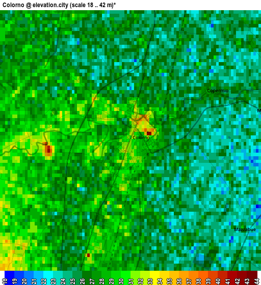
Below is the Elevation map of Colorno, which displays elevation range with different colors. Scale of the first map is from 18 to 42 m (59 to 138 ft) with average elevation of 26.3 meters (=86 ft) [note 1]
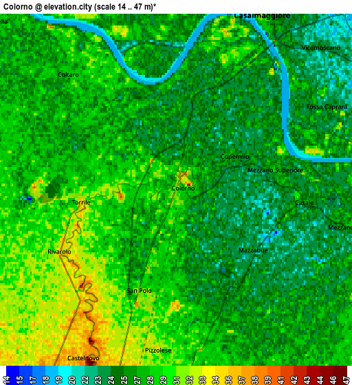
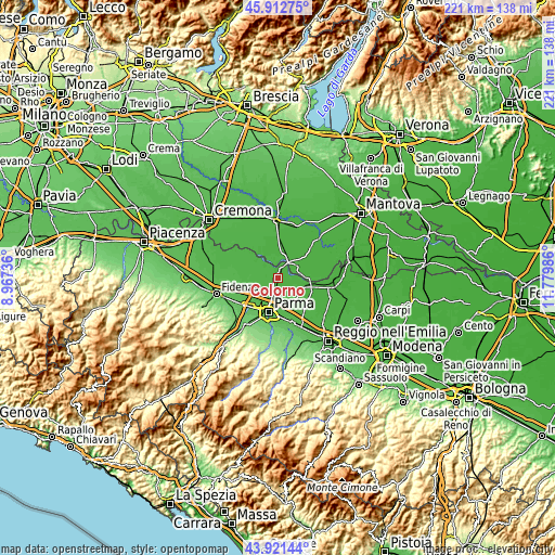
These maps also provides idea of topography and contour of this city, they are displayed at different zoom levels. More info about maps, scale and edge coordinates you can find below images.
| \ | Map #1 | Map #2 | Topo.Map |
| Scale [m] | 18..42 m | 14..47 m | × |
| Scale [ft] | 59..138 ft | 46..154 ft | × |
| Average | 26.3 m = 86 ft | 27 m = 89 ft | × |
| Width | 6.92 km = 4.3 mi | 13.84 km = 8.6 mi | 221.4 km = 137.6 mi |
| Height | 6.92 km = 4.3 mi | 13.84 km = 8.6 mi | 221.4 km = 137.6 mi |
| ↑Max Latitude | 44.956826° | 44.987915° | 45.91275° |
| Latitude at center | 44.92572° | 44.92572° | 44.92572° |
| ↓Min Latitude | 44.894597° | 44.863458° | 43.92144° |
| ← Min Longitude | 10.329665° | 10.285719° | 8.96736° |
| Longitude center | 10.37361° | 10.37361° | 10.37361° |
| →Max Longitude | 10.417555° | 10.461501° | 11.77986° |
Nearby cities:
Cities around Colorno sort by population:
• Casalmaggiore elevation 23 m
8 km,  27°
27°
• San Polo 31 m
4.2 km,  198°
198°
• Gussola 27 m
9.7 km,  348°
348°
• Baganzola 42 m
9.4 km,  213°
213°
• Trecasali 33 m
8 km,  279°
279°
• Martignana di Po 28 m
9.5 km,  2°
2°
• Sissa 31 m
9.6 km,  292°
292°
• Mezzano Inferiore 28 m
6.8 km,  102°
102°
• Vicomoscano 24 m
8.1 km,  47°
47°
• Casale 27 m
4.7 km, 102°
• Torrile 29 m
3.9 km,  269°
269°
• Casale di Mezzani 27 m
4.6 km, 104°
Multilingual:
 En español:
Colorno elevación 30 m.
 En France:
Colorno élévation 30 m.


Sources and notes:
- [note 1] Map square and city borders are not equal. Map elevation data is calculated only from area inside that square.
- [src 1] Elevation data from geonames database provided with same terms of usage.
- [src 2] The elevation map of Colorno is generated using elevation data from NASA's 3 arcsec (90m) resolution SRTM data.
- [src 3] Base (background) map © OpenStreetMap contributors tiles are generated by Geofabrik and OpenTopoMap.
Copyright & License:
This Colorno Elevation Map is licensed under CC BY-SA. You may reuse any part from this page, if you give a proper credit by linking to this URL:
 More info on terms of use page.