Controne elevation
Controne (Campania, Provincia di Salerno), Italy elevation is 198 meters and Controne elevation in feet is 650 ft above sea level [src 1]. Controne is a seat of a third-order administrative division (feature code) with elevation that is 124 meters (407 ft) smaller than average city elevation in Italy.
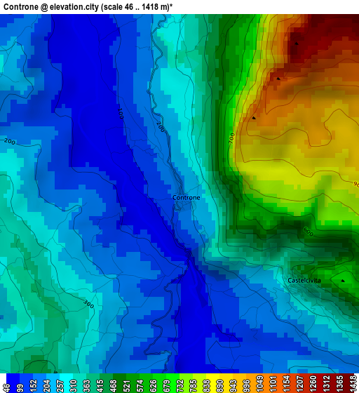
Below is the Elevation map of Controne, which displays elevation range with different colors. Scale of the first map is from 46 to 1418 m (151 to 4652 ft) with average elevation of 374.9 meters (=1230 ft) [note 1]
These maps also provides idea of topography and contour of this city, they are displayed at different zoom levels. More info about maps, scale and edge coordinates you can find below images.
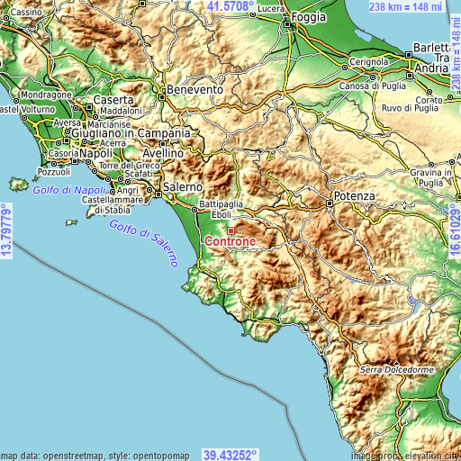
| \ | Map #1 | Topo.Map |
| Scale [m] | 46..1418 m | × |
| Scale [ft] | 151..4652 ft | × |
| Average | 374.9 m = 1230 ft | × |
| Width | 7.43 km = 4.6 mi | 237.8 km = 147.8 mi |
| Height | 7.43 km = 4.6 mi | 237.7 km = 147.7 mi |
| ↑Max Latitude | 40.543583° | 41.5708° |
| Latitude at center | 40.51018° | 40.51018° |
| ↓Min Latitude | 40.47676° | 39.43252° |
| ← Min Longitude | 15.160095° | 13.79779° |
| Longitude center | 15.20404° | 15.20404° |
| →Max Longitude | 15.247985° | 16.61029° |
Nearby cities:
Cities around Controne sort by population:
• Roccadaspide elevation 390 m
9.7 km,  186°
186°
• Serre 223 m
8.2 km,  349°
349°
• Castel San Lorenzo 332 m
10.2 km,  169°
169°
• Matinella 40 m
11.6 km,  265°
265°
• Albanella 223 m
8.3 km,  245°
245°
• Altavilla Silentina 316 m
6.5 km,  289°
289°
• Sicignano degli Alburni 606 m
10.1 km,  57°
57°
• Postiglione 637 m
5.9 km,  23°
23°
• Castelcivita 395 m
3.1 km,  126°
126°
• Aquara 527 m
8.5 km,  150°
150°
• Sant'Angelo A Fasanella 494 m
13 km,  116°
116°
• Ottati 511 m
10.8 km, 119°
Multilingual:
 En español:
Controne elevación 198 m.
 En France:
Controne élévation 198 m.
 Auf Deutsch:
Controne höhe über dem Meeresspiegel ist 198 m.

Sources and notes:
- [note 1] Map square and city borders are not equal. Map elevation data is calculated only from area inside that square.
- [src 1] Elevation data from geonames database provided with same terms of usage.
- [src 2] The elevation map of Controne is generated using elevation data from NASA's 3 arcsec (90m) resolution SRTM data.
- [src 3] Base (background) map © OpenStreetMap contributors tiles are generated by Geofabrik and OpenTopoMap.
Copyright & License:
This Controne Elevation Map is licensed under CC BY-SA. You may reuse any part from this page, if you give a proper credit by linking to this URL:
 More info on terms of use page.