Cornuda elevation
Cornuda (Veneto, Provincia di Treviso), Italy elevation is 165 meters and Cornuda elevation in feet is 541 ft above sea level [src 1]. Cornuda is a seat of a third-order administrative division (feature code) with elevation that is 157 meters (515 ft) smaller than average city elevation in Italy.
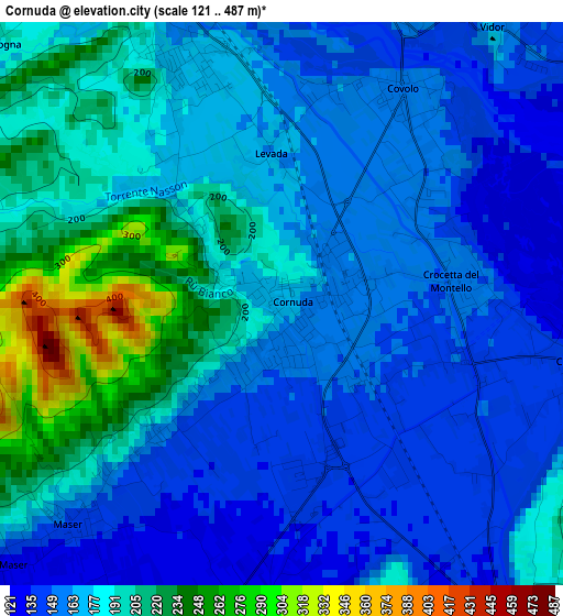
Below is the Elevation map of Cornuda, which displays elevation range with different colors. Scale of the first map is from 121 to 487 m (397 to 1598 ft) with average elevation of 177.2 meters (=581 ft) [note 1]
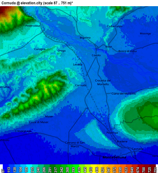
These maps also provides idea of topography and contour of this city, they are displayed at different zoom levels. More info about maps, scale and edge coordinates you can find below images.
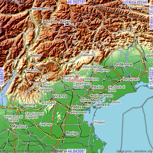
| \ | Map #1 | Map #2 | Topo.Map |
| Scale [m] | 121..487 m | 87..751 m | × |
| Scale [ft] | 397..1598 ft | 285..2464 ft | × |
| Average | 177.2 m = 581 ft | 175.7 m = 576 ft | × |
| Width | 6.81 km = 4.2 mi | 13.62 km = 8.5 mi | 217.9 km = 135.4 mi |
| Height | 6.81 km = 4.2 mi | 13.62 km = 8.5 mi | 217.9 km = 135.4 mi |
| ↑Max Latitude | 45.862131° | 45.892726° | 46.80273° |
| Latitude at center | 45.83152° | 45.83152° | 45.83152° |
| ↓Min Latitude | 45.800892° | 45.770247° | 44.84306° |
| ← Min Longitude | 11.962035° | 11.918089° | 10.59973° |
| Longitude center | 12.00598° | 12.00598° | 12.00598° |
| →Max Longitude | 12.049925° | 12.093871° | 13.41223° |
Nearby cities:
Cities around Cornuda sort by population:
• Caerano di San Marco elevation 116 m
5.6 km,  185°
185°
• Crocetta del Montello 152 m
2.2 km,  75°
75°
• Vidor 147 m
4.9 km,  37°
37°
• Crocetta-Nogarè 148 m
1.9 km,  104°
104°
• Covolo-Levada 165 m
1.9 km,  358°
358°
• Onigo 172 m
3.1 km,  337°
337°
• Pederobba 224 m
6.6 km,  318°
318°
• Ciano 142 m
3.8 km, 102°
• Bigolino 174 m
4 km,  12°
12°
• Maser 141 m
3.6 km,  221°
221°
• Mosnigo 132 m
6.6 km,  58°
58°
• Monfumo 195 m
6.6 km,  269°
269°
Multilingual:
 En español:
Cornuda elevación 165 m.
 En France:
Cornuda élévation 165 m.


Sources and notes:
- [note 1] Map square and city borders are not equal. Map elevation data is calculated only from area inside that square.
- [src 1] Elevation data from geonames database provided with same terms of usage.
- [src 2] The elevation map of Cornuda is generated using elevation data from NASA's 3 arcsec (90m) resolution SRTM data.
- [src 3] Base (background) map © OpenStreetMap contributors tiles are generated by Geofabrik and OpenTopoMap.
Copyright & License:
This Cornuda Elevation Map is licensed under CC BY-SA. You may reuse any part from this page, if you give a proper credit by linking to this URL:
 More info on terms of use page.