Crema elevation
Crema (Lombardy, Provincia di Cremona), Italy elevation is 77 meters and Crema elevation in feet is 253 ft above sea level [src 1]. Crema is a seat of a third-order administrative division (feature code) with elevation that is 245 meters (804 ft) smaller than average city elevation in Italy.
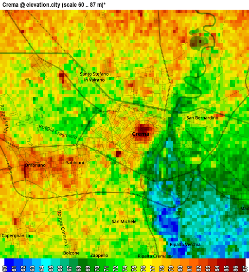
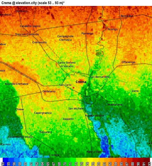
Below is the Elevation map of Crema, which displays elevation range with different colors. Scale of the first map is from 60 to 87 m (197 to 285 ft) with average elevation of 74.7 meters (=245 ft) [note 1]
These maps also provides idea of topography and contour of this city, they are displayed at different zoom levels. More info about maps, scale and edge coordinates you can find below images.
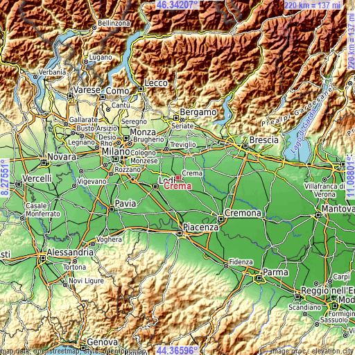
| \ | Map #1 | Map #2 | Topo.Map |
| Scale [m] | 60..87 m | 53..93 m | × |
| Scale [ft] | 197..285 ft | 174..305 ft | × |
| Average | 74.7 m = 245 ft | 74.7 m = 245 ft | × |
| Width | 6.87 km = 4.3 mi | 13.73 km = 8.5 mi | 219.7 km = 136.5 mi |
| Height | 6.87 km = 4.3 mi | 13.73 km = 8.5 mi | 219.7 km = 136.5 mi |
| ↑Max Latitude | 45.393508° | 45.42436° | 46.34207° |
| Latitude at center | 45.36264° | 45.36264° | 45.36264° |
| ↓Min Latitude | 45.331755° | 45.300853° | 44.36596° |
| ← Min Longitude | 9.637815° | 9.593869° | 8.27551° |
| Longitude center | 9.68176° | 9.68176° | 9.68176° |
| →Max Longitude | 9.725705° | 9.769651° | 11.08801° |
Nearby cities:
Cities around Crema sort by population:
• Offanengo elevation 82 m
5.1 km,  69°
69°
• Bagnolo Cremasco 80 m
5.4 km,  268°
268°
• Trescore Cremasco 82 m
6.4 km,  314°
314°
• Madignano 70 m
3.7 km,  121°
121°
• Pianengo 84 m
4.5 km,  13°
13°
• Chieve 78 m
5.7 km,  244°
244°
• Izano 77 m
5.5 km,  98°
98°
• Ripalta Nuova 75 m
3.5 km,  166°
166°
• Capergnanica 77 m
3.9 km,  227°
227°
• Cremosano 82 m
4.9 km,  316°
316°
• Ricengo 84 m
5.8 km,  34°
34°
• Campagnola Cremasca 81 m
4.1 km,  346°
346°
Multilingual:
 En español:
Crema elevación 77 m.
 En France:
Crema élévation 77 m.


Sources and notes:
- [note 1] Map square and city borders are not equal. Map elevation data is calculated only from area inside that square.
- [src 1] Elevation data from geonames database provided with same terms of usage.
- [src 2] The elevation map of Crema is generated using elevation data from NASA's 3 arcsec (90m) resolution SRTM data.
- [src 3] Base (background) map © OpenStreetMap contributors tiles are generated by Geofabrik and OpenTopoMap.
Copyright & License:
This Crema Elevation Map is licensed under CC BY-SA. You may reuse any part from this page, if you give a proper credit by linking to this URL:
 More info on terms of use page.