Croviana elevation
Croviana (Trentino-Alto Adige, Provincia autonoma di Trento), Italy elevation is 724 meters and Croviana elevation in feet is 2375 ft above sea level [src 1]. Croviana is a seat of a third-order administrative division (feature code) with elevation that is 402 meters (1319 ft) bigger than average city elevation in Italy.
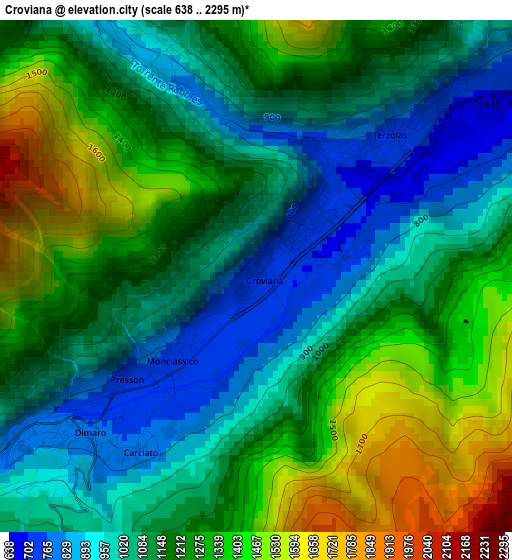
Below is the Elevation map of Croviana, which displays elevation range with different colors. Scale of the first map is from 638 to 2295 m (2093 to 7530 ft) with average elevation of 1169.9 meters (=3838 ft) [note 1]
These maps also provides idea of topography and contour of this city, they are displayed at different zoom levels. More info about maps, scale and edge coordinates you can find below images.
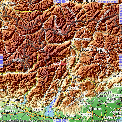
| \ | Map #1 | Topo.Map |
| Scale [m] | 638..2295 m | × |
| Scale [ft] | 2093..7530 ft | × |
| Average | 1169.9 m = 3838 ft | × |
| Width | 6.75 km = 4.2 mi | 215.9 km = 134.2 mi |
| Height | 6.75 km = 4.2 mi | 215.9 km = 134.2 mi |
| ↑Max Latitude | 46.375128° | 47.30694° |
| Latitude at center | 46.3448° | 46.3448° |
| ↓Min Latitude | 46.314455° | 45.36542° |
| ← Min Longitude | 10.859185° | 9.49688° |
| Longitude center | 10.90313° | 10.90313° |
| →Max Longitude | 10.947075° | 12.30938° |
Nearby cities:
Cities around Croviana sort by population:
• Malè elevation 746 m
1.2 km,  36°
36°
• Rabbi Fonti 1097 m
7.3 km,  325°
325°
• Dimaro 777 m
3.1 km,  227°
227°
• Commezzadura 812 m
5.5 km,  242°
242°
• Monclassico 757 m
1.8 km, 227°
• Mezzana 930 m
8.5 km,  248°
248°
• Terzolas 742 m
2.5 km, 43°
• Caldes 722 m
3.8 km,  49°
49°
• San Bernardo 1088 m
7.7 km,  324°
324°
• Cavizzana 711 m
4.9 km,  59°
59°
• Fontana Nuova-Bevia 1064 m
9 km,  33°
33°
• Dimaro-Folgarida 822 m
2.8 km, 238°
Multilingual:
 En español:
Croviana elevación 724 m.
 En France:
Croviana élévation 724 m.
 Auf Deutsch:
Croviana höhe über dem Meeresspiegel ist 724 m.

Sources and notes:
- [note 1] Map square and city borders are not equal. Map elevation data is calculated only from area inside that square.
- [src 1] Elevation data from geonames database provided with same terms of usage.
- [src 2] The elevation map of Croviana is generated using elevation data from NASA's 3 arcsec (90m) resolution SRTM data.
- [src 3] Base (background) map © OpenStreetMap contributors tiles are generated by Geofabrik and OpenTopoMap.
Copyright & License:
This Croviana Elevation Map is licensed under CC BY-SA. You may reuse any part from this page, if you give a proper credit by linking to this URL:
 More info on terms of use page.