Cupramontana elevation
Cupramontana (The Marches, Provincia di Ancona), Italy elevation is 442 meters and Cupramontana elevation in feet is 1450 ft above sea level [src 1]. Cupramontana is a seat of a third-order administrative division (feature code) with elevation that is 120 meters (394 ft) bigger than average city elevation in Italy.
Below is the Elevation map of Cupramontana, which displays elevation range with different colors. Scale of the first map is from 114 to 557 m (374 to 1827 ft) with average elevation of 302.7 meters (=993 ft) [note 1]
These maps also provides idea of topography and contour of this city, they are displayed at different zoom levels. More info about maps, scale and edge coordinates you can find below images.
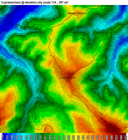
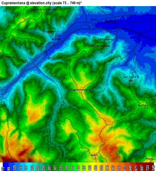
| \ | Map #1 | Map #2 | Topo.Map |
| Scale [m] | 114..557 m | 73..749 m | × |
| Scale [ft] | 374..1827 ft | 240..2457 ft | × |
| Average | 302.7 m = 993 ft | 294.3 m = 966 ft | × |
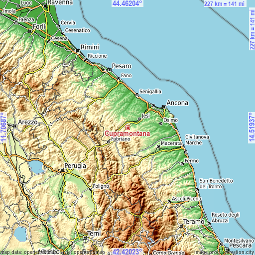
| Width | 7.09 km = 4.4 mi | 14.19 km = 8.8 mi | 227 km = 141.1 mi |
| Height | 7.09 km = 4.4 mi | 14.19 km = 8.8 mi | 227 km = 141.1 mi |
| ↑Max Latitude | 43.481645° | 43.513523° | 44.46204° |
| Latitude at center | 43.44975° | 43.44975° | 43.44975° |
| ↓Min Latitude | 43.417838° | 43.38591° | 42.42023° |
| ← Min Longitude | 13.069175° | 13.025229° | 11.70687° |
| Longitude center | 13.11312° | 13.11312° | 13.11312° |
| →Max Longitude | 13.157065° | 13.201011° | 14.51937° |
Nearby cities:
Cities around Cupramontana sort by population:
• Moie elevation 114 m
6.2 km,  14°
14°
• Stazione 95 m
6.4 km,  28°
28°
• Pianello Vallesina 114 m
5.8 km,  42°
42°
• Macine-Borgo Loreto 133 m
4.6 km,  332°
332°
• Staffolo 440 m
6.1 km,  107°
107°
• Apiro 517 m
6.5 km,  167°
167°
• Castelplanio 312 m
5.6 km, 332°
• Maiolati Spontini 402 m
3 km, 10°
• San Paolo di Jesi 223 m
4.8 km,  83°
83°
• Rosora 377 m
5.2 km,  315°
315°
• Monte Roberto 332 m
4 km, 30°
• Castelbellino 247 m
4.8 km, 31°
Multilingual:
 En español:
Cupramontana elevación 442 m.
 En France:
Cupramontana élévation 442 m.
 Auf Deutsch:
Cupramontana höhe über dem Meeresspiegel ist 442 m.

Sources and notes:
- [note 1] Map square and city borders are not equal. Map elevation data is calculated only from area inside that square.
- [src 1] Elevation data from geonames database provided with same terms of usage.
- [src 2] The elevation map of Cupramontana is generated using elevation data from NASA's 3 arcsec (90m) resolution SRTM data.
- [src 3] Base (background) map © OpenStreetMap contributors tiles are generated by Geofabrik and OpenTopoMap.
Copyright & License:
This Cupramontana Elevation Map is licensed under CC BY-SA. You may reuse any part from this page, if you give a proper credit by linking to this URL:
 More info on terms of use page.