Dorno elevation
Dorno (Lombardy, Provincia di Pavia), Italy elevation is 88 meters and Dorno elevation in feet is 289 ft above sea level [src 1]. Dorno is a seat of a third-order administrative division (feature code) with elevation that is 234 meters (768 ft) smaller than average city elevation in Italy.
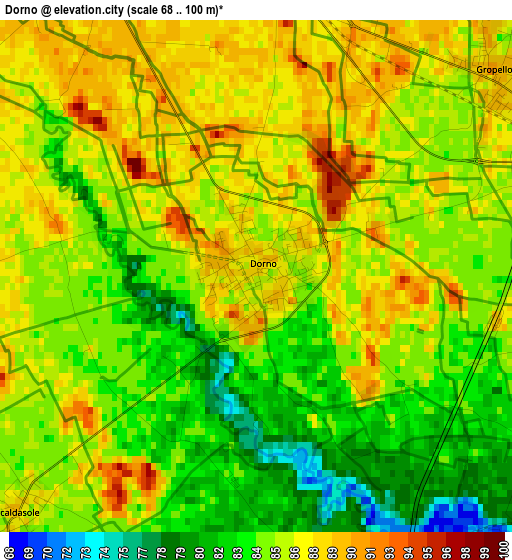
Below is the Elevation map of Dorno, which displays elevation range with different colors. Scale of the first map is from 68 to 100 m (223 to 328 ft) with average elevation of 85.3 meters (=280 ft) [note 1]
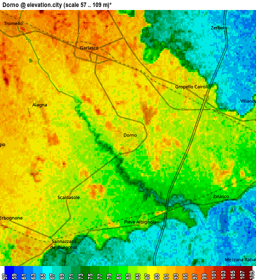
These maps also provides idea of topography and contour of this city, they are displayed at different zoom levels. More info about maps, scale and edge coordinates you can find below images.
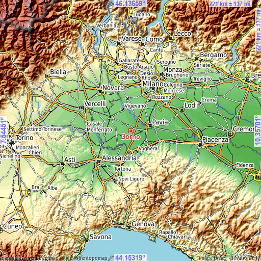
| \ | Map #1 | Map #2 | Topo.Map |
| Scale [m] | 68..100 m | 57..109 m | × |
| Scale [ft] | 223..328 ft | 187..358 ft | × |
| Average | 85.3 m = 280 ft | 81.8 m = 268 ft | × |
| Width | 6.89 km = 4.3 mi | 13.78 km = 8.6 mi | 220.5 km = 137 mi |
| Height | 6.89 km = 4.3 mi | 13.78 km = 8.6 mi | 220.5 km = 137 mi |
| ↑Max Latitude | 45.184502° | 45.215468° | 46.13659° |
| Latitude at center | 45.15352° | 45.15352° | 45.15352° |
| ↓Min Latitude | 45.122521° | 45.091505° | 44.15319° |
| ← Min Longitude | 8.906815° | 8.862869° | 7.54451° |
| Longitude center | 8.95076° | 8.95076° | 8.95076° |
| →Max Longitude | 8.994705° | 9.038651° | 10.35701° |
Nearby cities:
Cities around Dorno sort by population:
• Garlasco elevation 95 m
5.1 km,  335°
335°
• Sannazzaro de' Burgondi 88 m
6.7 km,  211°
211°
• Gropello Cairoli 88 m
4.3 km,  52°
52°
• Sairano 85 m
8.1 km,  103°
103°
• Ferrera Erbognone 91 m
8 km,  237°
237°
• Zinasco Vecchio 82 m
6.8 km,  114°
114°
• Scaldasole 87 m
4.5 km,  224°
224°
• Zerbolò 69 m
7.7 km,  40°
40°
• Pieve Albignola 84 m
4.5 km,  170°
170°
• Alagna 93 m
5.1 km,  289°
289°
• Villanova d'Ardenghi 85 m
7.3 km,  75°
75°
• Valeggio 94 m
7 km,  267°
267°
Multilingual:
 En español:
Dorno elevación 88 m.
 En France:
Dorno élévation 88 m.


Sources and notes:
- [note 1] Map square and city borders are not equal. Map elevation data is calculated only from area inside that square.
- [src 1] Elevation data from geonames database provided with same terms of usage.
- [src 2] The elevation map of Dorno is generated using elevation data from NASA's 3 arcsec (90m) resolution SRTM data.
- [src 3] Base (background) map © OpenStreetMap contributors tiles are generated by Geofabrik and OpenTopoMap.
Copyright & License:
This Dorno Elevation Map is licensed under CC BY-SA. You may reuse any part from this page, if you give a proper credit by linking to this URL:
 More info on terms of use page.