Favria elevation
Favria (Piedmont, Torino), Italy elevation is 320 meters and Favria elevation in feet is 1050 ft above sea level [src 1]. Favria is a seat of a third-order administrative division (feature code) with elevation that is 2 meters (7 ft) smaller than average city elevation in Italy.
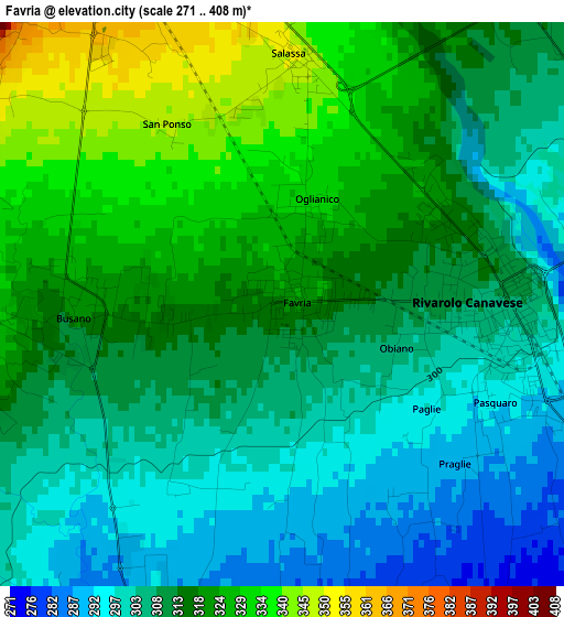
Below is the Elevation map of Favria, which displays elevation range with different colors. Scale of the first map is from 271 to 408 m (889 to 1339 ft) with average elevation of 312.9 meters (=1027 ft) [note 1]
These maps also provides idea of topography and contour of this city, they are displayed at different zoom levels. More info about maps, scale and edge coordinates you can find below images.
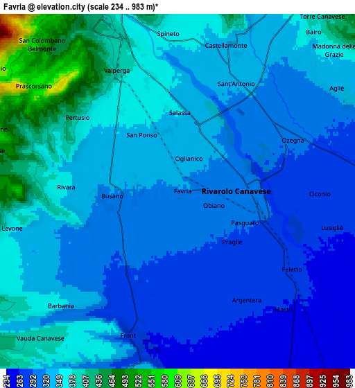
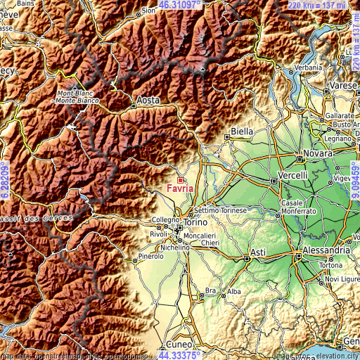
| \ | Map #1 | Map #2 | Topo.Map |
| Scale [m] | 271..408 m | 234..983 m | × |
| Scale [ft] | 889..1339 ft | 768..3225 ft | × |
| Average | 312.9 m = 1027 ft | 337.2 m = 1106 ft | × |
| Width | 6.87 km = 4.3 mi | 13.74 km = 8.5 mi | 219.8 km = 136.6 mi |
| Height | 6.87 km = 4.3 mi | 13.74 km = 8.5 mi | 219.8 km = 136.6 mi |
| ↑Max Latitude | 45.361876° | 45.392744° | 46.31097° |
| Latitude at center | 45.33099° | 45.33099° | 45.33099° |
| ↓Min Latitude | 45.300088° | 45.269168° | 44.33375° |
| ← Min Longitude | 7.644395° | 7.600449° | 6.28209° |
| Longitude center | 7.68834° | 7.68834° | 7.68834° |
| →Max Longitude | 7.732285° | 7.776231° | 9.09459° |
Nearby cities:
Cities around Favria sort by population:
• Rivarolo Canavese elevation 304 m
2.6 km,  96°
96°
• Castellamonte 348 m
6 km,  15°
15°
• Valperga 380 m
4.8 km,  334°
334°
• Feletto 276 m
5.4 km,  124°
124°
• Rivara 319 m
3.1 km,  268°
268°
• Salassa 357 m
3.4 km,  353°
353°
• Busano 320 m
2.4 km, 270°
• Ozegna 300 m
4.8 km,  66°
66°
• Oglianico 331 m
1.2 km,  13°
13°
• Pertusio 371 m
4.6 km,  306°
306°
• Ciconio 278 m
5.5 km,  90°
90°
• San Ponso 346 m
2.6 km, 328°
Multilingual:
 En español:
Favria elevación 320 m.
 En France:
Favria élévation 320 m.


Sources and notes:
- [note 1] Map square and city borders are not equal. Map elevation data is calculated only from area inside that square.
- [src 1] Elevation data from geonames database provided with same terms of usage.
- [src 2] The elevation map of Favria is generated using elevation data from NASA's 3 arcsec (90m) resolution SRTM data.
- [src 3] Base (background) map © OpenStreetMap contributors tiles are generated by Geofabrik and OpenTopoMap.
Copyright & License:
This Favria Elevation Map is licensed under CC BY-SA. You may reuse any part from this page, if you give a proper credit by linking to this URL:
 More info on terms of use page.