Folignano elevation
Folignano (The Marches, Provincia di Ascoli Piceno), Italy elevation is 305 meters and Folignano elevation in feet is 1001 ft above sea level [src 1]. Folignano is a seat of a third-order administrative division (feature code) with elevation that is 17 meters (56 ft) smaller than average city elevation in Italy.
Below is the Elevation map of Folignano, which displays elevation range with different colors. Scale of the first map is from 62 to 1387 m (203 to 4551 ft) with average elevation of 346.3 meters (=1136 ft) [note 1]
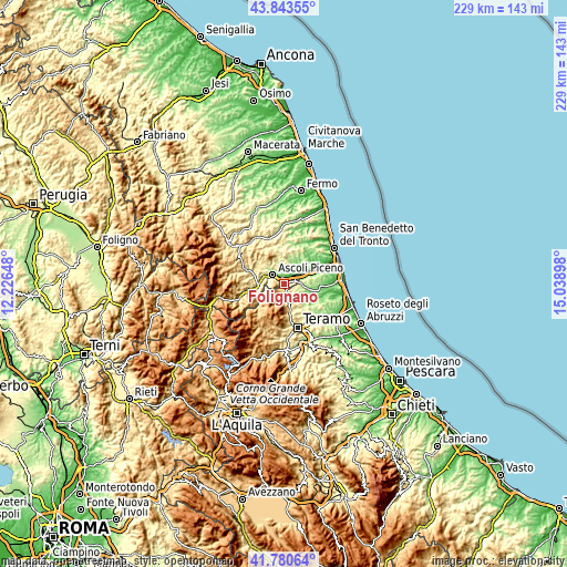
These maps also provides idea of topography and contour of this city, they are displayed at different zoom levels. More info about maps, scale and edge coordinates you can find below images.
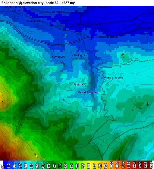
| \ | Map #1 | Topo.Map |
| Scale [m] | 62..1387 m | × |
| Scale [ft] | 203..4551 ft | × |
| Average | 346.3 m = 1136 ft | × |
| Width | 7.17 km = 4.5 mi | 229.4 km = 142.5 mi |
| Height | 7.17 km = 4.5 mi | 229.4 km = 142.5 mi |
| ↑Max Latitude | 42.852925° | 43.84355° |
| Latitude at center | 42.8207° | 42.8207° |
| ↓Min Latitude | 42.788458° | 41.78064° |
| ← Min Longitude | 13.588785° | 12.22648° |
| Longitude center | 13.63273° | 13.63273° |
| →Max Longitude | 13.676675° | 15.03898° |
Nearby cities:
Cities around Folignano sort by population:
• Ascoli Piceno elevation 160 m
6 km,  307°
307°
• Sant'Egidio alla Vibrata 235 m
7.3 km,  93°
93°
• Piattoni-Villa Sant'Antonio 148 m
8.2 km,  51°
51°
• Castel di Lama 81 m
8.6 km,  55°
55°
• Villa Pigna 177 m
1.4 km,  5°
5°
• Villa San Giuseppe 60 m
10.6 km, 59°
• Piane di Morro 304 m
1.7 km,  80°
80°
• Villa Lempa 424 m
3.2 km,  162°
162°
• Appignano del Tronto 184 m
8.9 km,  15°
15°
• Ancarano 252 m
9.5 km, 78°
• Maltignano 281 m
4.7 km,  74°
74°
• Civitella del Tronto 529 m
6.4 km,  146°
146°
Multilingual:
 En español:
Folignano elevación 305 m.
 En France:
Folignano élévation 305 m.
 Auf Deutsch:
Folignano höhe über dem Meeresspiegel ist 305 m.

Sources and notes:
- [note 1] Map square and city borders are not equal. Map elevation data is calculated only from area inside that square.
- [src 1] Elevation data from geonames database provided with same terms of usage.
- [src 2] The elevation map of Folignano is generated using elevation data from NASA's 3 arcsec (90m) resolution SRTM data.
- [src 3] Base (background) map © OpenStreetMap contributors tiles are generated by Geofabrik and OpenTopoMap.
Copyright & License:
This Folignano Elevation Map is licensed under CC BY-SA. You may reuse any part from this page, if you give a proper credit by linking to this URL:
 More info on terms of use page.