Fossalto elevation
Fossalto (Molise, Provincia di Campobasso), Italy elevation is 501 meters and Fossalto elevation in feet is 1644 ft above sea level [src 1]. Fossalto is a seat of a third-order administrative division (feature code) with elevation that is 179 meters (587 ft) bigger than average city elevation in Italy.
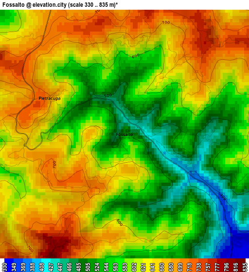
Below is the Elevation map of Fossalto, which displays elevation range with different colors. Scale of the first map is from 330 to 835 m (1083 to 2740 ft) with average elevation of 604 meters (=1982 ft) [note 1]
These maps also provides idea of topography and contour of this city, they are displayed at different zoom levels. More info about maps, scale and edge coordinates you can find below images.
| \ | Map #1 | Topo.Map |
| Scale [m] | 330..835 m | × |
| Scale [ft] | 1083..2740 ft | × |
| Average | 604 m = 1982 ft | × |
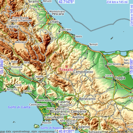
| Width | 7.3 km = 4.5 mi | 233.6 km = 145.2 mi |
| Height | 7.3 km = 4.5 mi | 233.6 km = 145.2 mi |
| ↑Max Latitude | 41.705747° | 42.71475° |
| Latitude at center | 41.67293° | 41.67293° |
| ↓Min Latitude | 41.640097° | 40.61397° |
| ← Min Longitude | 14.501785° | 13.13948° |
| Longitude center | 14.54573° | 14.54573° |
| →Max Longitude | 14.589675° | 15.95198° |
Nearby cities:
Cities around Fossalto sort by population:
• Oratino elevation 772 m
10.5 km,  157°
157°
• Limosano 629 m
6.4 km,  87°
87°
• Torella del Sannio 820 m
4.3 km,  209°
209°
• Bagnoli del Trigno 629 m
7.9 km,  294°
294°
• Castropignano 615 m
6.2 km,  170°
170°
• Casalciprano 647 m
10.4 km,  187°
187°
• Salcito 673 m
8.7 km,  340°
340°
• Sant'Angelo Limosano 893 m
5.3 km,  65°
65°
• Duronia 864 m
7.3 km,  256°
256°
• San Biase 805 m
6 km,  38°
38°
• Pietracupa 697 m
2.4 km,  295°
295°
• Molise 860 m
6.4 km,  223°
223°
Multilingual:
 En español:
Fossalto elevación 501 m.
 En France:
Fossalto élévation 501 m.
 Auf Deutsch:
Fossalto höhe über dem Meeresspiegel ist 501 m.

Sources and notes:
- [note 1] Map square and city borders are not equal. Map elevation data is calculated only from area inside that square.
- [src 1] Elevation data from geonames database provided with same terms of usage.
- [src 2] The elevation map of Fossalto is generated using elevation data from NASA's 3 arcsec (90m) resolution SRTM data.
- [src 3] Base (background) map © OpenStreetMap contributors tiles are generated by Geofabrik and OpenTopoMap.
Copyright & License:
This Fossalto Elevation Map is licensed under CC BY-SA. You may reuse any part from this page, if you give a proper credit by linking to this URL:
 More info on terms of use page.