Gabicce Mare elevation
Gabicce Mare (The Marches, Provincia di Pesaro e Urbino), Italy elevation is 15 meters and Gabicce Mare elevation in feet is 49 ft above sea level [src 1]. Gabicce Mare is a seat of a third-order administrative division (feature code) with elevation that is 307 meters (1007 ft) smaller than average city elevation in Italy.
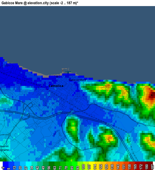
Below is the Elevation map of Gabicce Mare, which displays elevation range with different colors. Scale of the first map is from -2 to 187 m (-7 to 614 ft) with average elevation of 30.7 meters (=101 ft) [note 1]
These maps also provides idea of topography and contour of this city, they are displayed at different zoom levels. More info about maps, scale and edge coordinates you can find below images.
| \ | Map #1 | Map #2 | Topo.Map |
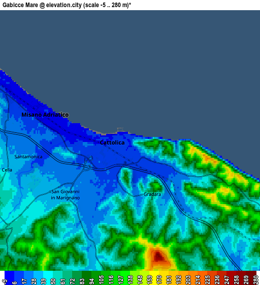
| Scale [m] | -2..187 m | -5..280 m | × |
| Scale [ft] | -7..614 ft | -16..919 ft | × |
| Average | 30.7 m = 101 ft | 55.4 m = 182 ft | × |
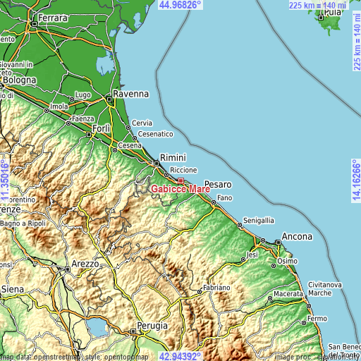
| Width | 7.03 km = 4.4 mi | 14.07 km = 8.7 mi | 225.1 km = 139.9 mi |
| Height | 7.03 km = 4.4 mi | 14.07 km = 8.7 mi | 225.1 km = 139.9 mi |
| ↑Max Latitude | 43.996332° | 44.027937° | 44.96826° |
| Latitude at center | 43.96471° | 43.96471° | 43.96471° |
| ↓Min Latitude | 43.933071° | 43.901415° | 42.94392° |
| ← Min Longitude | 12.712465° | 12.668519° | 11.35016° |
| Longitude center | 12.75641° | 12.75641° | 12.75641° |
| →Max Longitude | 12.800355° | 12.844301° | 14.16266° |
Nearby cities:
Cities around Gabicce Mare sort by population:
• Riccione elevation 9 m
8.8 km,  295°
295°
• Cattolica 11 m
1.6 km,  258°
258°
• Morciano di Romagna 80 m
10.1 km,  236°
236°
• San Giovanni in Marignano 31 m
4.5 km,  232°
232°
• Misano Adriatico 3 m
4.9 km,  286°
286°
• Borgo Santa Maria 38 m
10.5 km,  159°
159°
• Tavullia 152 m
7.4 km,  183°
183°
• Sant'Andrea in Casale 86 m
9.2 km,  247°
247°
• Santa Monica-Cella 27 m
5.5 km, 261°
• Gradara 58 m
3.1 km, 159°
• Fanano 19 m
2.5 km,  195°
195°
• Montalbano 21 m
3.3 km, 258°
Multilingual:
 En español:
Gabicce Mare elevación 15 m.
 En France:
Gabicce Mare élévation 15 m.
 Auf Deutsch:
Gabicce Mare höhe über dem Meeresspiegel ist 15 m.

Sources and notes:
- [note 1] Map square and city borders are not equal. Map elevation data is calculated only from area inside that square.
- [src 1] Elevation data from geonames database provided with same terms of usage.
- [src 2] The elevation map of Gabicce Mare is generated using elevation data from NASA's 3 arcsec (90m) resolution SRTM data.
- [src 3] Base (background) map © OpenStreetMap contributors tiles are generated by Geofabrik and OpenTopoMap.
Copyright & License:
This Gabicce Mare Elevation Map is licensed under CC BY-SA. You may reuse any part from this page, if you give a proper credit by linking to this URL:
 More info on terms of use page.