Isola del Liri elevation
Isola del Liri (Latium, Provincia di Frosinone), Italy elevation is 273 meters and Isola del Liri elevation in feet is 896 ft above sea level [src 1]. Isola del Liri is a seat of a third-order administrative division (feature code) with elevation that is 49 meters (161 ft) smaller than average city elevation in Italy.
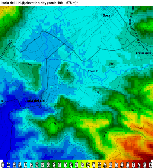
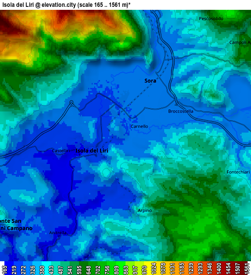
Below is the Elevation map of Isola del Liri, which displays elevation range with different colors. Scale of the first map is from 199 to 678 m (653 to 2224 ft) with average elevation of 317.9 meters (=1043 ft) [note 1]
These maps also provides idea of topography and contour of this city, they are displayed at different zoom levels. More info about maps, scale and edge coordinates you can find below images.
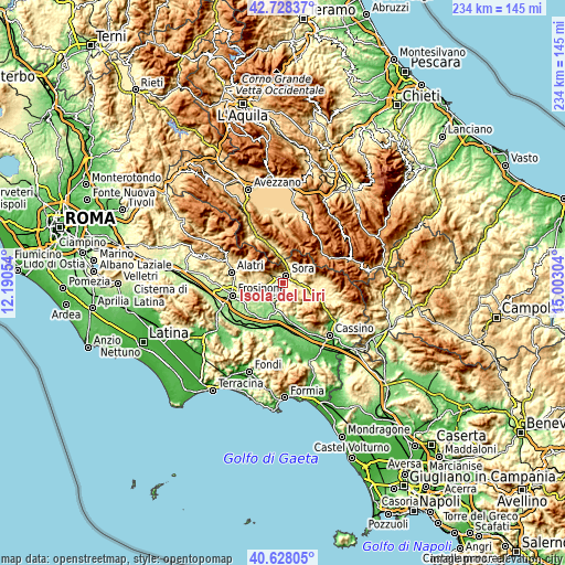
| \ | Map #1 | Map #2 | Topo.Map |
| Scale [m] | 199..678 m | 165..1561 m | × |
| Scale [ft] | 653..2224 ft | 541..5121 ft | × |
| Average | 317.9 m = 1043 ft | 453.1 m = 1487 ft | × |
| Width | 7.3 km = 4.5 mi | 14.6 km = 9.1 mi | 233.5 km = 145.1 mi |
| Height | 7.3 km = 4.5 mi | 14.6 km = 9.1 mi | 233.5 km = 145.1 mi |
| ↑Max Latitude | 41.71959° | 41.752383° | 42.72837° |
| Latitude at center | 41.68678° | 41.68678° | 41.68678° |
| ↓Min Latitude | 41.653954° | 41.621111° | 40.62805° |
| ← Min Longitude | 13.552845° | 13.508899° | 12.19054° |
| Longitude center | 13.59679° | 13.59679° | 13.59679° |
| →Max Longitude | 13.640735° | 13.684681° | 15.00304° |
Nearby cities:
Cities around Isola del Liri sort by population:
• Sora elevation 283 m
3.8 km,  21°
21°
• Collefontana-Fontana Liri Inferiore 154 m
9.2 km,  205°
205°
• Castelliri 217 m
4.8 km,  257°
257°
• Anitrella-Chiaiamari 224 m
6.7 km,  216°
216°
• Arpino 429 m
4.6 km,  164°
164°
• Broccostella 300 m
3.5 km,  65°
65°
• Campoli Appennino 623 m
9 km,  53°
53°
• Posta Fibreno 320 m
6.9 km,  85°
85°
• Monte San Giovanni Campano 405 m
8.6 km,  235°
235°
• Pescosolido 619 m
8.5 km,  35°
35°
• Vicalvi 427 m
9.3 km,  95°
95°
• Fontechiari 386 m
6.8 km,  107°
107°
Multilingual:
 En español:
Isola del Liri elevación 273 m.
 En France:
Isola del Liri élévation 273 m.
 Auf Deutsch:
Isola del Liri höhe über dem Meeresspiegel ist 273 m.

Sources and notes:
- [note 1] Map square and city borders are not equal. Map elevation data is calculated only from area inside that square.
- [src 1] Elevation data from geonames database provided with same terms of usage.
- [src 2] The elevation map of Isola del Liri is generated using elevation data from NASA's 3 arcsec (90m) resolution SRTM data.
- [src 3] Base (background) map © OpenStreetMap contributors tiles are generated by Geofabrik and OpenTopoMap.
Copyright & License:
This Isola del Liri Elevation Map is licensed under CC BY-SA. You may reuse any part from this page, if you give a proper credit by linking to this URL:
 More info on terms of use page.