Langosco elevation
Langosco (Lombardy, Provincia di Pavia), Italy elevation is 110 meters and Langosco elevation in feet is 361 ft above sea level [src 1]. Langosco is a seat of a third-order administrative division (feature code) with elevation that is 212 meters (696 ft) smaller than average city elevation in Italy.
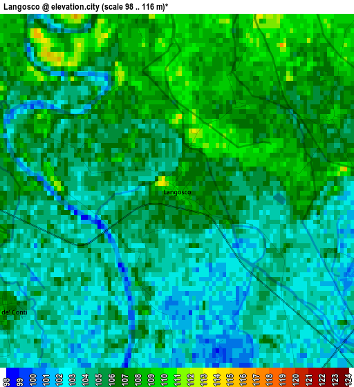
Below is the Elevation map of Langosco, which displays elevation range with different colors. Scale of the first map is from 98 to 116 m (322 to 381 ft) with average elevation of 105 meters (=344 ft) [note 1]
These maps also provides idea of topography and contour of this city, they are displayed at different zoom levels. More info about maps, scale and edge coordinates you can find below images.
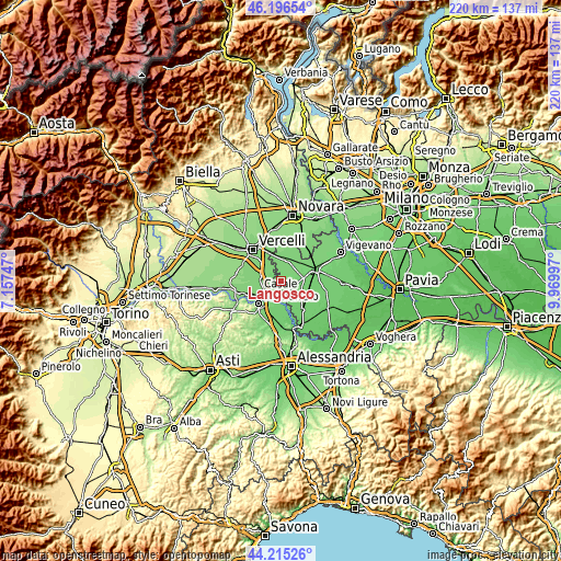
| \ | Map #1 | Topo.Map |
| Scale [m] | 98..116 m | × |
| Scale [ft] | 322..381 ft | × |
| Average | 105 m = 344 ft | × |
| Width | 6.88 km = 4.3 mi | 220.3 km = 136.9 mi |
| Height | 6.88 km = 4.3 mi | 220.3 km = 136.9 mi |
| ↑Max Latitude | 45.245479° | 46.19654° |
| Latitude at center | 45.21453° | 45.21453° |
| ↓Min Latitude | 45.183564° | 44.21526° |
| ← Min Longitude | 8.519775° | 7.15747° |
| Longitude center | 8.56372° | 8.56372° |
| →Max Longitude | 8.607665° | 9.96997° |
Nearby cities:
Cities around Langosco sort by population:
• Robbio elevation 121 m
8.6 km,  15°
15°
• Villanova Monferrato 113 m
7.7 km,  241°
241°
• Candia Lomellina 105 m
4.9 km,  149°
149°
• Pezzana 117 m
8.1 km,  309°
309°
• Stroppiana 119 m
8.7 km,  281°
281°
• Zeme 106 m
8.4 km,  103°
103°
• Caresana 114 m
4.7 km, 279°
• Sant'Angelo Lomellina 112 m
7.2 km,  60°
60°
• Motta Dè Conti 107 m
4.1 km, 235°
• Rosasco 115 m
4.2 km, 17°
• Castelnovetto 116 m
5.8 km,  40°
40°
• Cozzo 105 m
4.5 km,  123°
123°
Multilingual:
 En español:
Langosco elevación 110 m.
 En France:
Langosco élévation 110 m.
 Auf Deutsch:
Langosco höhe über dem Meeresspiegel ist 110 m.

Sources and notes:
- [note 1] Map square and city borders are not equal. Map elevation data is calculated only from area inside that square.
- [src 1] Elevation data from geonames database provided with same terms of usage.
- [src 2] The elevation map of Langosco is generated using elevation data from NASA's 3 arcsec (90m) resolution SRTM data.
- [src 3] Base (background) map © OpenStreetMap contributors tiles are generated by Geofabrik and OpenTopoMap.
Copyright & License:
This Langosco Elevation Map is licensed under CC BY-SA. You may reuse any part from this page, if you give a proper credit by linking to this URL:
 More info on terms of use page.