Lerici elevation
Lerici (Liguria, Provincia di La Spezia), Italy elevation is 12 meters and Lerici elevation in feet is 39 ft above sea level [src 1]. Lerici is a seat of a third-order administrative division (feature code) with elevation that is 310 meters (1017 ft) smaller than average city elevation in Italy.
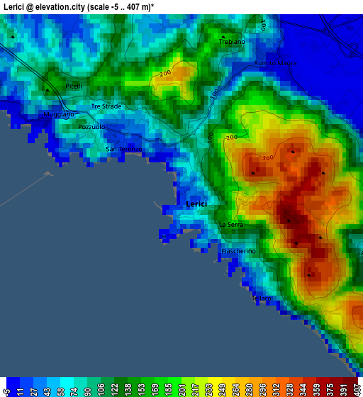
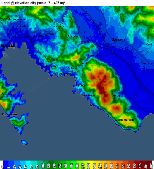
Below is the Elevation map of Lerici, which displays elevation range with different colors. Scale of the first map is from -5 to 407 m (-16 to 1335 ft) with average elevation of 131.1 meters (=430 ft) [note 1]
These maps also provides idea of topography and contour of this city, they are displayed at different zoom levels. More info about maps, scale and edge coordinates you can find below images.
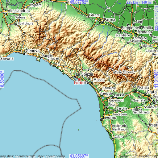
| \ | Map #1 | Map #2 | Topo.Map |
| Scale [m] | -5..407 m | -7..407 m | × |
| Scale [ft] | -16..1335 ft | -23..1335 ft | × |
| Average | 131.1 m = 430 ft | 75.6 m = 248 ft | × |
| Width | 7.02 km = 4.4 mi | 14.04 km = 8.7 mi | 224.7 km = 139.6 mi |
| Height | 7.02 km = 4.4 mi | 14.04 km = 8.7 mi | 224.7 km = 139.6 mi |
| ↑Max Latitude | 44.107433° | 44.138979° | 45.07752° |
| Latitude at center | 44.07587° | 44.07587° | 44.07587° |
| ↓Min Latitude | 44.04429° | 44.012694° | 43.05697° |
| ← Min Longitude | 9.867265° | 9.823319° | 8.50496° |
| Longitude center | 9.91121° | 9.91121° | 9.91121° |
| →Max Longitude | 9.955155° | 9.999101° | 11.31746° |
Nearby cities:
Cities around Lerici sort by population:
• La Spezia elevation 2 m
7.6 km,  293°
293°
• Sarzana 28 m
5.7 km,  45°
45°
• Arcola 25 m
4.7 km,  0°
0°
• Stazione-Fornola 40 m
6.2 km,  345°
345°
• Ameglia 3 m
4.4 km,  97°
97°
• Romito Magra 10 m
3 km,  33°
33°
• Borghetto-Melara 27 m
6.8 km,  68°
68°
• Le Grazie 1 m
6.3 km,  260°
260°
• Vezzano Ligure 219 m
7.5 km, 345°
• San Terenzo 25 m
1.6 km,  312°
312°
• Portovenere 18 m
6.7 km,  245°
245°
• Pitelli 113 m
3 km, 314°
Multilingual:
 En español:
Lerici elevación 12 m.
 En France:
Lerici élévation 12 m.


Sources and notes:
- [note 1] Map square and city borders are not equal. Map elevation data is calculated only from area inside that square.
- [src 1] Elevation data from geonames database provided with same terms of usage.
- [src 2] The elevation map of Lerici is generated using elevation data from NASA's 3 arcsec (90m) resolution SRTM data.
- [src 3] Base (background) map © OpenStreetMap contributors tiles are generated by Geofabrik and OpenTopoMap.
Copyright & License:
This Lerici Elevation Map is licensed under CC BY-SA. You may reuse any part from this page, if you give a proper credit by linking to this URL:
 More info on terms of use page.