Loreto elevation
Loreto (The Marches, Provincia di Ancona), Italy elevation is 92 meters and Loreto elevation in feet is 302 ft above sea level [src 1]. Loreto is a seat of a third-order administrative division (feature code) with elevation that is 230 meters (755 ft) smaller than average city elevation in Italy.
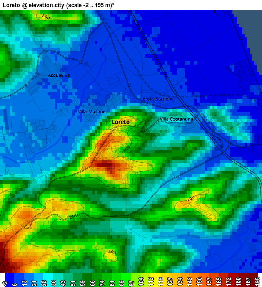
Below is the Elevation map of Loreto, which displays elevation range with different colors. Scale of the first map is from -2 to 195 m (-7 to 640 ft) with average elevation of 42.7 meters (=140 ft) [note 1]
These maps also provides idea of topography and contour of this city, they are displayed at different zoom levels. More info about maps, scale and edge coordinates you can find below images.
| \ | Map #1 | Map #2 | Topo.Map |
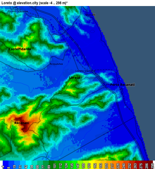
| Scale [m] | -2..195 m | -4..298 m | × |
| Scale [ft] | -7..640 ft | -13..978 ft | × |
| Average | 42.7 m = 140 ft | 52.1 m = 171 ft | × |
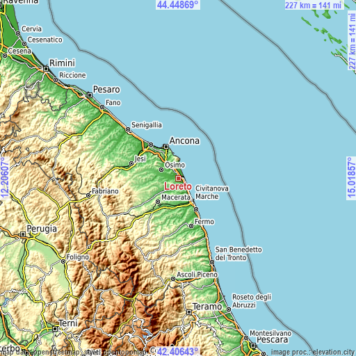
| Width | 7.1 km = 4.4 mi | 14.19 km = 8.8 mi | 227.1 km = 141.1 mi |
| Height | 7.1 km = 4.4 mi | 14.19 km = 8.8 mi | 227.1 km = 141.1 mi |
| ↑Max Latitude | 43.468072° | 43.499957° | 44.44869° |
| Latitude at center | 43.43617° | 43.43617° | 43.43617° |
| ↓Min Latitude | 43.404251° | 43.372315° | 42.40643° |
| ← Min Longitude | 13.568375° | 13.524429° | 12.20607° |
| Longitude center | 13.61232° | 13.61232° | 13.61232° |
| →Max Longitude | 13.656265° | 13.700211° | 15.01857° |
Nearby cities:
Cities around Loreto sort by population:
• Castelfidardo elevation 136 m
5.6 km,  297°
297°
• Recanati 236 m
5.9 km,  232°
232°
• Porto Recanati 3 m
4 km,  95°
95°
• Porto Potenza Picena 6 m
11.1 km,  141°
141°
• Potenza Picena 225 m
7.8 km,  173°
173°
• Sirolo 97 m
9.6 km,  1°
1°
• Villa Musone 11 m
1.3 km,  326°
326°
• Montelupone 253 m
10.9 km,  197°
197°
• Campocavallo 47 m
9.7 km,  286°
286°
• Marcelli 2 m
6.3 km,  9°
9°
• Numana 26 m
8.4 km, 4°
• Loreto Stazione 9 m
1.5 km,  25°
25°
Multilingual:
 En español:
Loreto elevación 92 m.
 En France:
Loreto élévation 92 m.


Sources and notes:
- [note 1] Map square and city borders are not equal. Map elevation data is calculated only from area inside that square.
- [src 1] Elevation data from geonames database provided with same terms of usage.
- [src 2] The elevation map of Loreto is generated using elevation data from NASA's 3 arcsec (90m) resolution SRTM data.
- [src 3] Base (background) map © OpenStreetMap contributors tiles are generated by Geofabrik and OpenTopoMap.
Copyright & License:
This Loreto Elevation Map is licensed under CC BY-SA. You may reuse any part from this page, if you give a proper credit by linking to this URL:
 More info on terms of use page.