Maiori elevation
Maiori (Campania, Provincia di Salerno), Italy elevation is 13 meters and Maiori elevation in feet is 43 ft above sea level [src 1]. Maiori is a seat of a third-order administrative division (feature code) with elevation that is 309 meters (1014 ft) smaller than average city elevation in Italy.
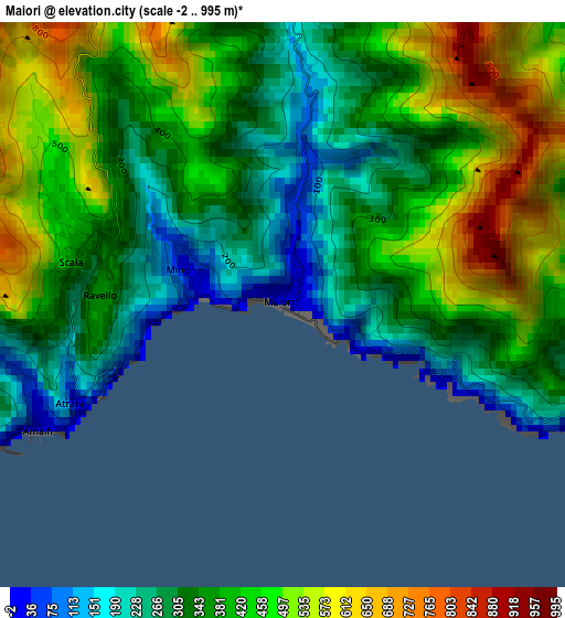
Below is the Elevation map of Maiori, which displays elevation range with different colors. Scale of the first map is from -2 to 995 m (-7 to 3264 ft) with average elevation of 393.8 meters (=1292 ft) [note 1]
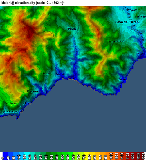
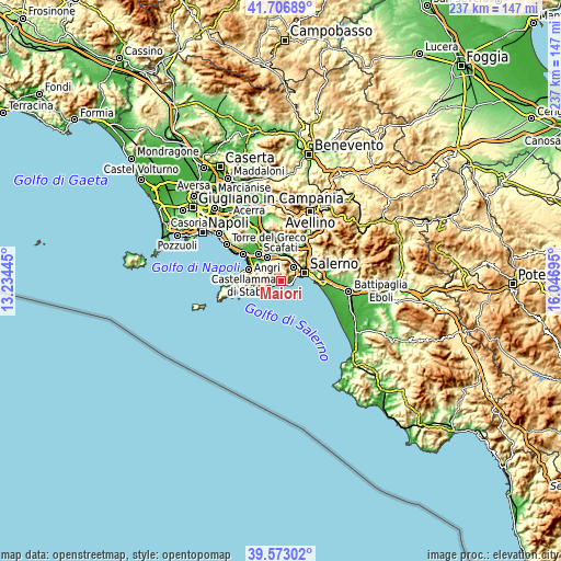
These maps also provides idea of topography and contour of this city, they are displayed at different zoom levels. More info about maps, scale and edge coordinates you can find below images.
| \ | Map #1 | Map #2 | Topo.Map |
| Scale [m] | -2..995 m | -2..1302 m | × |
| Scale [ft] | -7..3264 ft | -7..4272 ft | × |
| Average | 393.8 m = 1292 ft | 520.7 m = 1708 ft | × |
| Width | 7.41 km = 4.6 mi | 14.83 km = 9.2 mi | 237.3 km = 147.5 mi |
| Height | 7.41 km = 4.6 mi | 14.83 km = 9.2 mi | 237.3 km = 147.5 mi |
| ↑Max Latitude | 40.681814° | 40.715131° | 41.70689° |
| Latitude at center | 40.64848° | 40.64848° | 40.64848° |
| ↓Min Latitude | 40.615129° | 40.581762° | 39.57302° |
| ← Min Longitude | 14.596755° | 14.552809° | 13.23445° |
| Longitude center | 14.6407° | 14.6407° | 14.6407° |
| →Max Longitude | 14.684645° | 14.728591° | 16.04695° |
Nearby cities:
Cities around Maiori sort by population:
• Amalfi elevation 25 m
3.6 km,  244°
244°
• Tramonti 294 m
4.8 km,  4°
4°
• Vietri sul Mare 63 m
7.6 km,  71°
71°
• Minori 15 m
1.2 km,  279°
279°
• Cetara 21 m
5.1 km,  91°
91°
• Dragonea 296 m
6.8 km,  60°
60°
• Ravello 365 m
2.5 km,  272°
272°
• Pietre 399 m
6 km,  343°
343°
• Scala 432 m
2.9 km,  288°
288°
• Atrani 11 m
3 km, 242°
• Conca dei Marini 179 m
6.7 km, 238°
• Polvica 314 m
5.2 km,  359°
359°
Multilingual:
 En español:
Maiori elevación 13 m.
 En France:
Maiori élévation 13 m.


Sources and notes:
- [note 1] Map square and city borders are not equal. Map elevation data is calculated only from area inside that square.
- [src 1] Elevation data from geonames database provided with same terms of usage.
- [src 2] The elevation map of Maiori is generated using elevation data from NASA's 3 arcsec (90m) resolution SRTM data.
- [src 3] Base (background) map © OpenStreetMap contributors tiles are generated by Geofabrik and OpenTopoMap.
Copyright & License:
This Maiori Elevation Map is licensed under CC BY-SA. You may reuse any part from this page, if you give a proper credit by linking to this URL:
 More info on terms of use page.