Marsicovetere elevation
Marsicovetere (Basilicate, Provincia di Potenza), Italy elevation is 1006 meters and Marsicovetere elevation in feet is 3301 ft above sea level [src 1]. Marsicovetere is a seat of a third-order administrative division (feature code) with elevation that is 684 meters (2244 ft) bigger than average city elevation in Italy.
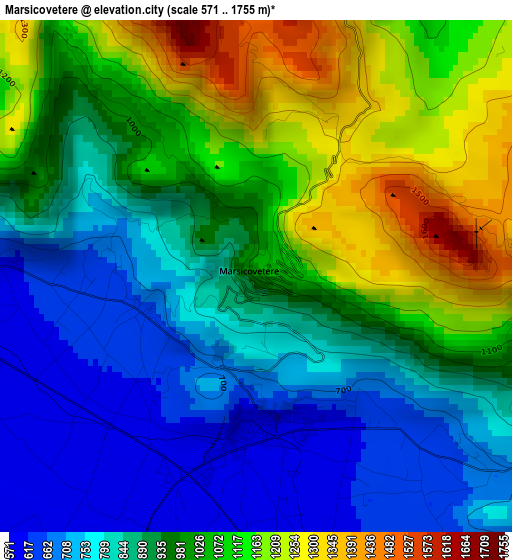
Below is the Elevation map of Marsicovetere, which displays elevation range with different colors. Scale of the first map is from 571 to 1755 m (1873 to 5758 ft) with average elevation of 943.6 meters (=3096 ft) [note 1]
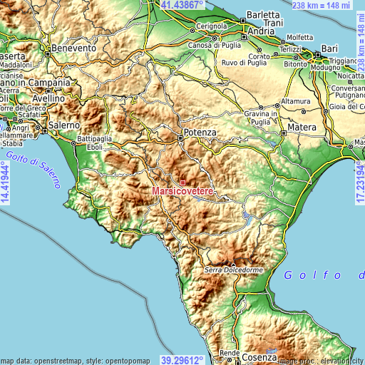
These maps also provides idea of topography and contour of this city, they are displayed at different zoom levels. More info about maps, scale and edge coordinates you can find below images.
| \ | Map #1 | Topo.Map |
| Scale [m] | 571..1755 m | × |
| Scale [ft] | 1873..5758 ft | × |
| Average | 943.6 m = 3096 ft | × |
| Width | 7.44 km = 4.6 mi | 238.2 km = 148 mi |
| Height | 7.44 km = 4.6 mi | 238.2 km = 148 mi |
| ↑Max Latitude | 40.40938° | 41.43867° |
| Latitude at center | 40.37591° | 40.37591° |
| ↓Min Latitude | 40.342424° | 39.29612° |
| ← Min Longitude | 15.781745° | 14.41944° |
| Longitude center | 15.82569° | 15.82569° |
| →Max Longitude | 15.869635° | 17.23194° |
Nearby cities:
Cities around Marsicovetere sort by population:
• Villa d'Agri elevation 597 m
2.4 km,  175°
175°
• Moliterno 880 m
15.1 km,  167°
167°
• Paterno 630 m
7.7 km,  269°
269°
• Padula 604 m
14.9 km,  254°
254°
• Viggiano 935 m
7.3 km,  120°
120°
• Tramutola 657 m
7.1 km,  206°
206°
• Calvello 720 m
11.2 km,  10°
10°
• Marsico Nuovo 847 m
9.4 km,  304°
304°
• Montesano sulla Marcellana 838 m
15.2 km,  222°
222°
• Abriola 944 m
14.7 km,  355°
355°
• Grumento Nova 734 m
11.7 km,  152°
152°
• Sarconi 635 m
15.2 km,  159°
159°
Multilingual:
 En español:
Marsicovetere elevación 1006 m.
 En France:
Marsicovetere élévation 1006 m.
 Auf Deutsch:
Marsicovetere höhe über dem Meeresspiegel ist 1006 m.

Sources and notes:
- [note 1] Map square and city borders are not equal. Map elevation data is calculated only from area inside that square.
- [src 1] Elevation data from geonames database provided with same terms of usage.
- [src 2] The elevation map of Marsicovetere is generated using elevation data from NASA's 3 arcsec (90m) resolution SRTM data.
- [src 3] Base (background) map © OpenStreetMap contributors tiles are generated by Geofabrik and OpenTopoMap.
Copyright & License:
This Marsicovetere Elevation Map is licensed under CC BY-SA. You may reuse any part from this page, if you give a proper credit by linking to this URL:
 More info on terms of use page.