Mercallo elevation
Mercallo (Lombardy, Provincia di Varese), Italy elevation is 277 meters and Mercallo elevation in feet is 909 ft above sea level [src 1]. Mercallo is a seat of a third-order administrative division (feature code) with elevation that is 45 meters (148 ft) smaller than average city elevation in Italy.
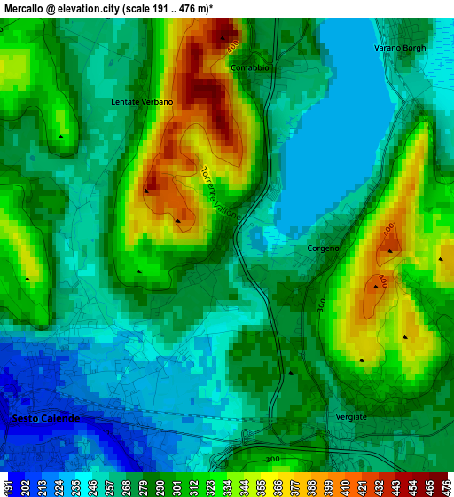
Below is the Elevation map of Mercallo, which displays elevation range with different colors. Scale of the first map is from 191 to 476 m (627 to 1562 ft) with average elevation of 286.6 meters (=940 ft) [note 1]
These maps also provides idea of topography and contour of this city, they are displayed at different zoom levels. More info about maps, scale and edge coordinates you can find below images.
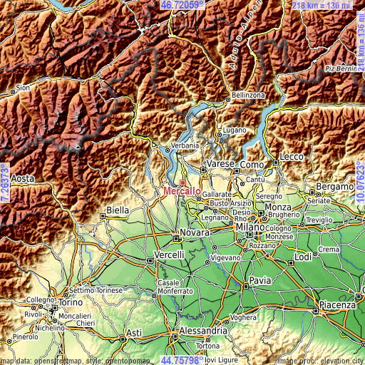
| \ | Map #1 | Topo.Map |
| Scale [m] | 191..476 m | × |
| Scale [ft] | 627..1562 ft | × |
| Average | 286.6 m = 940 ft | × |
| Width | 6.82 km = 4.2 mi | 218.2 km = 135.6 mi |
| Height | 6.82 km = 4.2 mi | 218.2 km = 135.6 mi |
| ↑Max Latitude | 45.778567° | 46.72059° |
| Latitude at center | 45.74791° | 45.74791° |
| ↓Min Latitude | 45.717236° | 44.75798° |
| ← Min Longitude | 8.626035° | 7.26373° |
| Longitude center | 8.66998° | 8.66998° |
| →Max Longitude | 8.713925° | 10.07623° |
Nearby cities:
Cities around Mercallo sort by population:
• Castelletto Sopra Ticino elevation 209 m
4.2 km,  222°
222°
• Sesto Calende 206 m
3.7 km,  229°
229°
• Vergiate 272 m
3.5 km,  145°
145°
• Taino 261 m
4.5 km,  291°
291°
• Varano Borghi 277 m
3.9 km,  42°
42°
• Golasecca 278 m
5.6 km,  187°
187°
• Ternate 259 m
4.9 km,  27°
27°
• Corgeno 282 m
1.4 km,  99°
99°
• Comabbio 272 m
2.9 km,  12°
12°
• Lisanza 208 m
5.6 km,  260°
260°
• Cimbro 283 m
4.1 km,  109°
109°
• Osmate 313 m
4.7 km,  345°
345°
Multilingual:
 En español:
Mercallo elevación 277 m.
 En France:
Mercallo élévation 277 m.
 Auf Deutsch:
Mercallo höhe über dem Meeresspiegel ist 277 m.

Sources and notes:
- [note 1] Map square and city borders are not equal. Map elevation data is calculated only from area inside that square.
- [src 1] Elevation data from geonames database provided with same terms of usage.
- [src 2] The elevation map of Mercallo is generated using elevation data from NASA's 3 arcsec (90m) resolution SRTM data.
- [src 3] Base (background) map © OpenStreetMap contributors tiles are generated by Geofabrik and OpenTopoMap.
Copyright & License:
This Mercallo Elevation Map is licensed under CC BY-SA. You may reuse any part from this page, if you give a proper credit by linking to this URL:
 More info on terms of use page.