Merine elevation
Merine (Apulia, Provincia di Lecce), Italy elevation is 42 meters and Merine elevation in feet is 138 ft above sea level [src 1]. Merine is a populated place (feature code) with elevation that is 280 meters (919 ft) smaller than average city elevation in Italy.
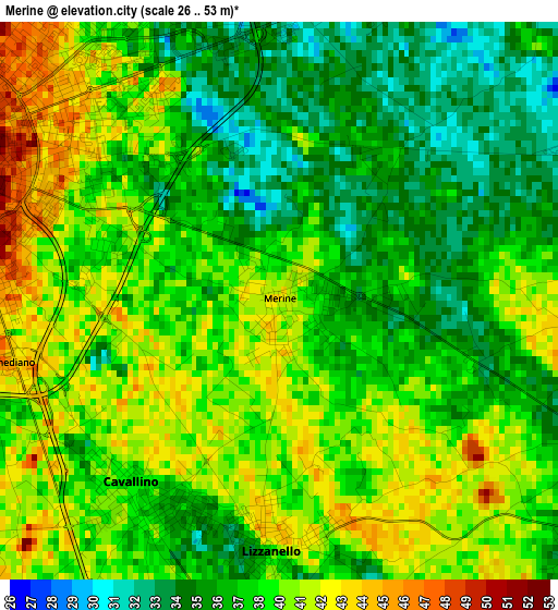
Below is the Elevation map of Merine, which displays elevation range with different colors. Scale of the first map is from 26 to 53 m (85 to 174 ft) with average elevation of 38.4 meters (=126 ft) [note 1]
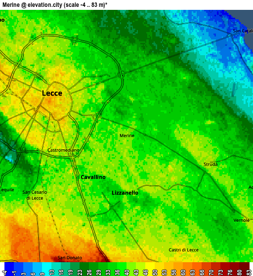
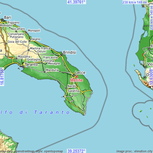
These maps also provides idea of topography and contour of this city, they are displayed at different zoom levels. More info about maps, scale and edge coordinates you can find below images.
| \ | Map #1 | Map #2 | Topo.Map |
| Scale [m] | 26..53 m | -4..83 m | × |
| Scale [ft] | 85..174 ft | -13..272 ft | × |
| Average | 38.4 m = 126 ft | 36.7 m = 120 ft | × |
| Width | 7.45 km = 4.6 mi | 14.9 km = 9.3 mi | 238.4 km = 148.1 mi |
| Height | 7.45 km = 4.6 mi | 14.9 km = 9.3 mi | 238.4 km = 148.1 mi |
| ↑Max Latitude | 40.36767° | 40.401144° | 41.39761° |
| Latitude at center | 40.33418° | 40.33418° | 40.33418° |
| ↓Min Latitude | 40.300673° | 40.267149° | 39.25372° |
| ← Min Longitude | 18.179885° | 18.135939° | 16.81758° |
| Longitude center | 18.22383° | 18.22383° | 18.22383° |
| →Max Longitude | 18.267775° | 18.311721° | 19.63008° |
Nearby cities:
Cities around Merine sort by population:
• Lecce elevation 53 m
4.9 km,  297°
297°
• Lequile 37 m
7.8 km,  246°
246°
• Cavallino 38 m
3.2 km,  214°
214°
• San Cesario di Lecce 44 m
6.4 km,  236°
236°
• Lizzanello 42 m
3.3 km,  181°
181°
• San Donato di Lecce 69 m
8.2 km, 205°
• Castromediano 46 m
3.9 km,  259°
259°
• Castri di Lecce 49 m
7.5 km,  154°
154°
• Vernole 36 m
8.3 km,  127°
127°
• Caprarica di Lecce 62 m
8.4 km,  168°
168°
• Strudà 45 m
5.2 km,  107°
107°
• Pisignano 37 m
5.2 km, 129°
Multilingual:
 En español:
Merine elevación 42 m.
 En France:
Merine élévation 42 m.


Sources and notes:
- [note 1] Map square and city borders are not equal. Map elevation data is calculated only from area inside that square.
- [src 1] Elevation data from geonames database provided with same terms of usage.
- [src 2] The elevation map of Merine is generated using elevation data from NASA's 3 arcsec (90m) resolution SRTM data.
- [src 3] Base (background) map © OpenStreetMap contributors tiles are generated by Geofabrik and OpenTopoMap.
Copyright & License:
This Merine Elevation Map is licensed under CC BY-SA. You may reuse any part from this page, if you give a proper credit by linking to this URL:
 More info on terms of use page.