Molina Aterno elevation
Molina Aterno (Abruzzo, Provincia dell' Aquila), Italy elevation is 495 meters and Molina Aterno elevation in feet is 1624 ft above sea level [src 1]. Molina Aterno is a seat of a third-order administrative division (feature code) with elevation that is 173 meters (568 ft) bigger than average city elevation in Italy.
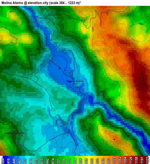
Below is the Elevation map of Molina Aterno, which displays elevation range with different colors. Scale of the first map is from 384 to 1223 m (1260 to 4012 ft) with average elevation of 703.8 meters (=2309 ft) [note 1]
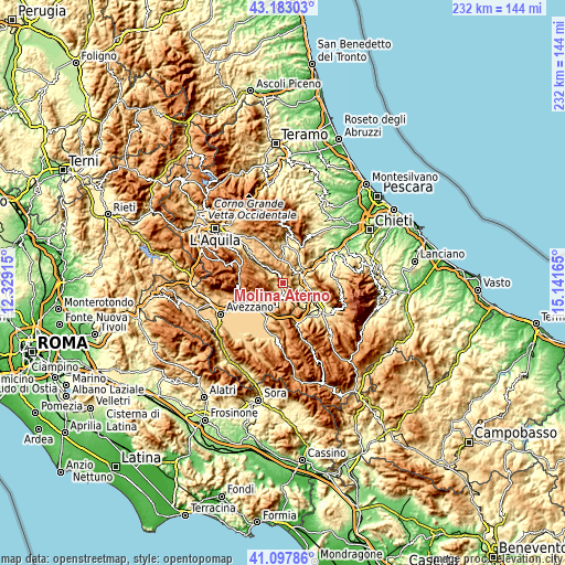
These maps also provides idea of topography and contour of this city, they are displayed at different zoom levels. More info about maps, scale and edge coordinates you can find below images.
| \ | Map #1 | Topo.Map |
| Scale [m] | 384..1223 m | × |
| Scale [ft] | 1260..4012 ft | × |
| Average | 703.8 m = 2309 ft | × |
| Width | 7.25 km = 4.5 mi | 231.8 km = 144 mi |
| Height | 7.25 km = 4.5 mi | 231.8 km = 144 mi |
| ↑Max Latitude | 42.181603° | 43.18303° |
| Latitude at center | 42.14903° | 42.14903° |
| ↓Min Latitude | 42.11644° | 41.09786° |
| ← Min Longitude | 13.691455° | 12.32915° |
| Longitude center | 13.7354° | 13.7354° |
| →Max Longitude | 13.779345° | 15.14165° |
Nearby cities:
Cities around Molina Aterno sort by population:
• Popoli elevation 245 m
8.1 km,  74°
74°
• Raiano 390 m
8.3 km,  129°
129°
• Castelvecchio Subequo 480 m
2.3 km,  193°
193°
• Corfinio 354 m
9.1 km,  109°
109°
• Vittorito 373 m
7.1 km, 110°
• Goriano Sicoli 713 m
8.3 km,  157°
157°
• Secinaro 735 m
4.5 km,  272°
272°
• Castel di Ieri 524 m
4 km,  172°
172°
• Gagliano Aterno 654 m
3.9 km,  228°
228°
• Collepietro 847 m
8.8 km,  25°
25°
• San Benedetto in Perillis 854 m
4.8 km,  36°
36°
• Acciano 594 m
3.4 km,  334°
334°
Multilingual:
 En español:
Molina Aterno elevación 495 m.
 En France:
Molina Aterno élévation 495 m.
 Auf Deutsch:
Molina Aterno höhe über dem Meeresspiegel ist 495 m.

Sources and notes:
- [note 1] Map square and city borders are not equal. Map elevation data is calculated only from area inside that square.
- [src 1] Elevation data from geonames database provided with same terms of usage.
- [src 2] The elevation map of Molina Aterno is generated using elevation data from NASA's 3 arcsec (90m) resolution SRTM data.
- [src 3] Base (background) map © OpenStreetMap contributors tiles are generated by Geofabrik and OpenTopoMap.
Copyright & License:
This Molina Aterno Elevation Map is licensed under CC BY-SA. You may reuse any part from this page, if you give a proper credit by linking to this URL:
 More info on terms of use page.